
 Historic maps
Overlay of old maps on modern map
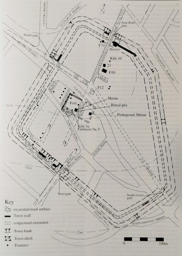
Roman
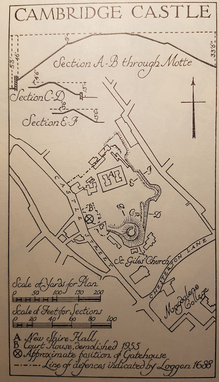
Castle
1340
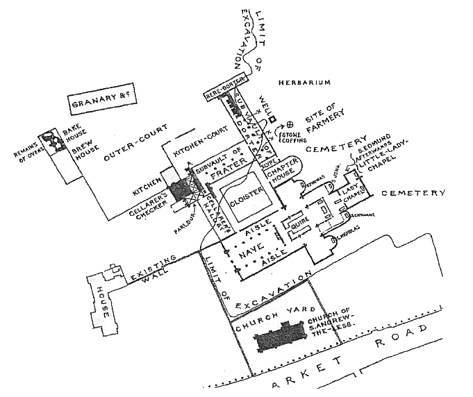
Barnwell Priory
Tudor
Abbey House
Stourbridge Fair
1798
Parish boundaries
Gwydir Street
Click on a button for maps of Cambridge at various times, plus some information about that time, and my sources. The maps do not show the shape of the buildings accurately, just the positions.


These are vaious maps that I have used elsewhere on my website. Click on thumbnails for a larger version (if there is one!).
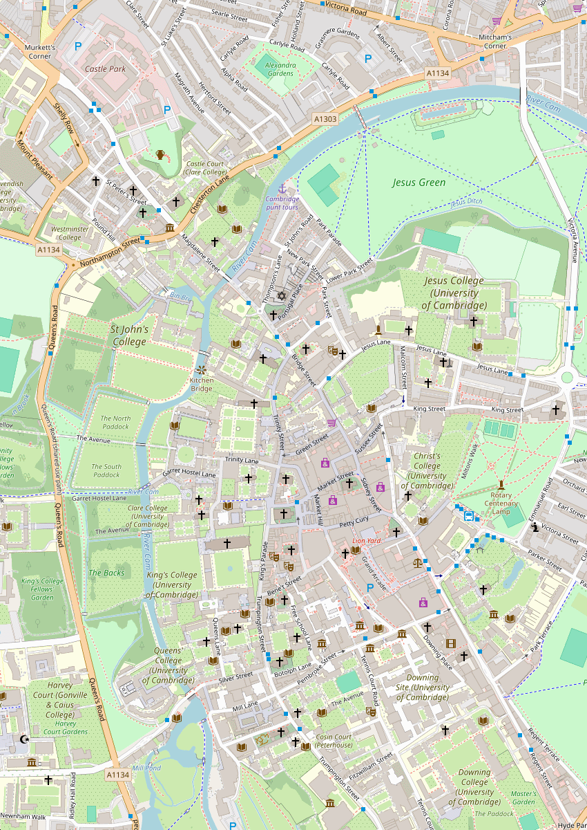
How the Roman camp fits in on a modern map of Cambridge

This Roman road map is in the Museum of Archaeology and Anthropology. The "Via Devana" (not its original name!) is Castle Street, Bridge Street, Sidney Street, St Andrews Street, Regent Street, Hills Road, and so on. The cross roads used to at the Roman camp, round Castle Mound, although the roads have changed within Cambridge itself. They can be traced outside Cambridge - Mares Way and Akemund Street (NOT the Akemund Street within Cambridge itself!)
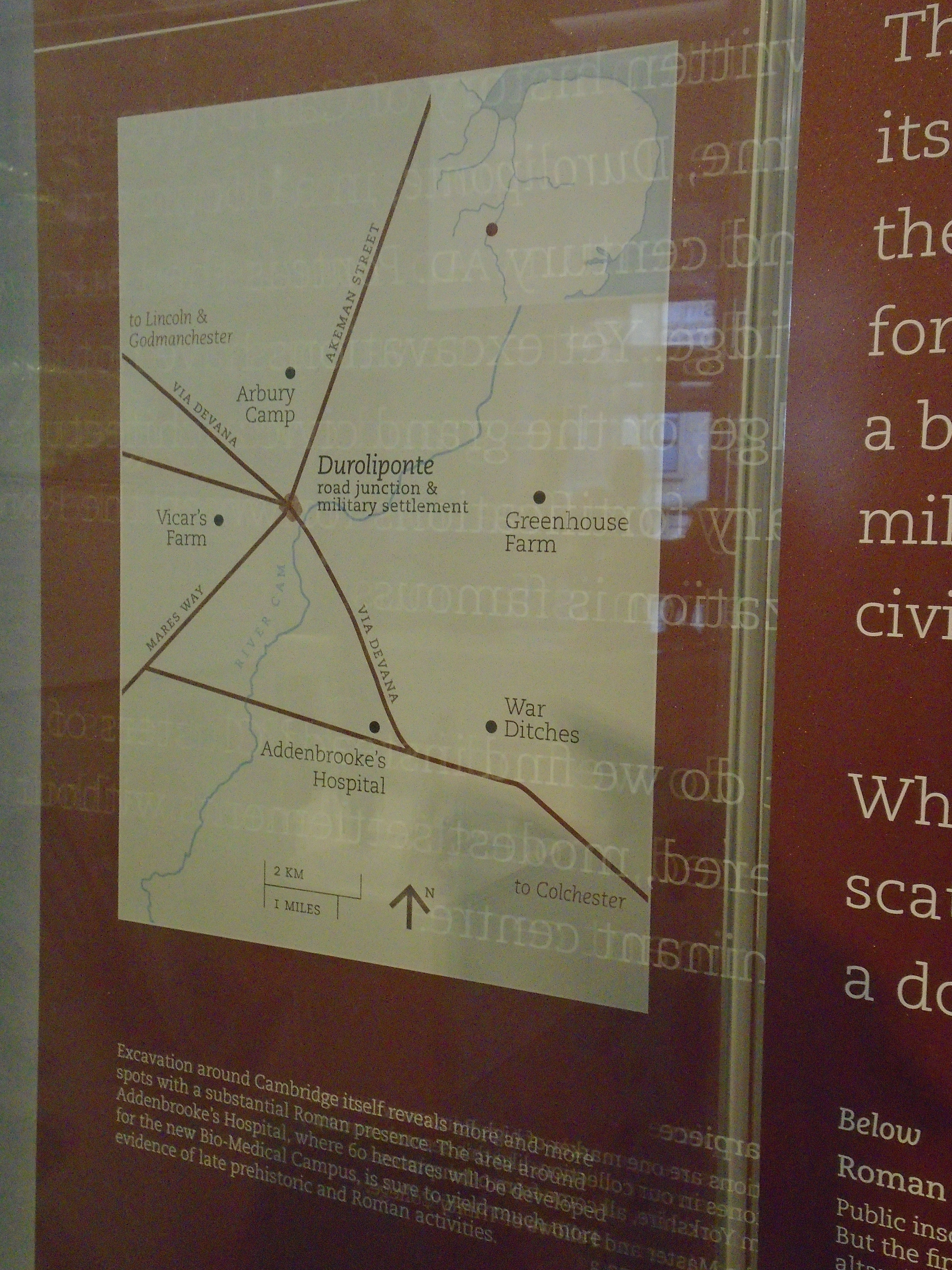
Roman Cambridge diagram 7.2 in CAS 1999 Roman Cambridge by John Alexander and Joyce Pullinger
This is taken from "An Historical Map of Cambridge" (isbn 978-1-8380719-5-0) which overlays historical features on a 1925 map. It shows the Norman castle (red) and earthworks by Cromwell (dark grey).
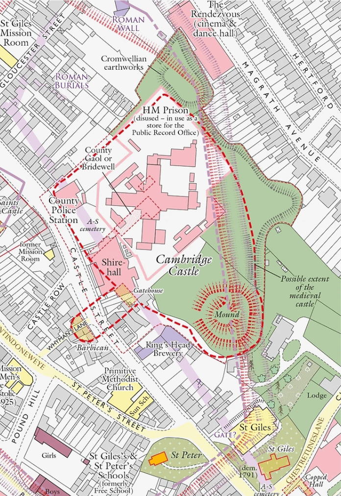
Another map showing how some parts of the castle survived until 1955.
This map shows Cambridge in 1340. It is in the Museum of Archaeology and Anthropology.

Map showing buildings of Barnwell Priory
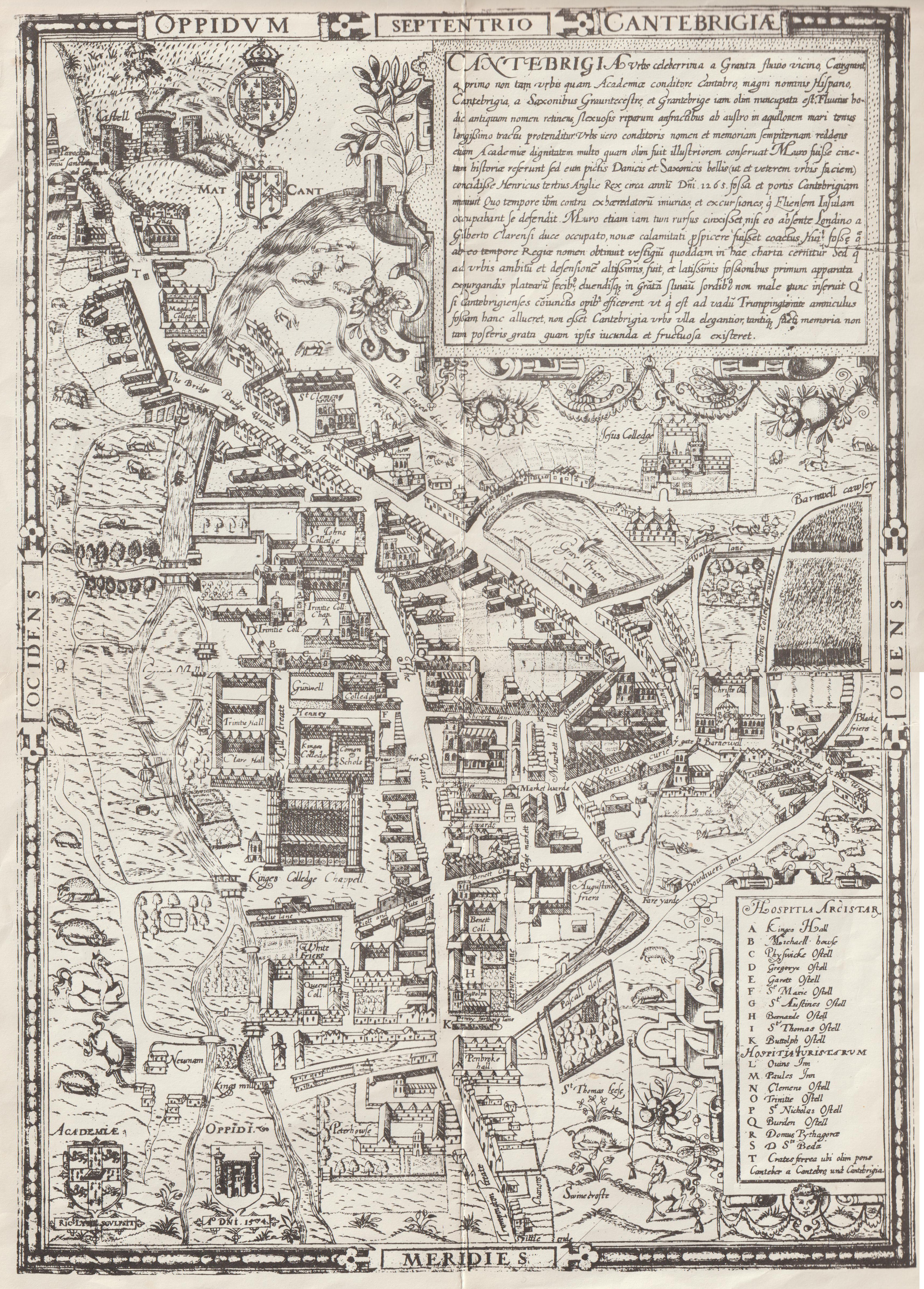
Tudor map of Cambridge, by Richard Lyne, dated 1574
Tudor map of Cambridge, dated 1575

Plan of Abbey House (off Newmarket Road) with parts dating back to 16C.

| Plans of Stourbridge Fair 1725. Please note that North is not at the top of the maps. The plan twisted the map round to fit the river and Newmarket Road into a neat square, and I have done the same to the modern map so you can compare them. The main road in the plan is Garlic Row, and this roads still exists today. Below, Daniel Defoe seems to suggest that in his time it was called Cheapside. The modern Oyster Row seems to appear on the early plan, although here it is called Brush Row. | Modern map for comparison | |
 |
 |
 |
William Custance's map of 1798
Parish boundaries c. 1800

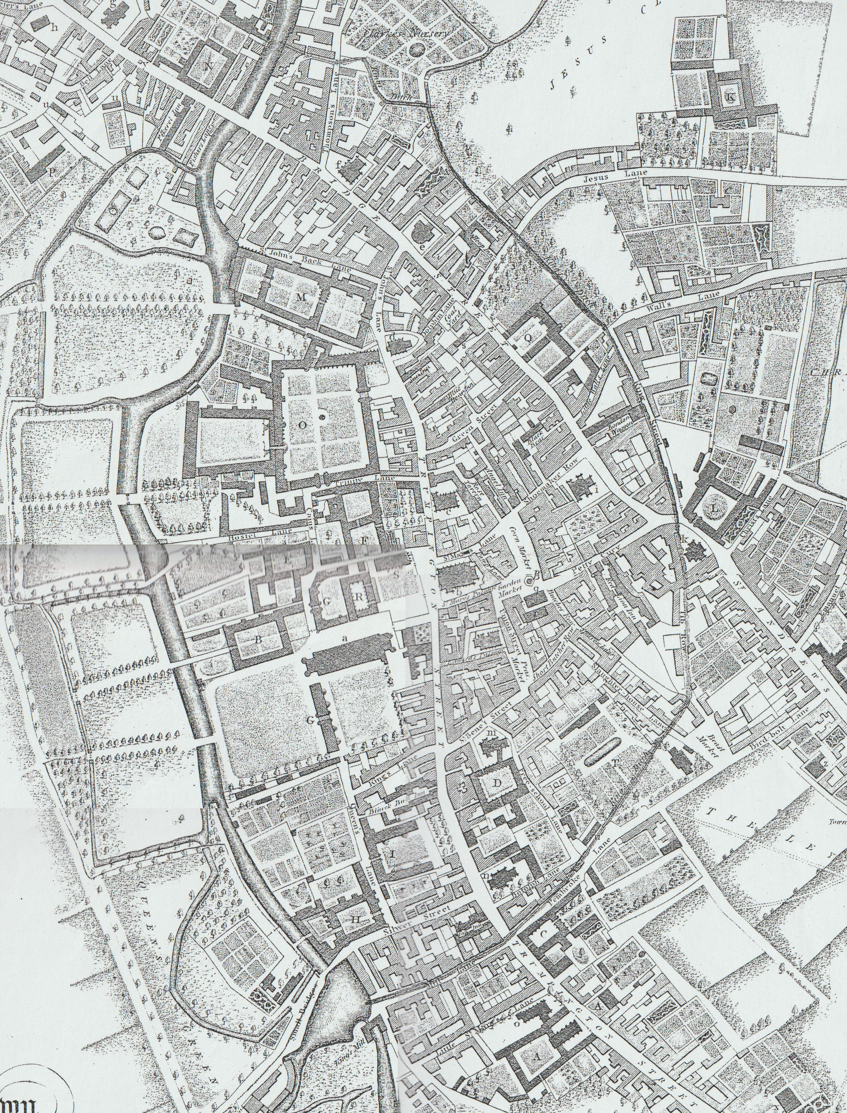
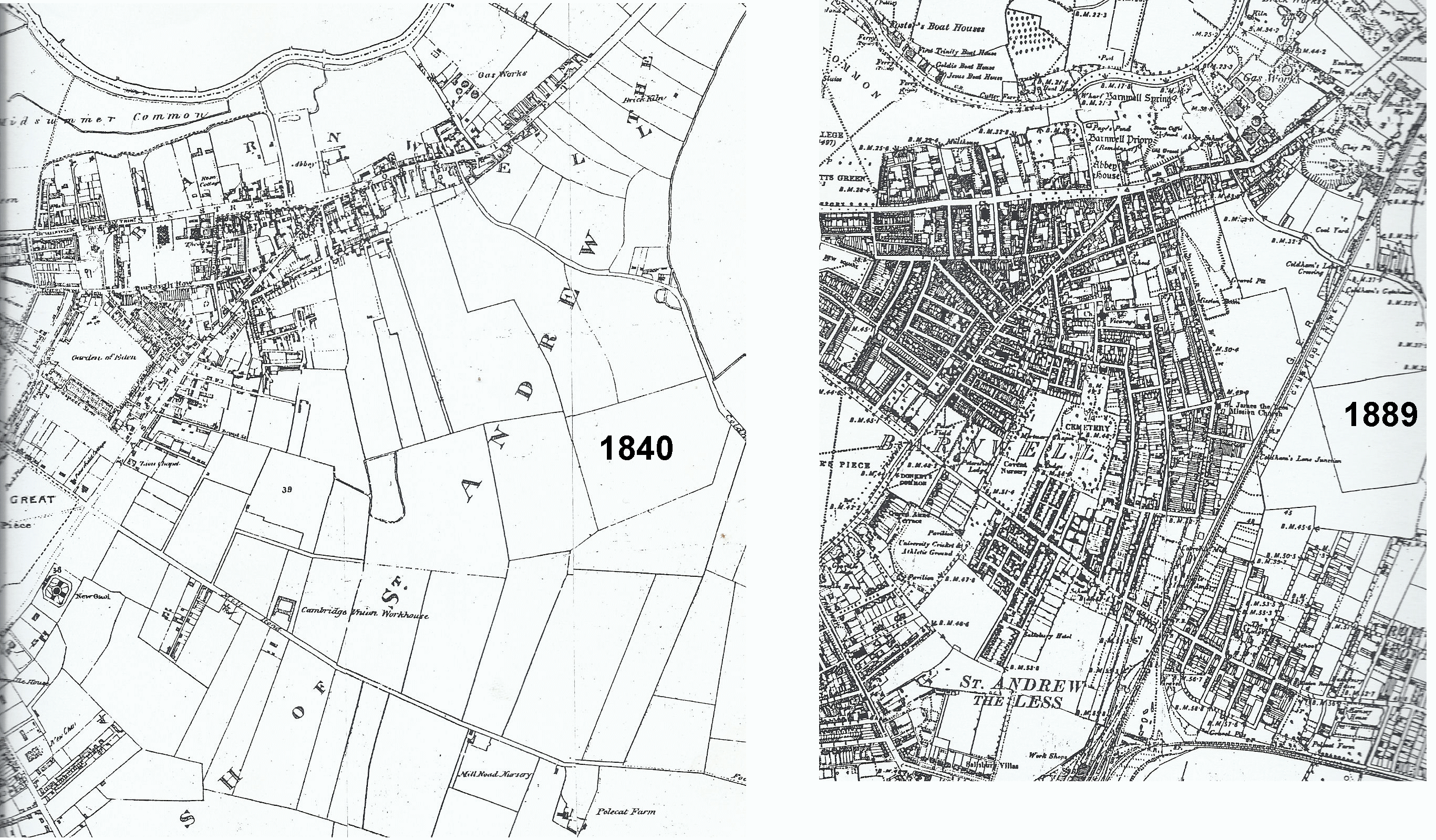
Maps of area round Gwydir Street, showing development between 1840 and 1889
© Jo Edkins 2025 - Return to Walks index