


| U3AC walks | U3AC walk - Kings Ditch |
Route: Board Walk, New Park Street, Park Street, Jesus Lane, Sidney Street, Sussex Street, Hobson Street, round back of St Andrews the Great, Lion Yard, passage along the Hilton, along Downing / Pembroke Street, Mill Lane
Length: 1.24 miles Start: Quayside Finish: The river at Mill Lane
Description: The walk covers a feature which no longer exists! Cambridge has never had a city wall, but it did used to have a fortification. This was a ditch, dug from near Quayside, round the eastern side of the city, meeting the river again near Silver Street bridge.This is called the Kings Ditch, because in 1267 Henry III was at Cambridge actively fortifying the town during a period of war against the Barons. There is archaeological evidence that the ditch may have been dug earlier, late C11 or early C12,, but it might have even been a Saxon fortification. At the bottom of the page are some finds there was an archaeological dig before John Lewis was built. This found some 11th or 12th century pottery sherds where the Kings Ditch used to be. There is a photo at the bottom of this webpage.
The Kings Ditch caused frequent problems as it was used (unofficially) as a sewer. A statute of 1388 ordered the King's Ditch should be cleared of "dung and filth of garbage and entrails, as well of beasts killed, as of other corruptions". In 1502, three heads of Colleges were fined by the Town Court for having "privvies" (toilets) overhanging the Ditch. Eventually it was either removed or built over . See Capturing Cambridge for more information.
There are maps and more information at the bottom of this webpage.

Click on photos for a larger version.
This gargoyle features Benedick Spinola, an Elizabethan banker. Magdalene College owned some land in London. In 1574, Benedick Spinola persuaded the college to temporarily transfer the title of the land to him, in order to increase the rental. Then Spinola sold the land to the Earl of Oxford, for £2,500. Magdalene College considered it had been cheated but was unable to regain the land. When Magdalene redeveloped the Quayside site in 1989, it avenged itself by erecting a gargoyle representing Spinola, designed by Peter Fluck and Roger Law, the creators of Spitting Image. See Magdalene College history.
It is quite hard to find this gargoyle, however. Walk from Quayside to entrance of the boardwalk, just beyond the punt station. There is an entrance to a restaurant, with a short brick wall between you and the river. Look over the wall to see the gargoyle.
On top it says "BENEDICT SPINOLA 12 XII 1574". The coat of arms is Spinola's own (the pointy thing is a spinola, for tapping a barrel). This is a true gargoyle, with water sometimes spouting from its mouth. Moral - Cambridge colleges have long memories!


Walk along boardwalk, then turn right down the passageway. This is close to where the Kings Ditch met the river.
Carry on walking down New Park Street, then Park Street. The Kings Ditch was to our right.
Look to your left to see Lower Park Street.

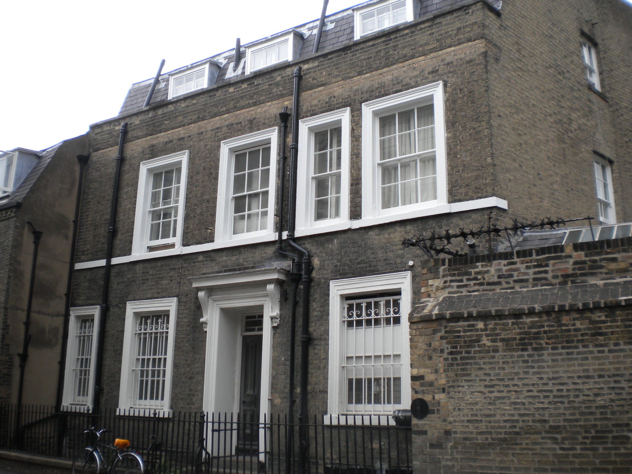
19-44 Lower Park Street are listed grade II. They were built early C19.

There is modern development in Round Church Street and Park Street. During World War II, Cambridge experienced bombing incidents, including one on July 28, 1942, where a raider attacked Bridge Street and Sidney Street with explosive incendiary bombs. This attack resulted in damage to 127 buildings, destruction of ten buildings, three deaths, and seven injuries. Additionally, a bomb fell on the Union Society building near the Round Church, causing a fire and damaging the historic stained glass window. I suspect this modern development shows where the bombs fell.
The last part of Park Street, just before it meets Jesus Lane, follows the route of the King's Ditch.
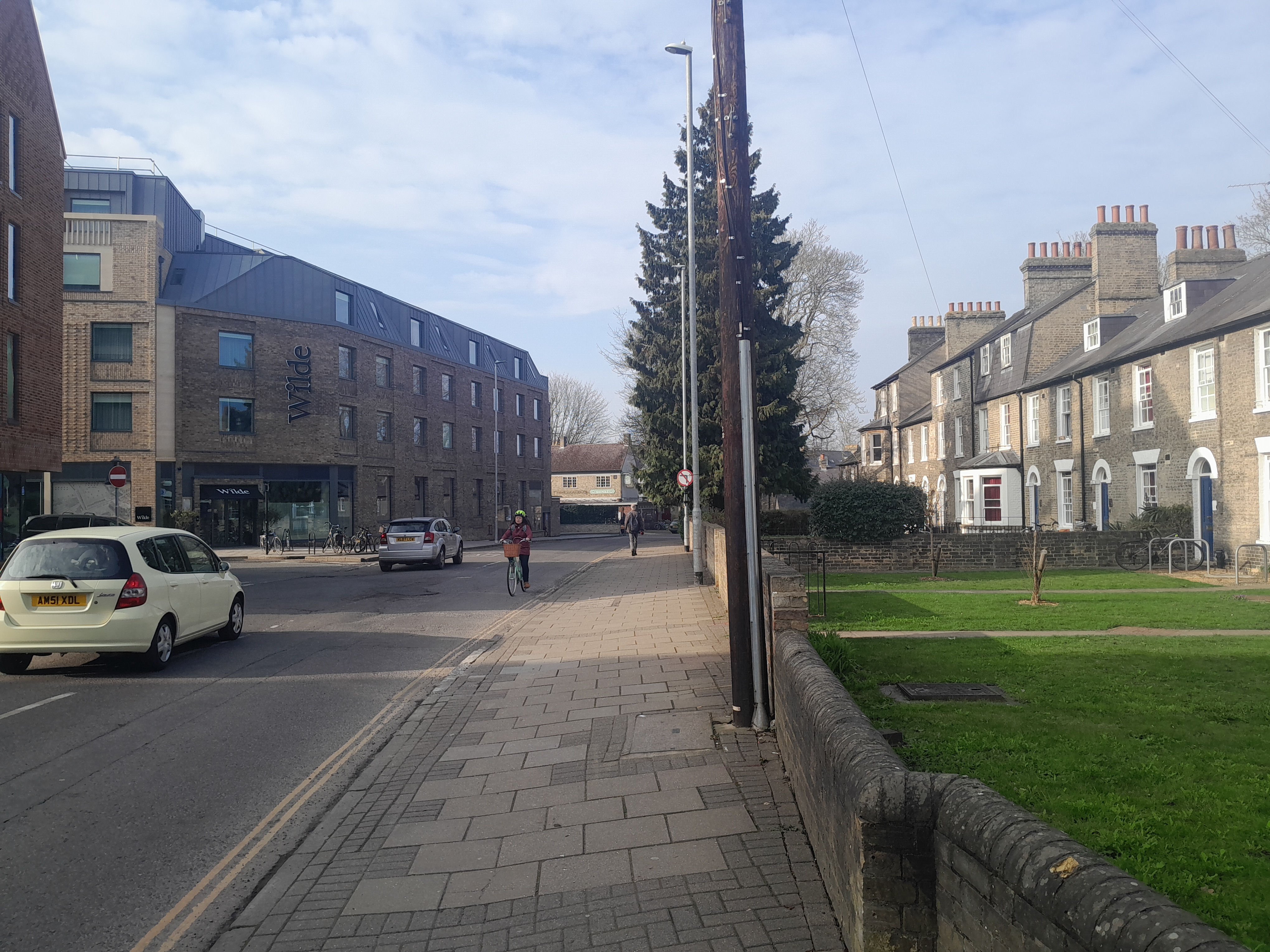
When we reach Jesus Lane, we can't walk forwards along the Kings Ditch any more, as Sidney Sussex college built over the top of it. So turn right along Jesus Lane.
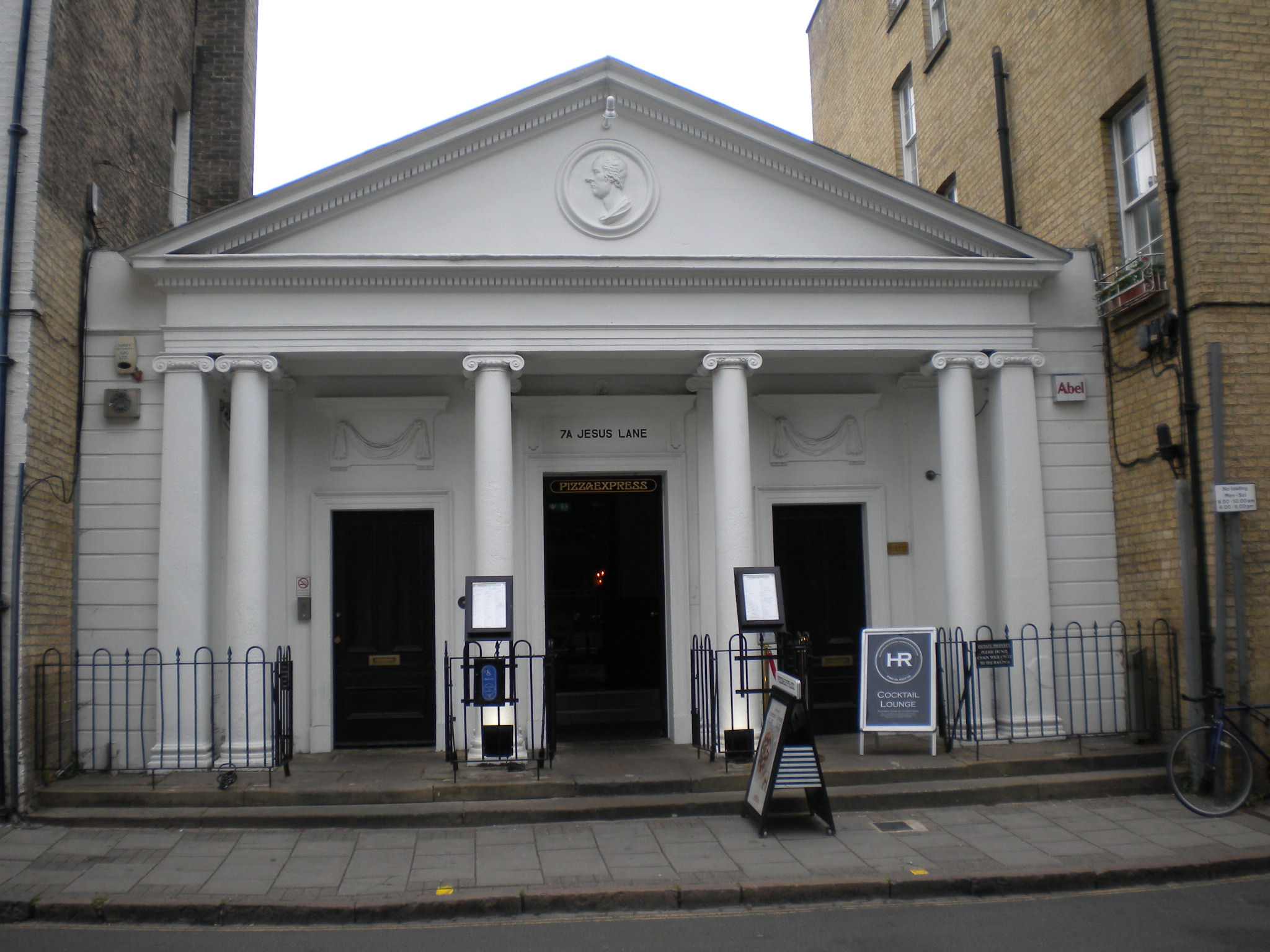
The premises were built by the Roman Bath Co, and opened on 1863. The bath was 56 feet by 22 feet and was heated to 62 degs F. It proved unsuccessful, and the Pitt Club moved in from their previous location.
The Pitt Club was founded in Michaelmas term 1835 in honour of Prime Minister William Pitt the Younger (1759-1806), who had been a student at Pembroke College, Cambridge. It was originally intended as one of the Pitt Clubs, a series political clubs set up across Great Britain, 'to do honour to the name and memory of Mr William Pitt, to uphold in general the political principles for which he stood'. In particular the University Pitt Club was intended 'to assist the local party organisations of the town of Cambridge to return worthy, that is to say, Tory, representatives to Parliament and to the Borough Council'. From the start, however, there was a social element as the Club's political events were combined with 'the pleasures of social intercourse at dinner, when party fervour among friends, dining in party uniform, might be warmed towards a political incandescence by the speeches to successive toasts'. The building is listed grade II.

The corner house has a weather vane with a barrel.

There was bomb damage in Cambridge during WWII, although it got off more lightly than a lot of places. Here are some shrapnel marks on the wall of Whewell's Court, in Bridge Street. Newspapers at the time, reported (25-29 Aug 1942): "Blast blew in windows of Whewell's Court of Trinity College and the outer wall of the court was extensively scarred by splinters".
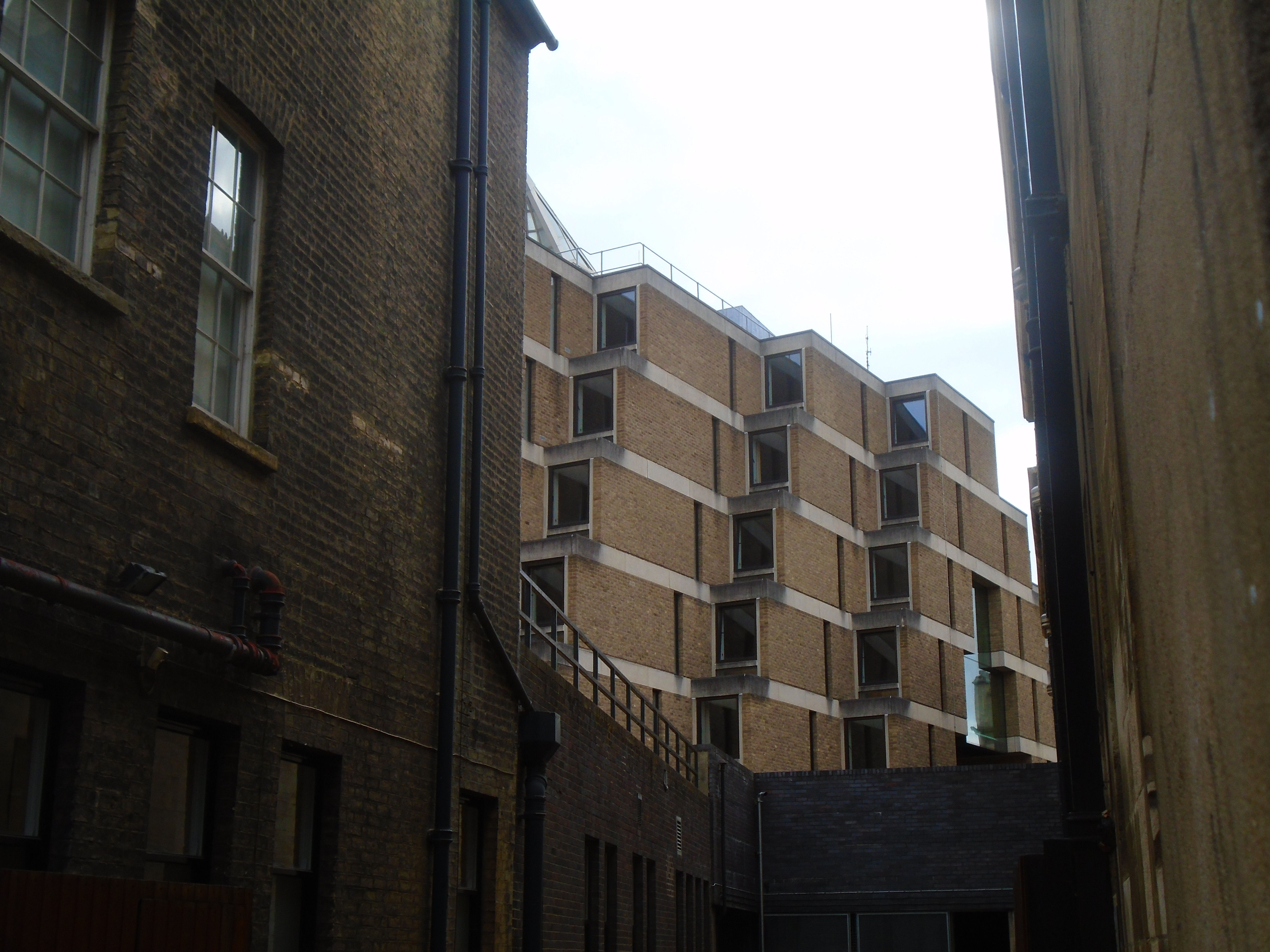
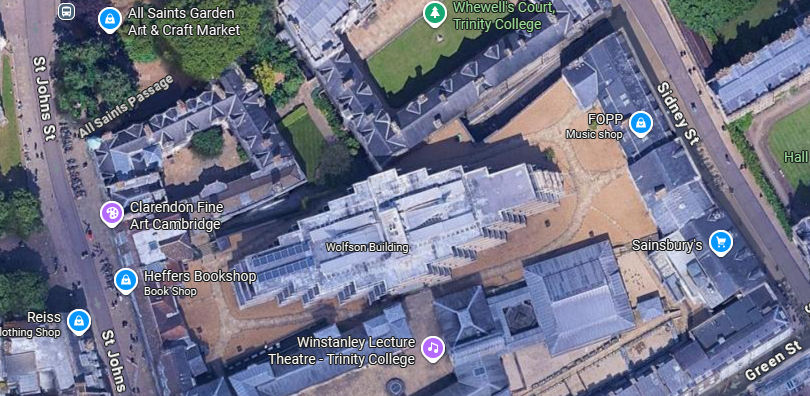
If you look to your right, you can see the Wolfson building. A sattelite photo of Cambridge shows the size of this student accomodation block, but it's almost invisible at ground level.
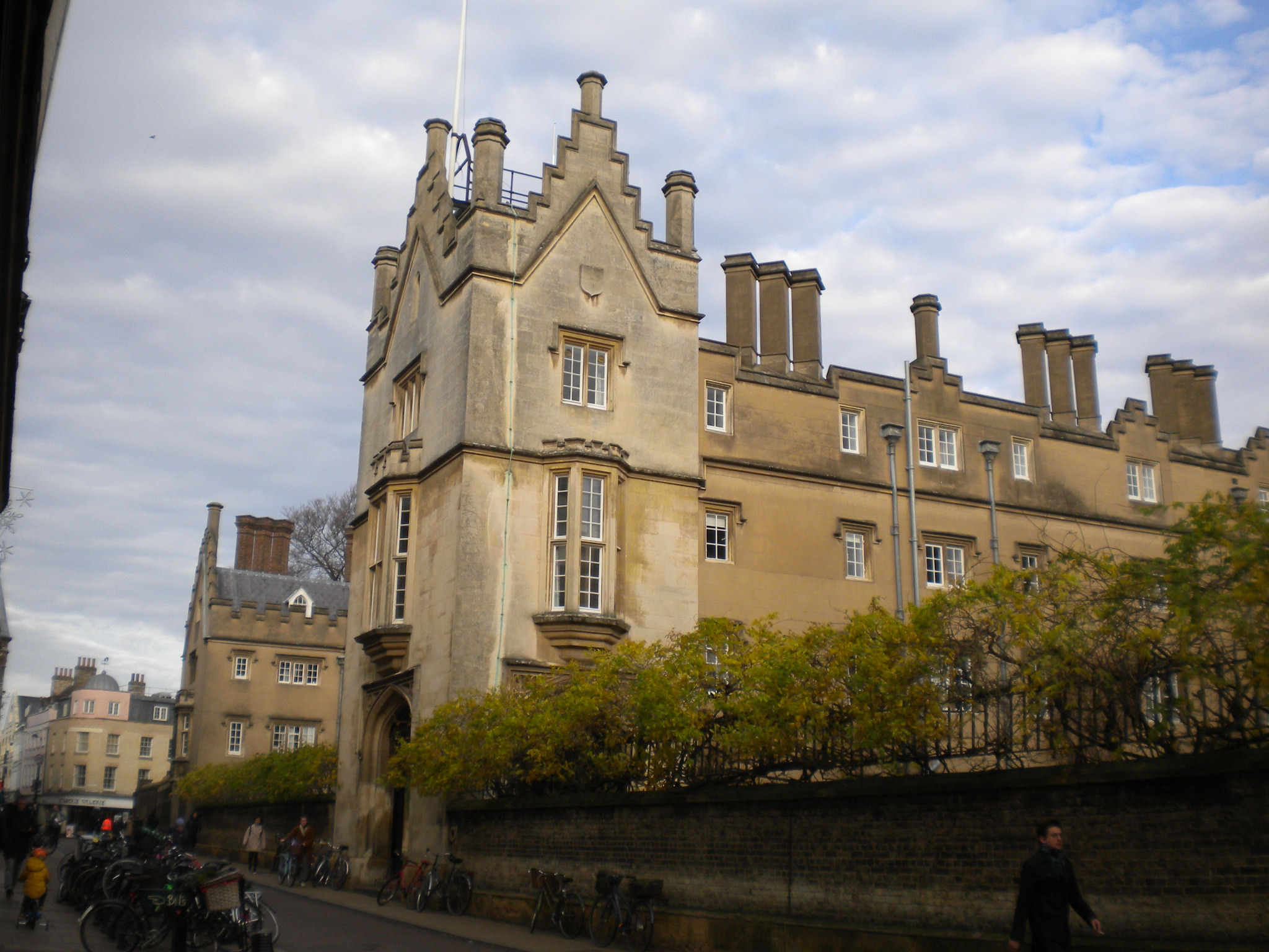
Sidney Sussex is listed grade I. It was built in 1595-8, although not the concrete rending. Local building stone in Cambridge was clunch, a type of chalk, and it was such poor building material that sometimes they used concrete to preserve it.
Oliver Cromwell was MP for Cambridge, and he also attended Sidney Sussex College. His head is buried there, but the college won't say exactly where (although they know themselves) because they don't want either Cromwell supporters or critics making a nuisance of themselves!
Turn left into Sussex Street.


Sussex Street is listed grade II. It was built in 1928-39.
If you look up at the buildings on either side of Sussex Street, you will see carvings of either leaves or rams heads. I suspect that they are a joke. There are different types (or orders) of pillars. An Ionic pillar has spirals at the top, based on rams horns, and Corithinthian has acanthus leaves (and rams horns as well). Here we have the whole head or plant! But there are more conventional pillars as well.


At the end of Sussex Street, there is an archway over the street. This joins two parts of Sidney Sussex college. This archway was built in 1991. Walk under the arch, and turn round to look at the other side. There is a blue porcupine. Sidney Sussex College was founded by Frances Sidney, Countess of Sussex. The crest of her family is a blue and gold porcupine, and so this is the corporate seal of the college.
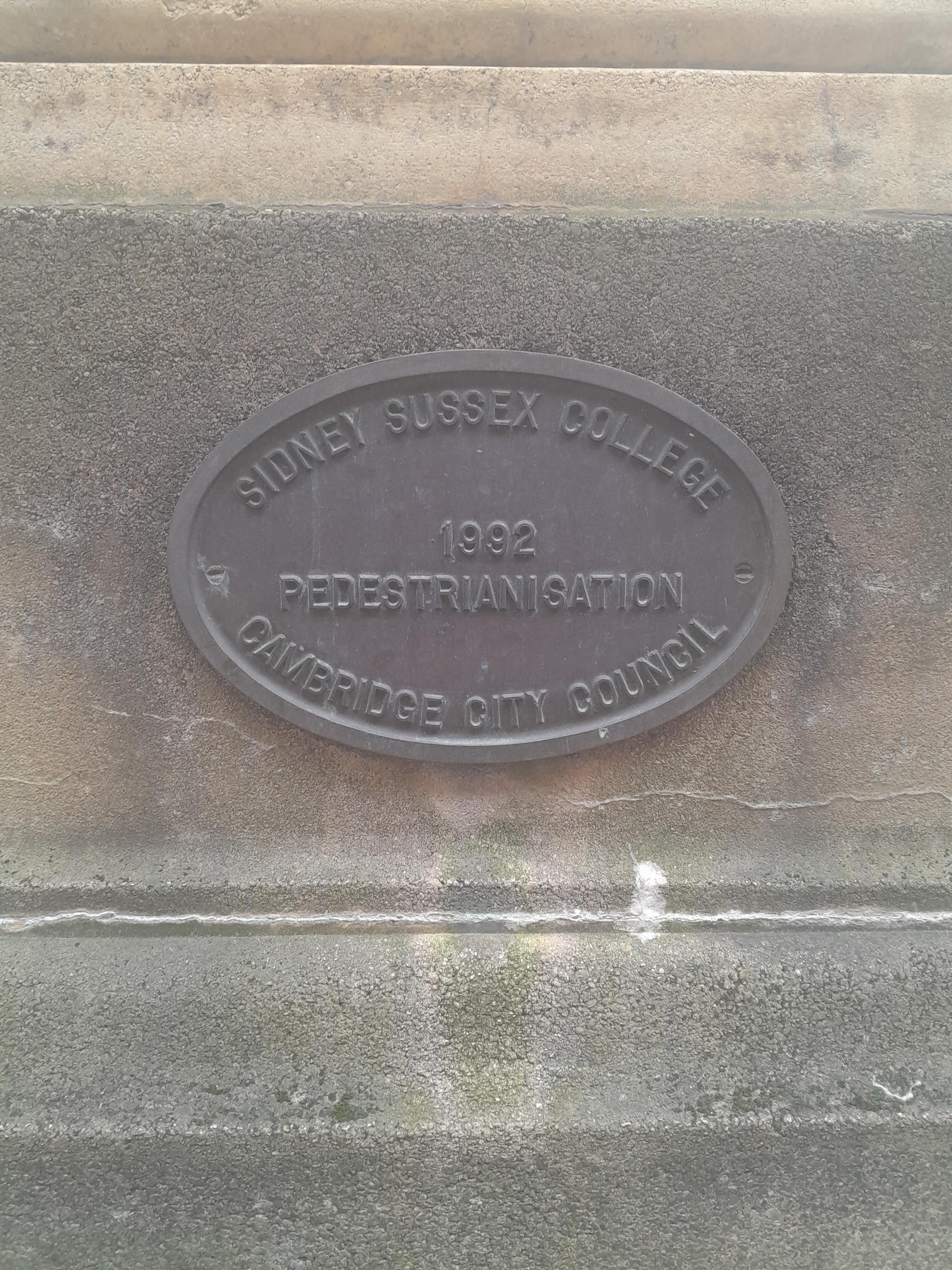
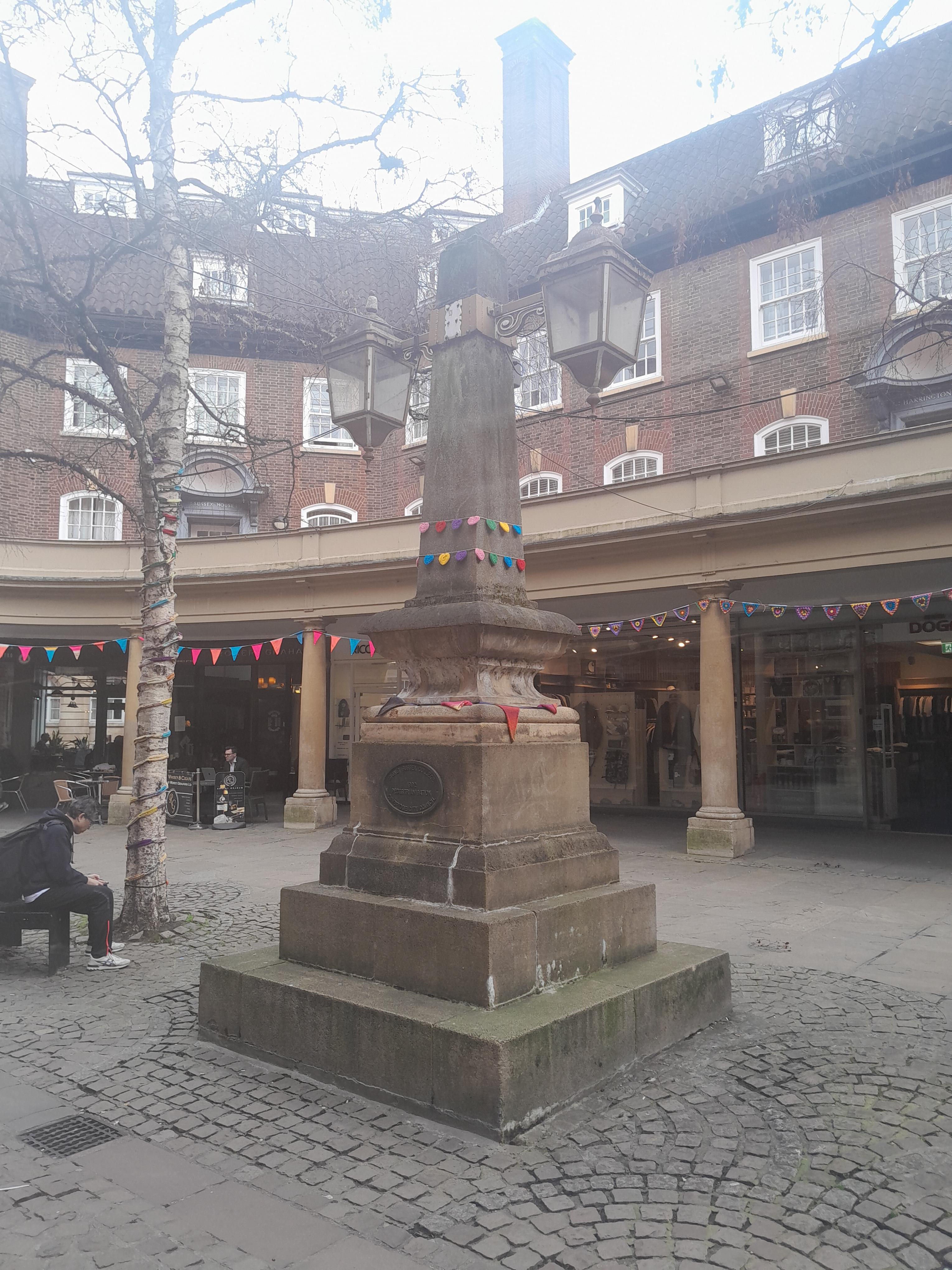
In the middle of Sussex Street, there is a very grand lamp stand in the shape of an obelisk. This has a plaque showing that pedestrianisation happened in 1991.


There is a Dinky Door, on the right.

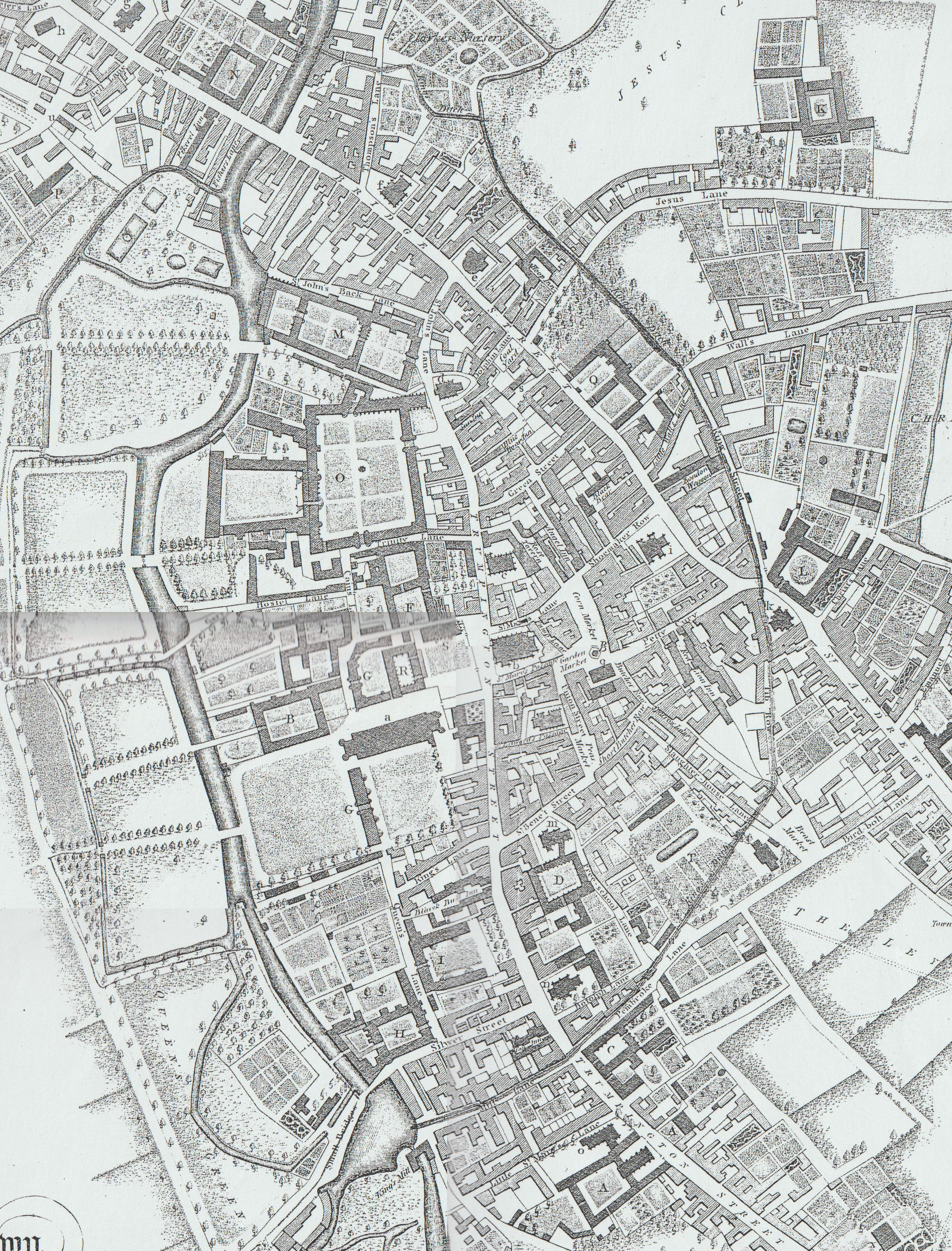
Notice the sharp left turn between King Street and Hobson Street. This is the point that we pick up the Kings Ditch again. Hobsons Street is odd, with a backstreet feel about it. It runs along the path of the Kings Ditch. It doesn't exist on the Tudor map (see bottom of this page). The 1789 map shows it (called King Street) with the Kings Ditch running down it. The ditch may have been underground by that time, though. the modern Kings Street and Hobson Street have rather a confusion of names. King St started as Walls Street, and Hobson Street was originally King St, presumably after the King's Ditch. The modern names were used in an 1840 map.
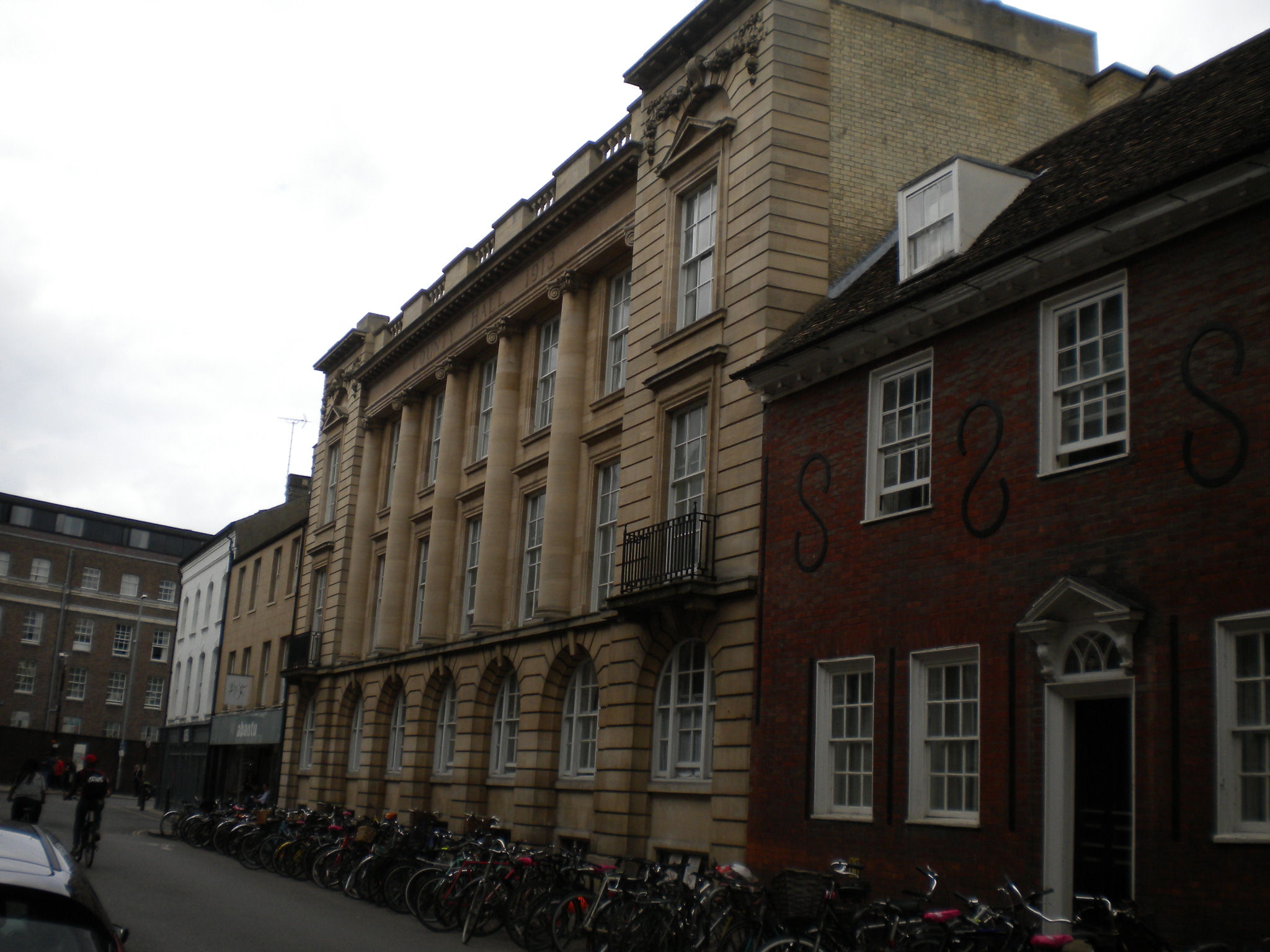
The Old County Hall is listed grade II. It dates from 1913. Then Shire Hall was built in 1932, near Castle Mound. Now the County Council is now at Alconbury.


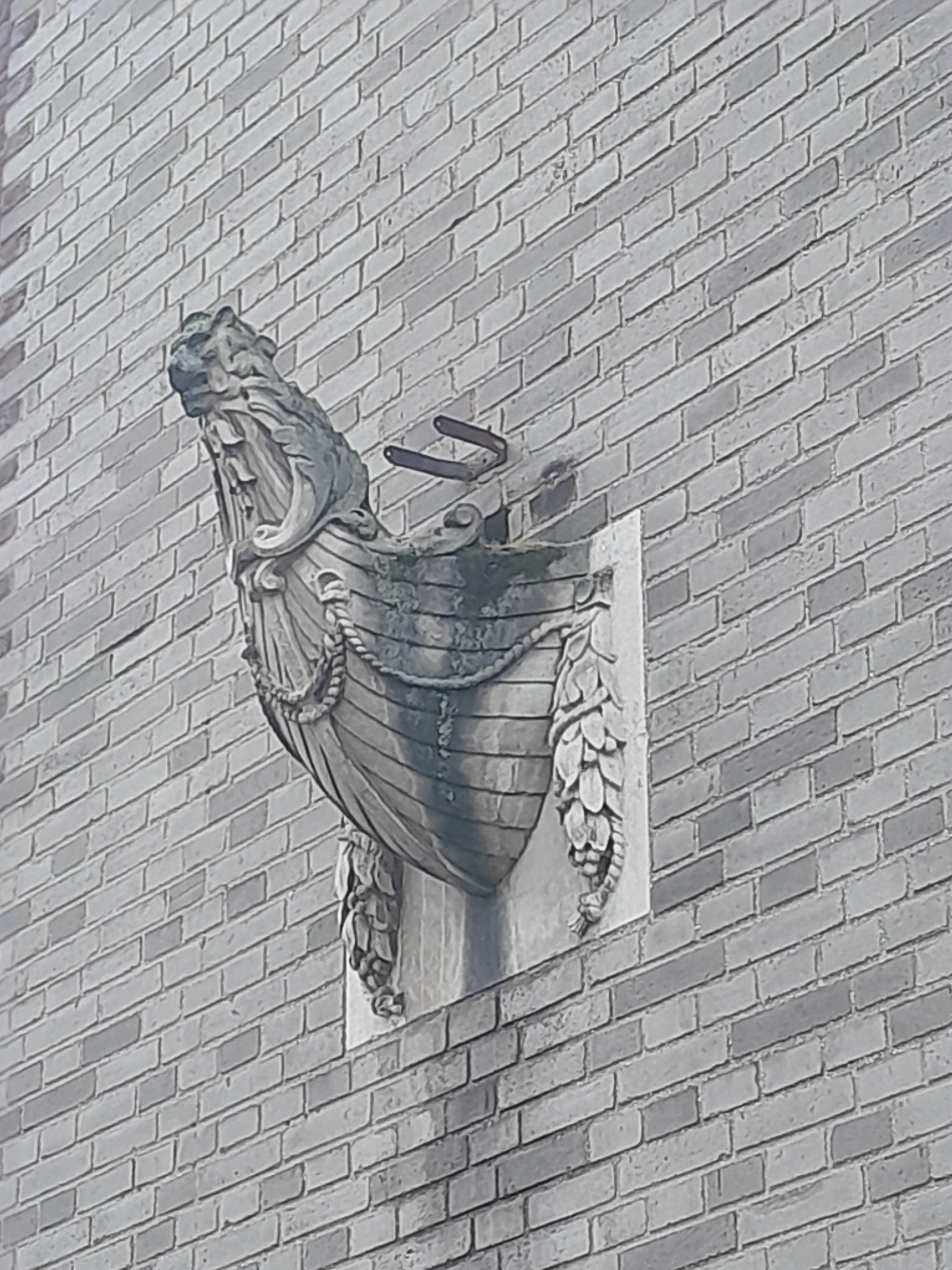

22 Sidney Street stretches back to Hobson Street. It is in an Art Deco style. It was originally a dance hall called the Dorothy. It's not listed. On the Hobson Street side, there is a feature of ship ends set into the wall. The "Rostra" was a large platform built in ancient Rome. It was called that because it was decorated with "rostra" (a form of bow on naval ships) from captured ships. I wonder if this is supposed to be a similar effect, as they flank the balconey.
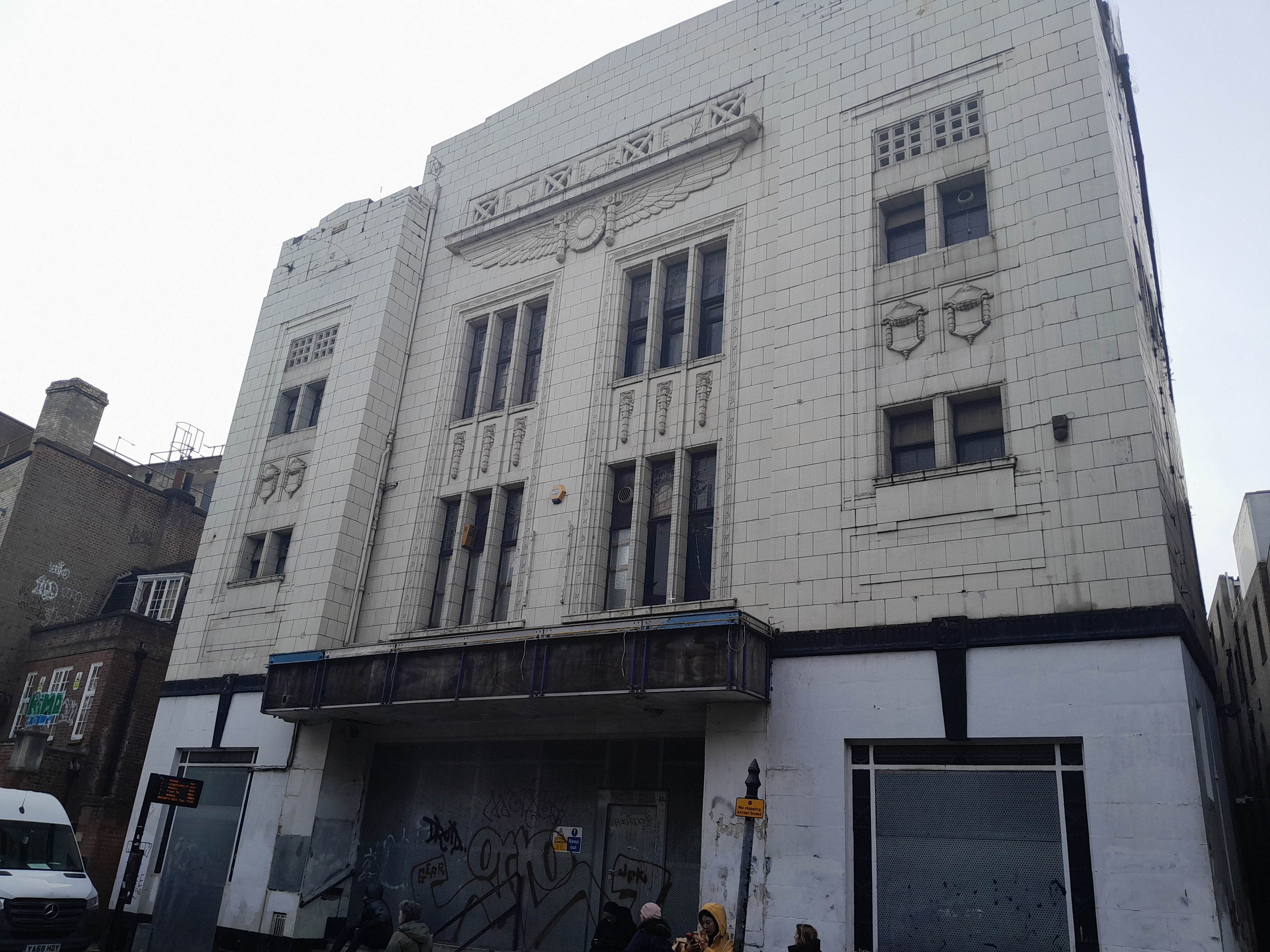

The Central Cinema was built in Hobson Street, in 1930, with a facade in the Egyptienne style. It then became a bingo hall, and now unhappily is not used. This isn't listed either, and there are sometimes rumours of demolition.
18 Hobson Street is listed grade II. It is early C19. It is now part of Christs college.


At the end of Hobsons Street is Christ's college is listed grade I. It dates from early C16. Its gatehouse looks similar to St Johns College, with yales and marguerites, because they had the same founder, Lady Margaret Beaufort, who was the mother of Henry VII.
This area of street shows the awkward angle of Hobson Street to St Andrews Street, and this is because of the Kings Ditch crossing the Roman road. There was a gate here called Barnwell Gate. Rather pleasingly, there is a modern gate there, stopping cars from entering the pedestrianised city centre.

Carry on along the passage behind Great St Andrews Church, until you meet the path into the Lion Yard.
At this point, we have to leave the Kings Ditch. This area has beeen redeveloped for shopping, and not just in modern times. Walk through Lion Yard.

When in Fisher Square, turn left along a modern walkway which runs along side the Lion Yard carpark. (If you can't find it, then you can walk along Corn Exchange Street, but the walkway is a more pleasant experience.) By the way, the King's Ditch has been traced as running beneath the Grand Arcade. We will be crossing it at some point walking along this walkway, although there is no mark of it.


Look across the street to see a spiral artwork, tucked behind a staircase. It is made of Welsh slate. Holes have been left between them in the hope that native bees will use them! The artists are Heather Ackroyd and Dan Harvey and it was commissioned in 2016. Their website is here - it describes the works in more detail.


Cross Downing Street. To your left, there is a mamoth, and a shield with Iguanodon and sloth supporters. They are on the wall of the Sedgwick Museum, which contains fossils.


The drainpipes on the front of the Downing site are decorated with bees.

This is above the gate to the Downing Site. The motton says "Hinc lucem et pucula sacra" which means "Out of here comes light and sacred draughts". The lady in the middle holds a sun and a cup to represent these. She is labelled "Alma Mater Cantabrigia", which means "Bountiful mother Cambridge". If you look carefully at her, she is indeed bountiful - she's lactating! She's the University's emblem, and was first used by John Legate in 1600. This is the first use of the term "alma mater" to mean a university.


These green men (and a lion) are above the entrance of the Downing site. These are creatures with branches coming out of their mouths, which can be found in medieval churches. These ones are Victorian! The pillars have grining faces as well.


Turn back to enter the Downing site, then turn slightly towards your left. In the paving, you will see two human-sized foot prints. This installation is a human figure buried up side down with only the soles of the feet showing. There is no information near-by about it, and you can walk right over it without seeing it if you're not careful. It is by Anthony Gormley. It is dated 2002, and it is called Earthbound: Plant. The photos show it being installed.


The Sedgwick Museum is close by. This has a collection of fossils, and minerals. The architect of the Sedgwick Museum was Thomas Graham Jackson and he was responsible for this art. The museum was opened in 1904. The stairs leading to the museum have pairs of splendid animals at the bottom, bears and bisons. Why bears and bison? In 1904 geologists found fossils of bear and bison in the gravels of Barrington, a village south-east of Cambridge.

There is also a model of a dinosaur, Clare the Tyrannosaurus rex by Ian Curran (and nothing to do with Thomas Graham Jackson!) It was centrepiece at Clare college's "Primordial" May Ball in 2014, and then acquired by the Sedgewick Museum, which involved moving it through the centre of Cambridge! See more here.


Look above the Sedgwick Museum. There is a weather vane with an ichthyosaur on it!
Nearby, on the lawn, there is a rather splendid sun dial. From sundial walk: "The rather battered sundial near the Downing Street entrance to the site is actually a collection of 17 dials all cut into a single block of stone. The sundial was presented by Professor Sir William Ridgeway (a famous archaeologist and classical scholar) and his wife Lucy in 1913. Their daughter, also named Lucy, married the son of John Venn (of diagrams fame). Sir William and (daughter) Lucy later set up the University's Ridgeway-Venn Travel Fund. According to University Ordinances, the first call on this Fund is for the maintenance of this sundial."

In the other corner is the back door to the Archaeology and Anthropology museum (Arc and Anth). Outside, there is this statue. There is a board nearby, which says: "Lyonel Grant (born 1957) is an internationally distinguished Maori sculptor, renouned for work that bridges customary practice and contemporary art. Displaced Mihi was made especially for the Museum of Archaeology and Anthroplogy. The work adapts the traditional tekoteko, the figure that stood at the top of a customary meeting house to challenge and welcome visitors. On the surface of this contemporary bronze, customary design has been replaced with writings and imagery, referring to history and empire. Displaced Miki offers a Polynesian welcome to visitors to the northern hemisphere museum, and acts as kaitiaki, as guardian, of the ancestral treasures from many cultures that are here" - a good description of the museum!
On the ground floor of the Arc and Anth, there is archaeology and finds from Cambridge and Cambridgeshire, if you want to find out more about local history.


Return to Downing Street. Cross it to see another Dinky Door. Remember, we are in Downing Street! (Although number 10 is further down, now part of John Lewis.)
As we move on to Pembroke Street, we rejoin the path of the Kings Ditch, which we have been neglecting somewhat. The Tudor map shows the ditch running alongside the road.
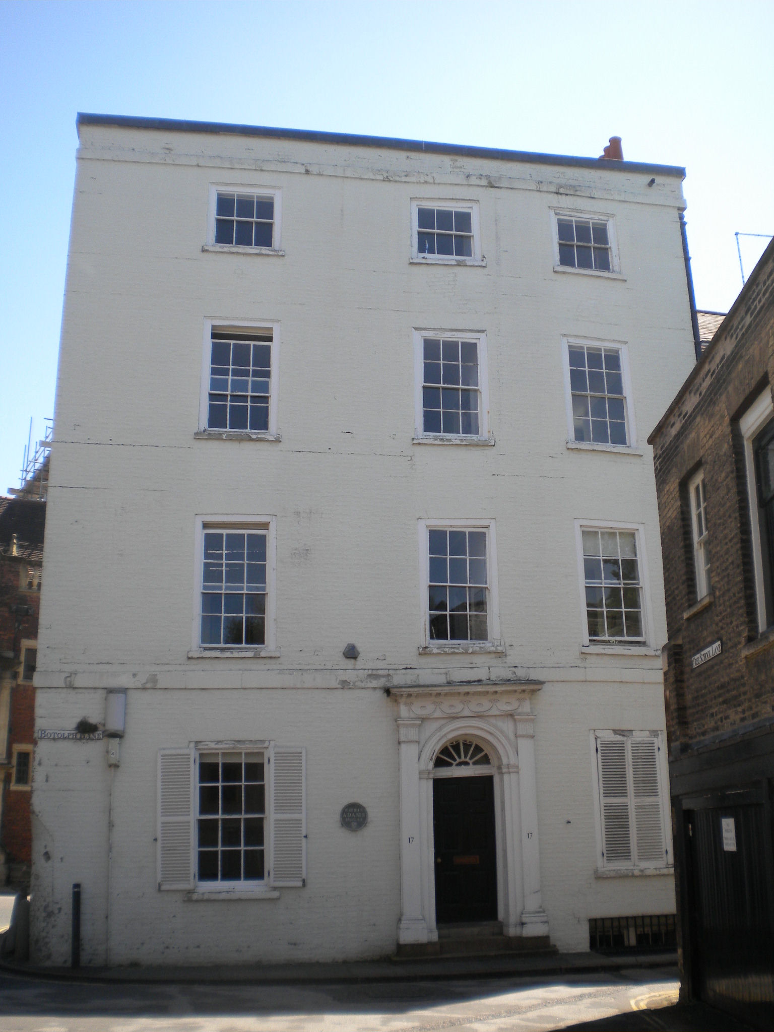
If we turn into Free School Lane, we can see the white building called Charles Adams House (formerly Botolph House). It is circa 1790, and grade II. But there is something else interesting about it. You can see that above the door, and some of the windows has sagged. The map shows that the King's Ditch went right under the house, and this has caused subsidence problems!


Return to Pembroke Street. We will now be walking along the Kings Ditch to the end of the walk.

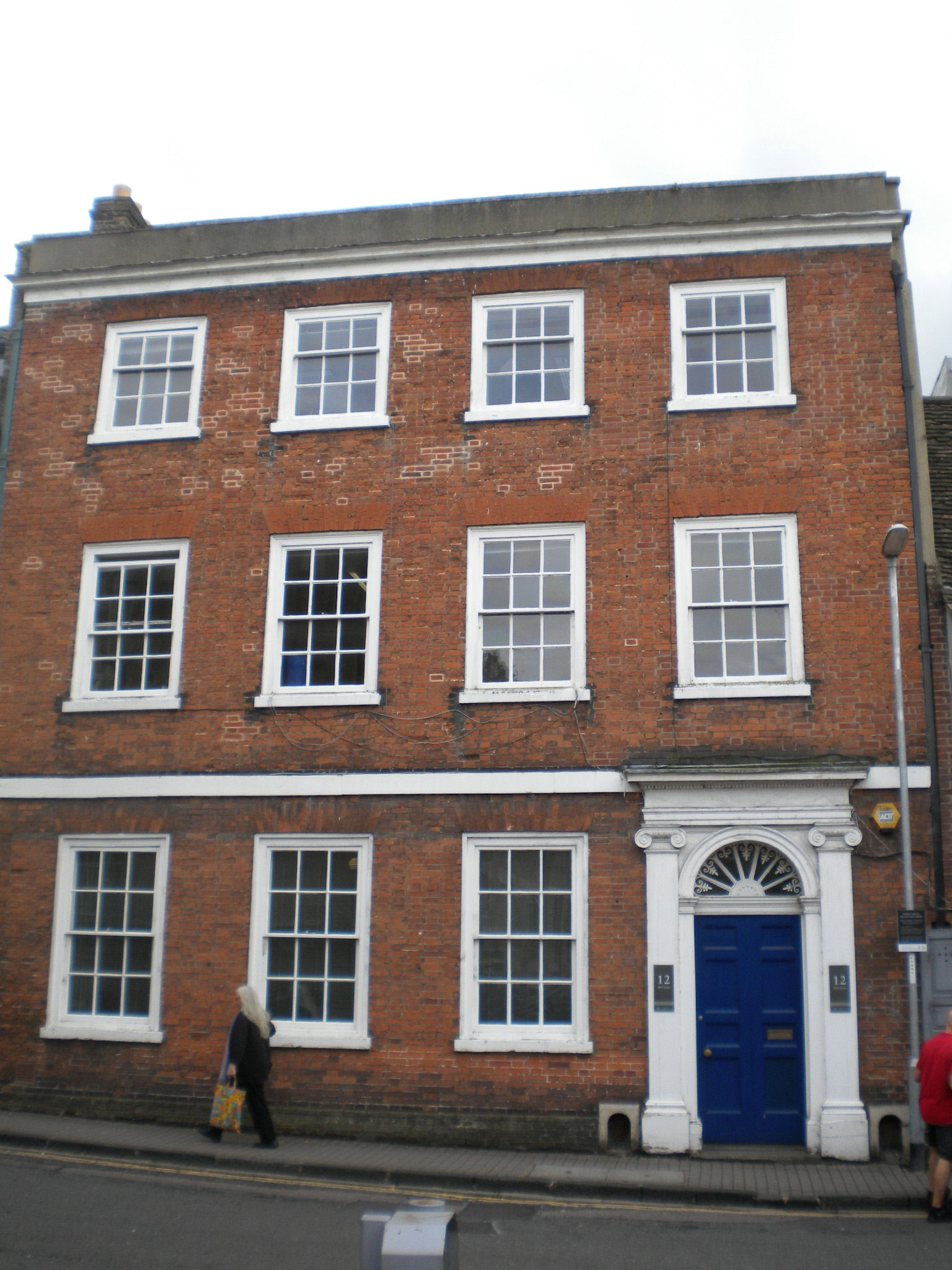
6-12, Pembroke Street is listed grade II and is C18.

3, Pembroke Street is listed grade II and is C17.

There was another gate at the end of Pembroke Street, where the Kings Ditch crossed Trumpington Street. It was called Trumpington Gate.


This sculpture was installed in 2025, outside Milstein House, Mill Lane. It is by Anthony Gormley and is called "Close".
Mill Haven, East House is listed grade II. It is about 1775.

Mill Haven, West House is listed grade II. it is C16 origin, front remodelled Cl8.
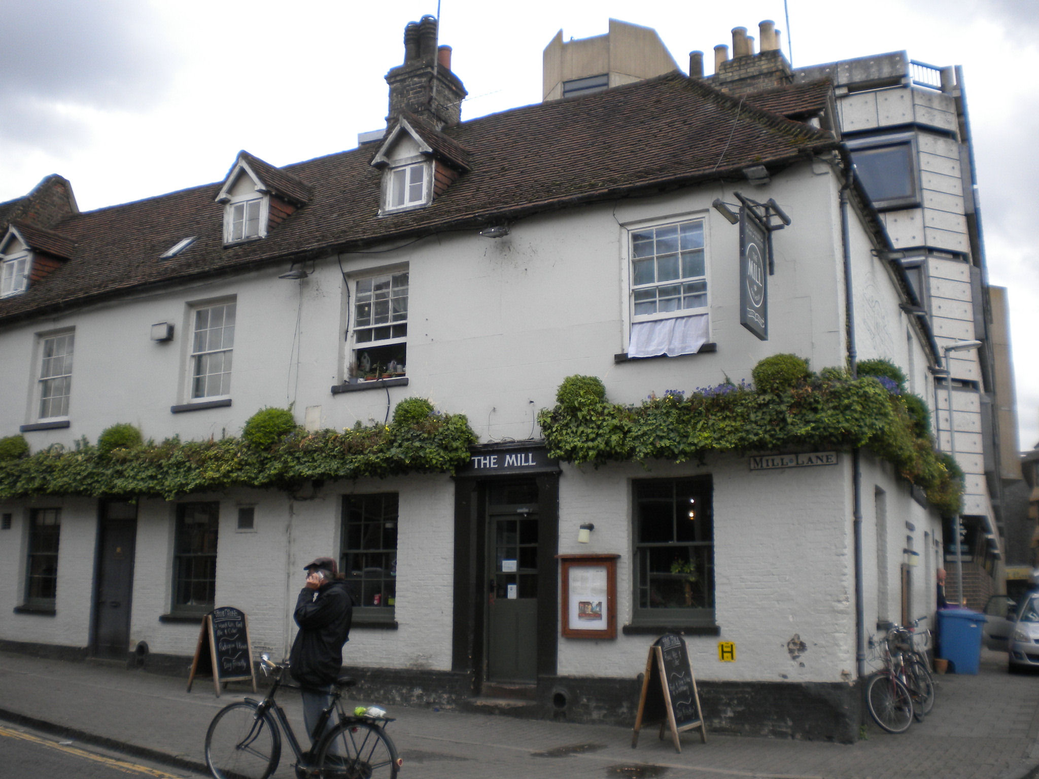
The Mill pub is listed grade II and is late C18.
This is the point that the Kings Ditch met the river.
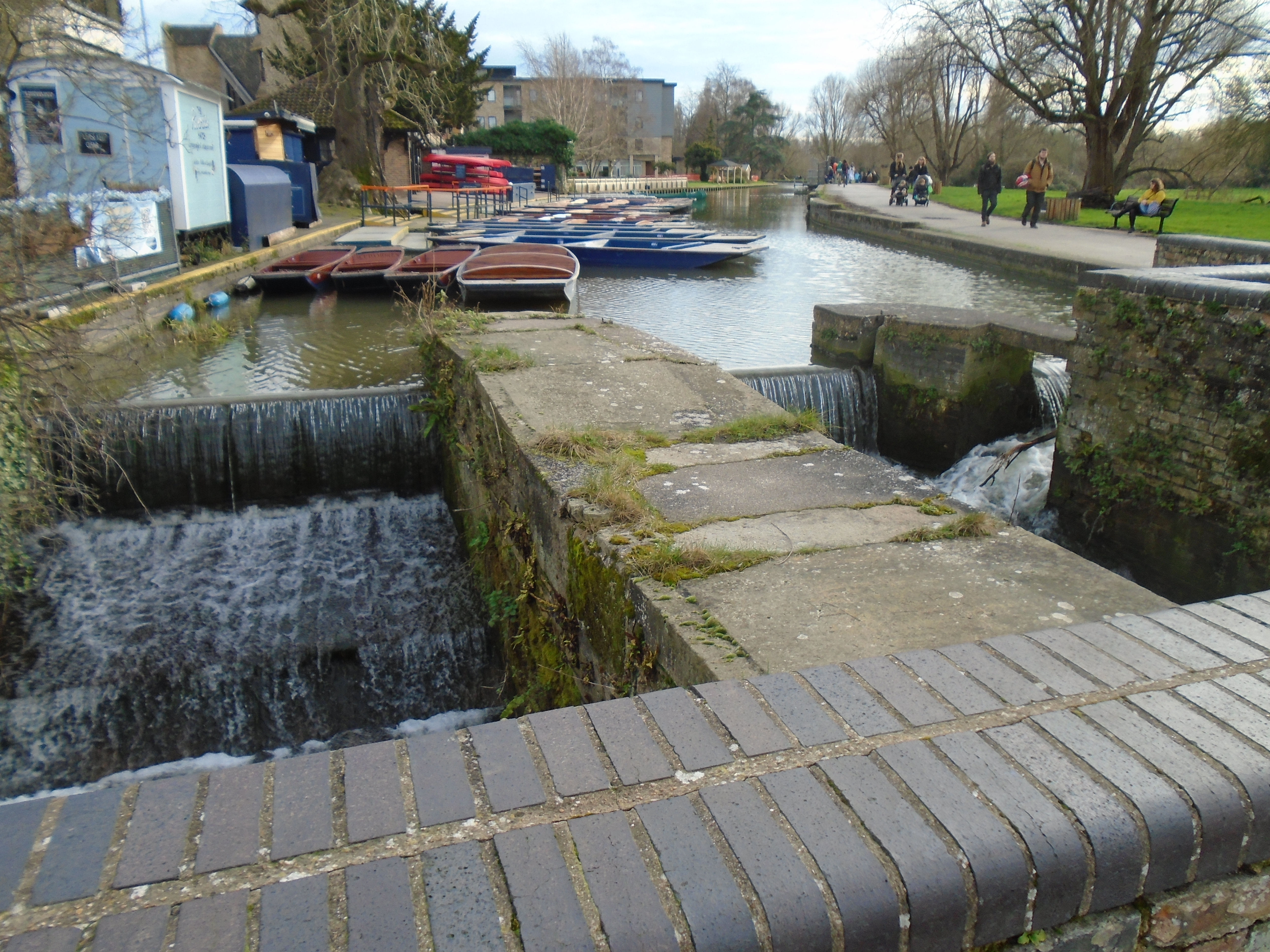


Mill Lane and the Mill pub are named after two mills, which used to be here. They were called Kings Mill and Bishops Mill, which were demolished in 20C. The photograph above is dated 1924.
The Domesday Book says "Picot himself [Sheriff of Cambridge] has made 3 mills there which diminish the pasture and which have destroyed many houses. Also a mill of the Abbot of Ely, and another of Count Alan. The mills themselves pay £9 a year." It seems likely that these are two of the mills, since they are close to Cambridge, but there was river navigation below them. It sounds as if local people didn't like Picot!
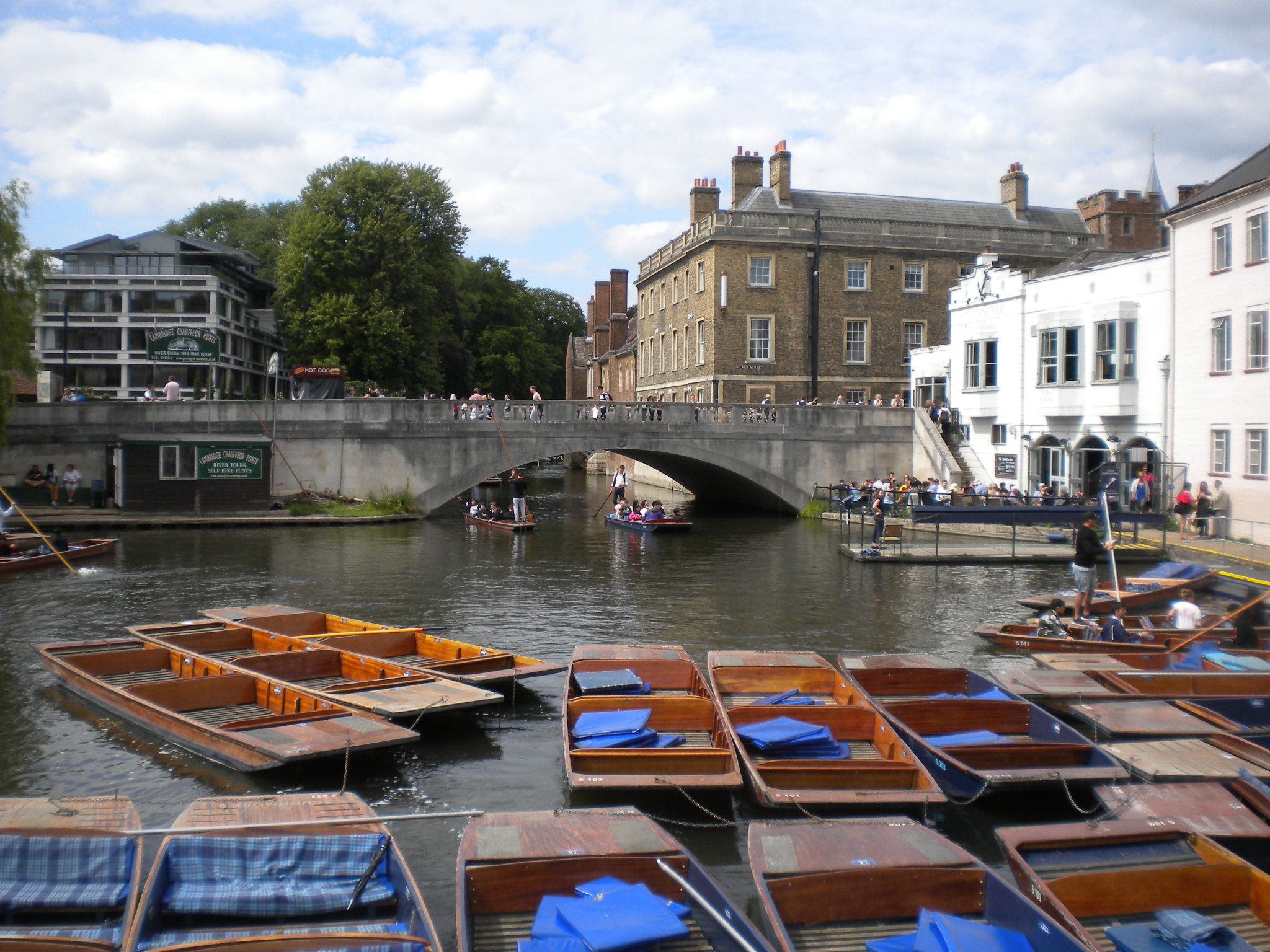
From this point, there is a good view of Silver Street bridge, which is listed grade II. It was designed by Sir Edwin Lutyens in 1932 and built in 1958-59.

When you cross the weir, you are in Laundress Green. This is actually an island. The Cam flows from Grantchester, but upriver from here, it divides in two, the main channel, and a smaller stream called Snob Stream. Then they rejoin below the weir - the photo, taken from Silver Street bridge, shows this. Snob Stream was used by the towns people to learn to swim, as it was shallower than the main river. "Snob" was the university name for the townsfolk. (Thackeray wrote "Book of Snobs", which used the modern meaning. He went to CambridgeUniversity!) Snob Stream flows under Newnham Mill, another old mill, although the building is 19C. The stream used to power it.
When the Grand Arcade was built, archaeologists used the opportunity to research the Kings Ditch. They found 11-12C pottery in it, which demonstrates ts age. These are now in the Museum of Archaeology and Anthropology, with this map showing part of the route of the Kings Ditch.


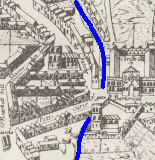
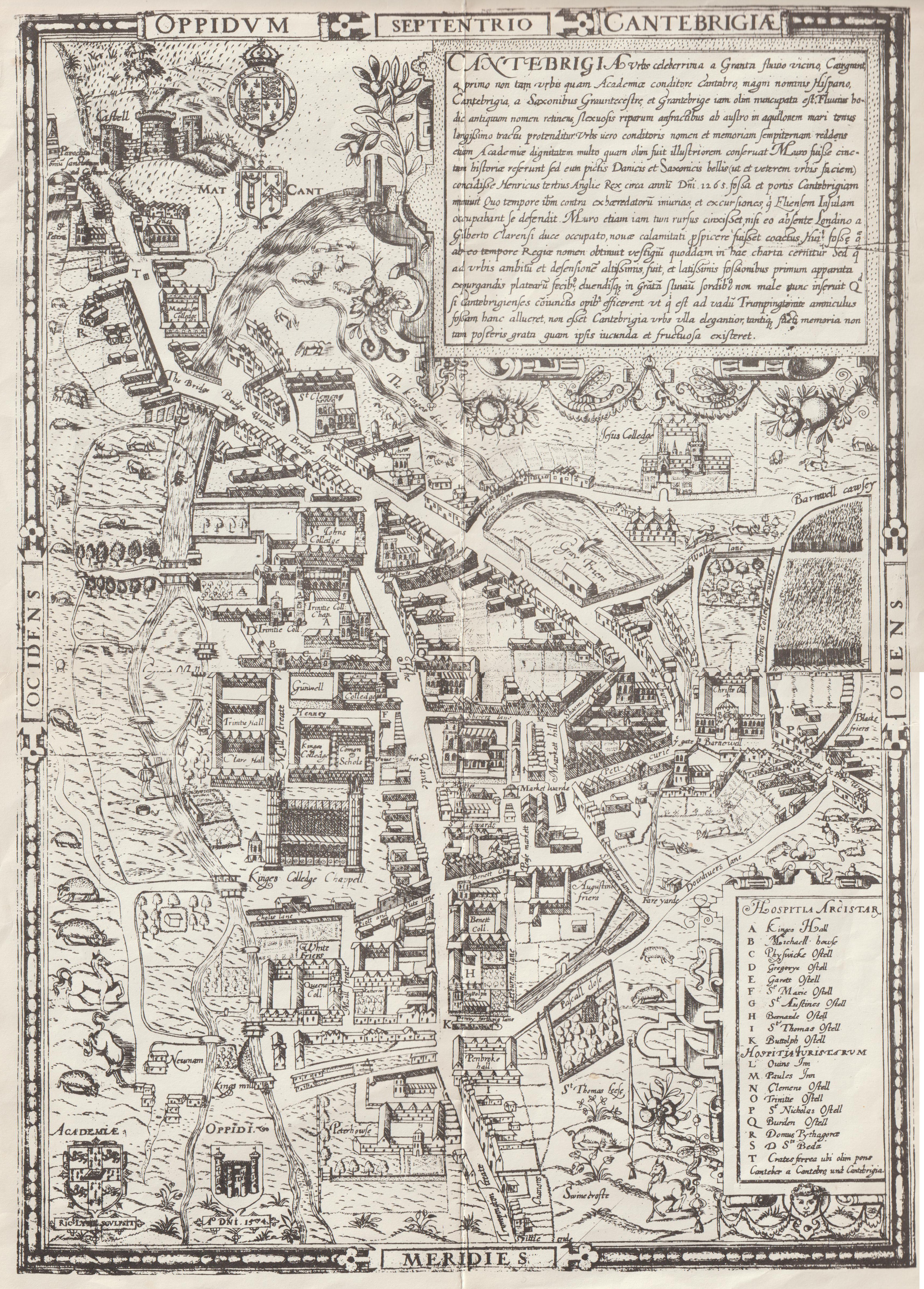
Henry III paid to improve the ditch because of the Second Barons' War in 1266. This led led to it being called the King's Ditch. It is marked on a Tudor map of Cambridge, dated 1574, and also on William Custance's map of 1798, although part of it might have been underground by that time.
It's hard to figure out how the ditch could ever have had flowing water, as the centre of it is higher than either end!
Click on the maps for large scale versions.
© Jo Edkins 2025 - Return to Walks index