| U3AC walks | U3AC walk - Grange Road |
Route: Castle Street, Northampton Street, Madingley Road, passage between Grange Road and Wilberforce Road, Clarkson Road, Grange Road, Burrell's Walk, digress to art in front of UL
Length: 1.56 miles Start: Quayside Finish: Queens Road
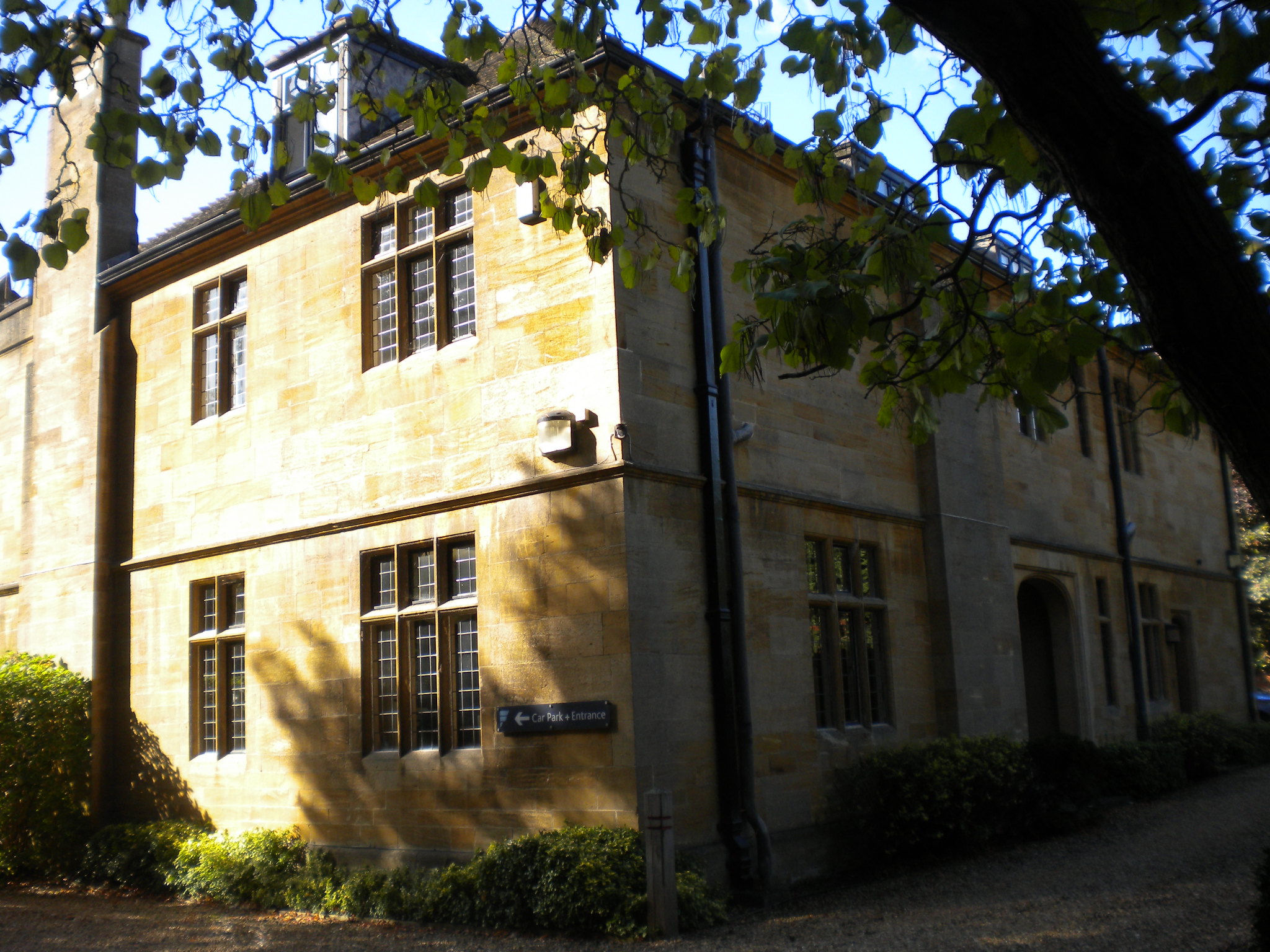
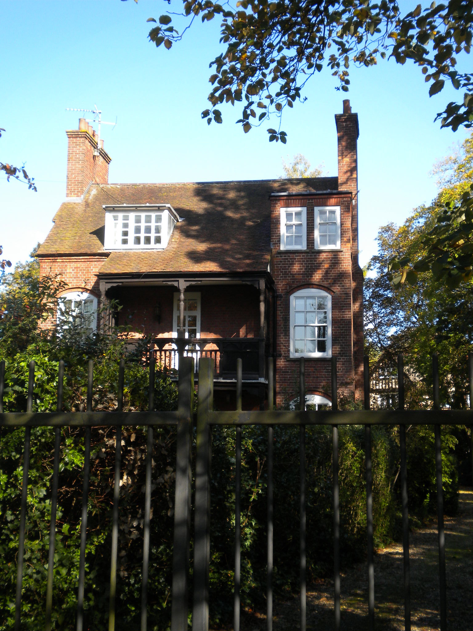
Description: The following is taken from one of the listings of this area: "The development of the former medieval West Fields began around 1870. This land, covering approximately 200 acres, was owned primarily by the colleges, notably St John's, which had always strongly resisted any building west of the Backs (the stretch of land which runs along the back of the riverside colleges). It was the loss of college revenue from the agricultural depression that led to their decision to lease the land in building plots. Three new institutions were established - Newnham College in 1875, Ridley Hall in 1877, and Selwyn Hostel (now College) in 1879 - and suburban houses in various styles from Queen Anne to Arts and Crafts and neo-Georgian were built piecemeal over almost half a century. The demand for such large family homes was partly fuelled by a new statute passed in 1882 that finally allowed dons to marry without having to give up their fellowships. The main arteries of development were West Road, Madingley Road and Grange Road which forms the central spine road running north-south through the suburb. Although economic necessity had forced the colleges to allow building on the land, they were determined to keep a strict control over the residential development which consisted almost entirely of high end middle class housing, interspersed with university playing fields, without any community facilities such as churches or shops. There was no overall plan but the landowners ensured that it was restricted to an affluent market by issuing leases that specified numerous conditions, including minimum plot sizes, minimum house costs, specification of superior building materials, usually red brick and tiles, and had stringent dilapidation clauses to ensure that property values did not deteriorate. St John's, for instance, specified one-acre plots with a minimum house cost of £1500 on its Grange Road estate, and half-acre plots with a house cost of at least £1000 on Madingley Road. To put this in context, in 1906 the sum of £1000 was considered well above the price of a substantial suburban villa. The great majority of building leases were taken up by individuals who commissioned either local or London-based architects, many of whom are now considered to be amongst the finest of the late Victorian/ Edwardian age, notably M. H. Baillie Scott who designed nine houses in west Cambridge, E. S. Prior, J. J. Stephenson, and Ernest Newton. Most of these houses were designed to accommodate at least two live-in servants, as shown by the census returns, and some had stables; although by 1910 there were requests either to convert these to garages or to build 'motor houses', as they were then known."

Click on photos for a larger version.
At the traffic lights by the Museum of Cambridge, cross Northampton Street, then turn left to walk along its north side. This avoids crossing too many main roads.
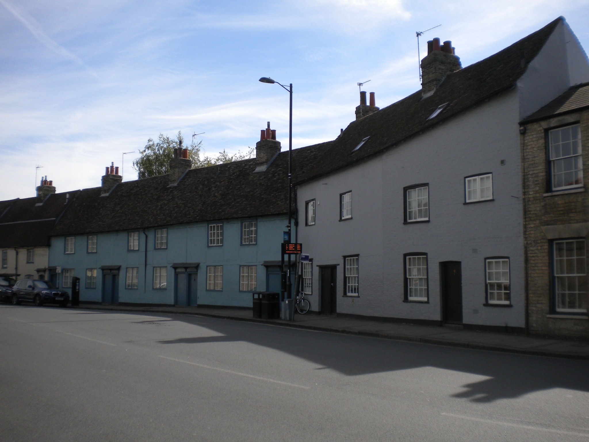
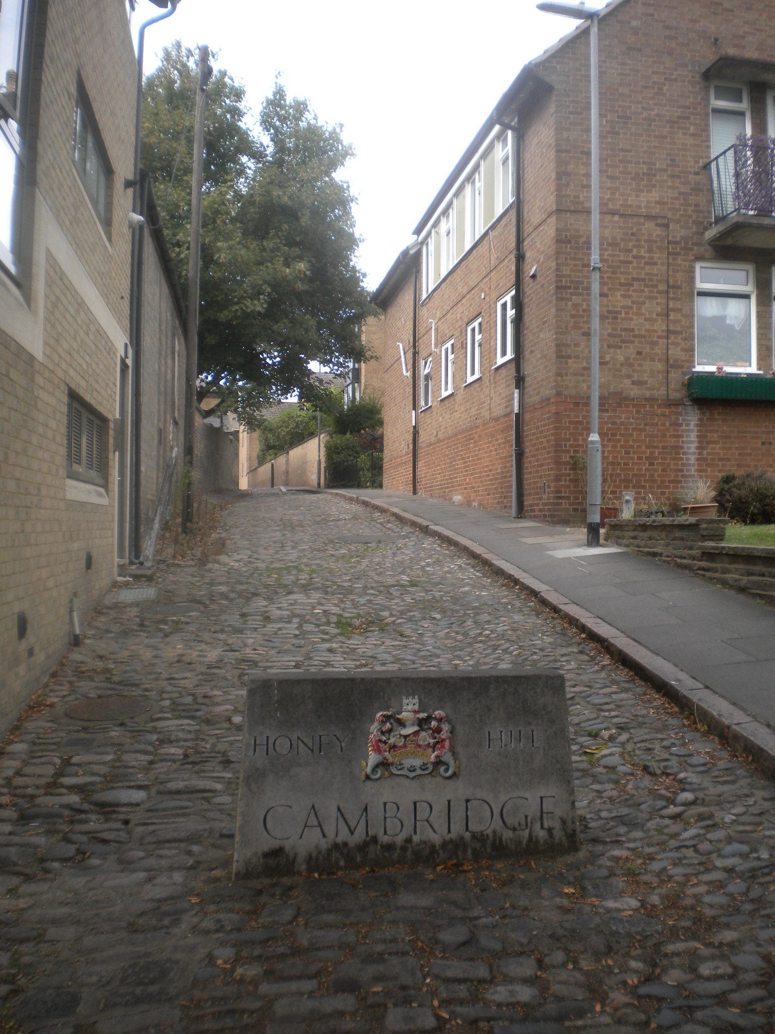
We have already seen this street, but this is a chance to see them across the road. Notice Cory House, the Chophouse, and in fact the whole sweep. Also, notice on this side of the road, Kettles Yard, St Peters and the botttom of Honey Hill.
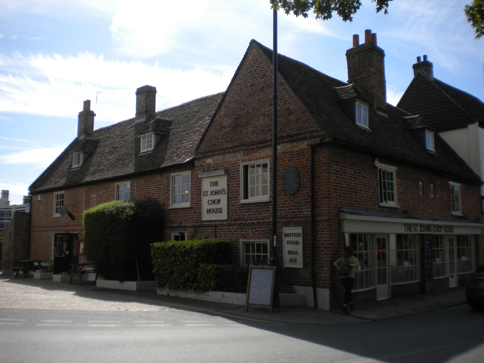
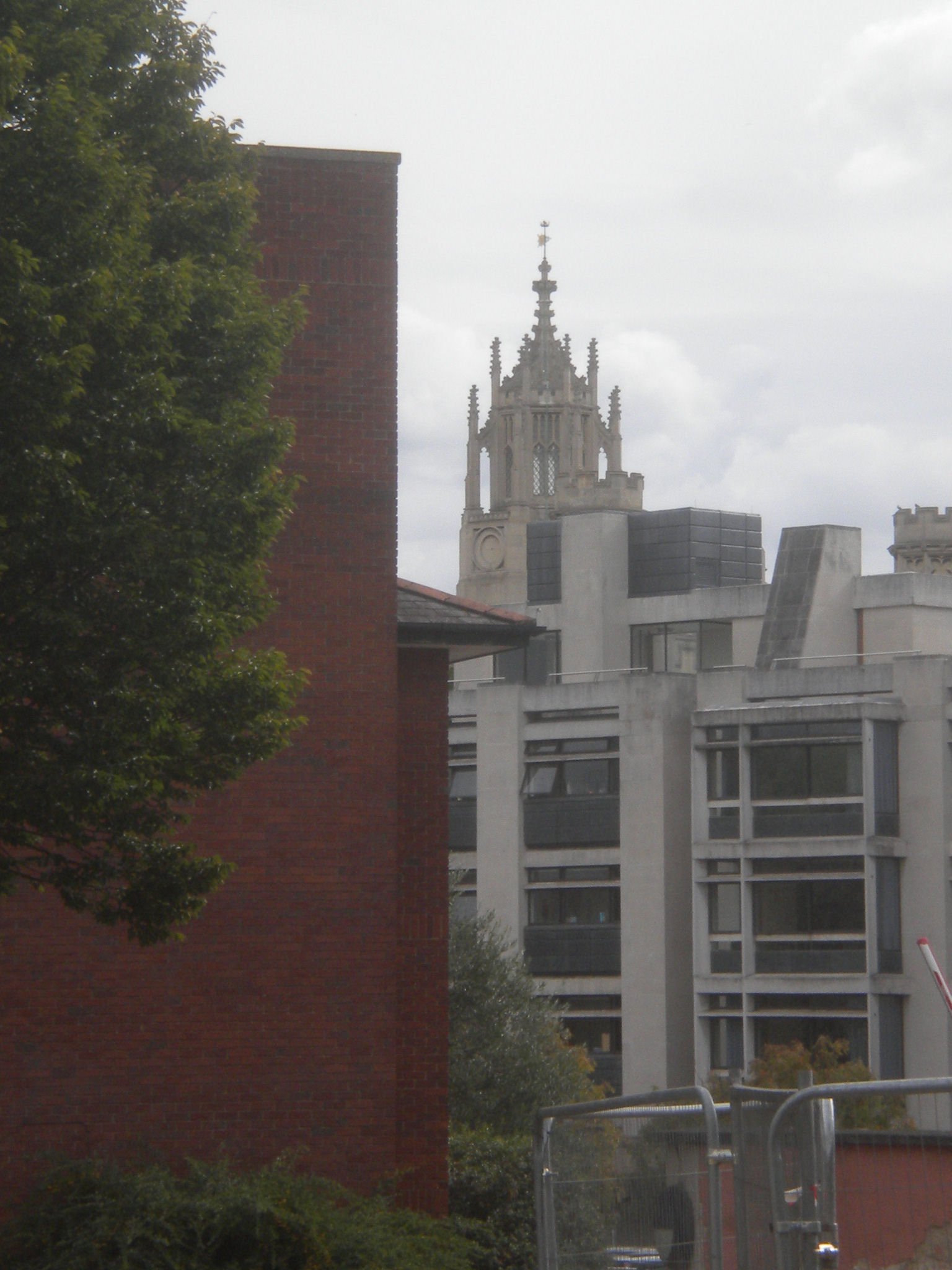
There is a roadway by the Chophouse. Look along it to see the "Wedding cake", part of New Court in St Johns, dated about 1831. This charming flourish is surprisingly hard to see from outside St Johns.

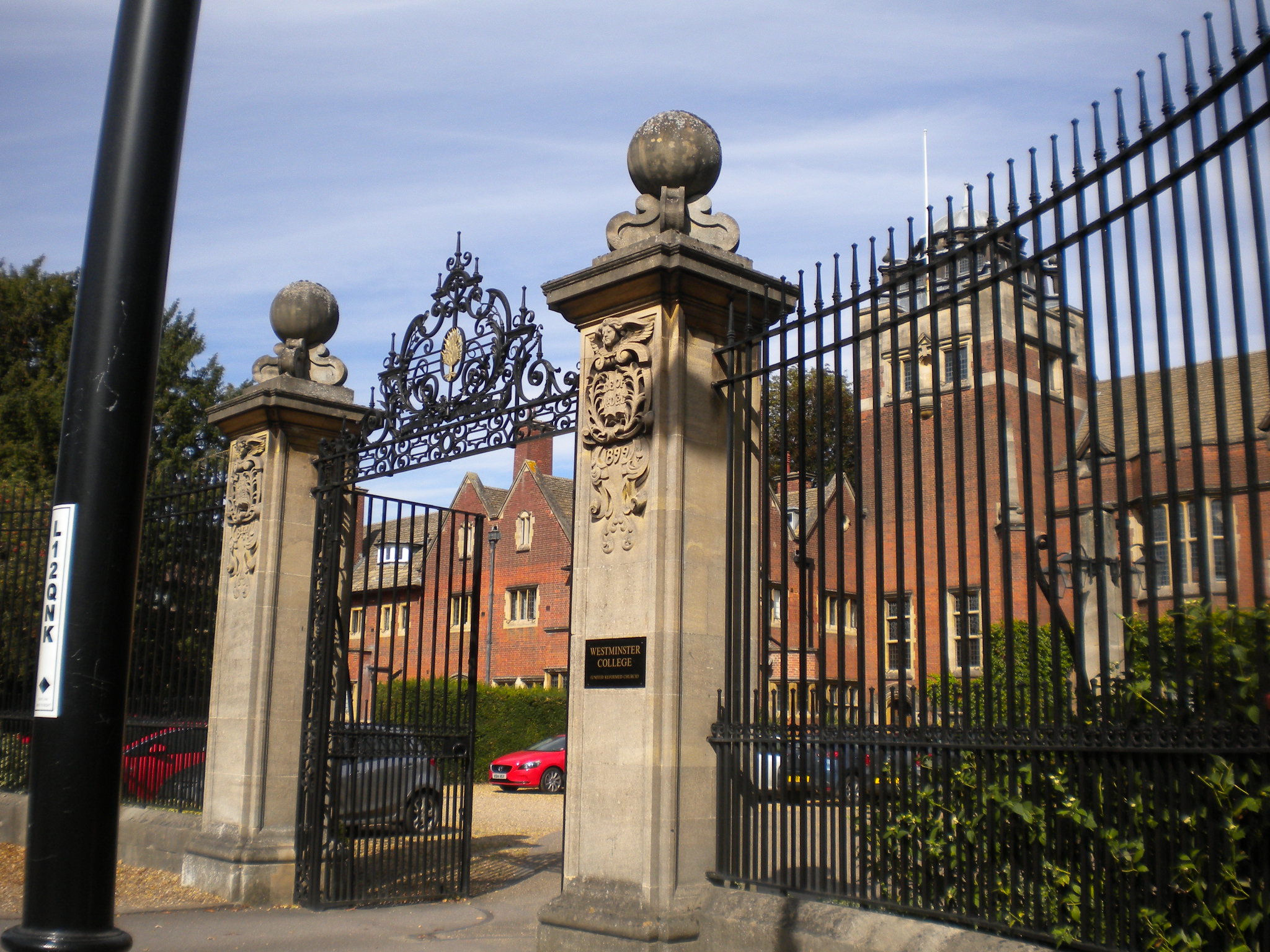
Westminsiter College and gates are listed grade II. The college is United Reformed Church and was built in 1899. The general style is Tudor.
Cross the Madingley Road by the first traffic lights crossing.
3 Madingley Road is listed grade II. It is called The Stone House. It was built in 1896, in a Queen Anne style. Clive Sinclair lived here.
Across the road, 6 Madingley Road is listed grade II. It was built in 1885. (May not be visible.)

Churchill college is across Madingley Road, just before we turn off. It is listed grade II. It was built 1961-1968.
Quite a but further up the Madingley Road is Conduit Head Road. This is where the Trinity Conduit took its water from. In 1325, the Franciscan Friars acquired from 17 different owners a strip of land one mile in length and two feet wide, from this spring to their Friary, in Sidney Street. In this strip, they laid pipes which crossed streets, brooks and the river, and passed through what is now Trinity College. After the dissolution of the monasteries, this water supply was assigned to Trinity. The fountain in Trinity takes its water from there, still. The townwsfolk were also allowed to use the water, and there is still a (modern) tap in Trinity Gatehouse (but I don't know if it works!) Later on in this walk we will cross the route of the conduit.

Just before Churchill, at the traffic lights, there is a passage on the left leading past the Isaac Newton Institute for Mathematical Sciences. It ends at Clarkson Road.

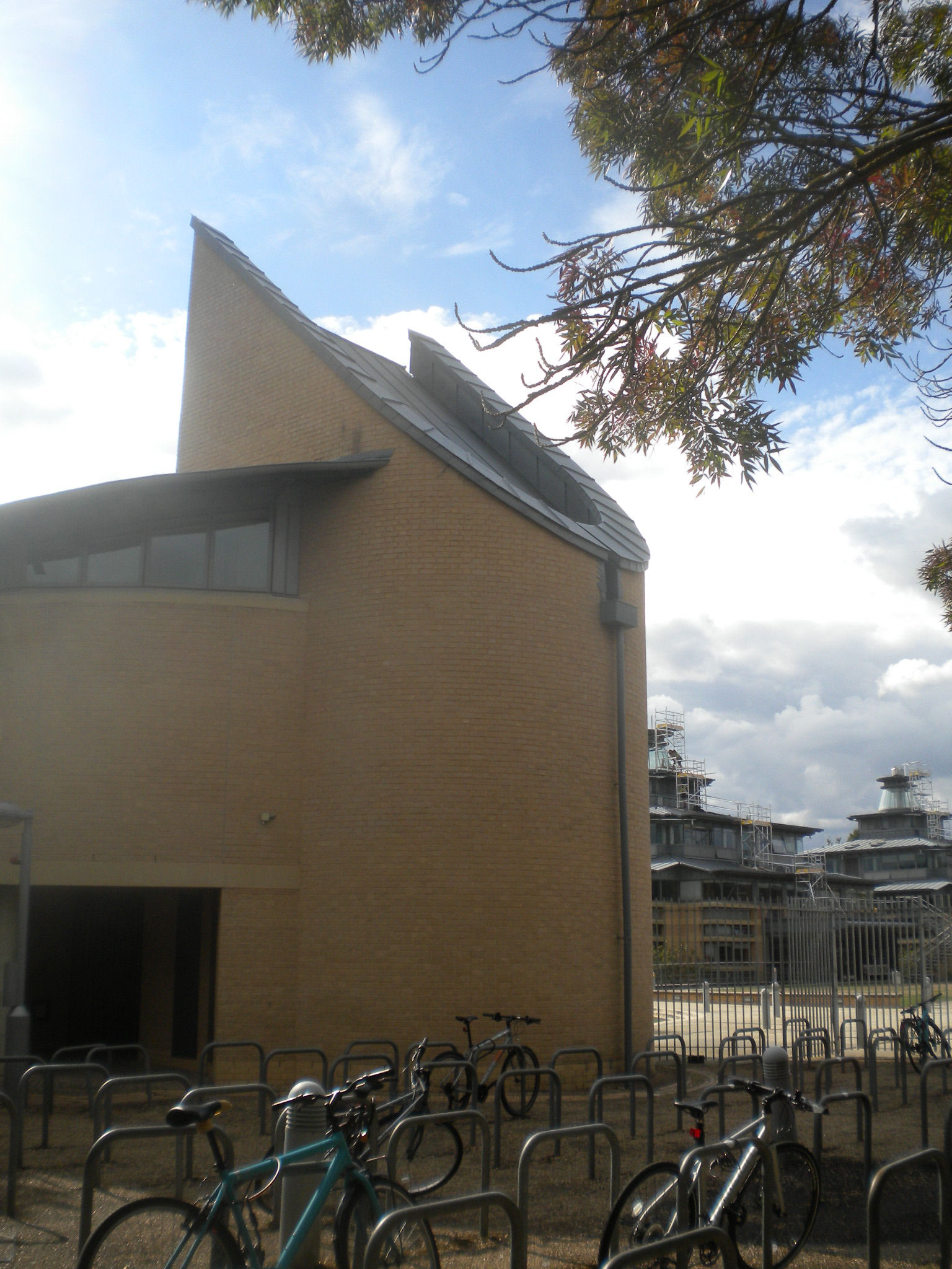
The buildings on the right are an interesting shape. Here is an explanation - "a building which recognises the importance of energy conservation and provides a comfortable environment without excessive maintenance and running costs. By using heavy construction and allowing the mass of the structure to absorb the daily heat gains generated by the use of the building and penetrating solar radiation, wildly fluctuating temperatures can be reduced, thereby easing the control of the environment." The picture seems to explain the turrets on top of the buildings.


The Faulkes Gatehouse contains Mathematical Gates by John Robinson (1970). These depict two knots each with eleven crossings. The knots are distinct from each other but you will need to look very closely at both gates to see the subtle difference between the two knots. The south gate shows the knot discovered by J H Conway, a Cambridge mathematician in 1970. The north gate shows a knot studied earlier by Kinoshita and Terasaka.


Turn right to see these three sculptures in front of Isaac Newton Institute are all by John Robinson. They are from the Universe Series. From left to right, the individual scultures are called "Creation" (dated 1991), "Intuition" (dated 1993) and "Genius" (dated 1995). There is more about the artist here. This webpage says "The three sculptures belong to Robinson's Universe Series, which he began in 1975, naming it after his sculpture The Universe which represents 'the Known, the Unknown and man'. This series of sculptures traces a path from the beginning of time to the present day, symbolically portraying his interpretation of the cosmos, earth, animals, man and woman, birth, death, religion, civilisation and the future. Other titles in the series include Solar Motion, Time, Space, Galaxies, and Eternity. Many of the sculptures are based on simple geometric forms: spirals, ovoids, cones, circles, spheres and knots, and some can even be described by exact mathematical formulae. The three sculptures at the Newton Institute are all based on the Borromean Rings, so that each has three interlocked shapes, no two of which are linked."

Further in, there is this sculpture of a Sierpinski Tree - a type of fractal, with a notice explaining it.
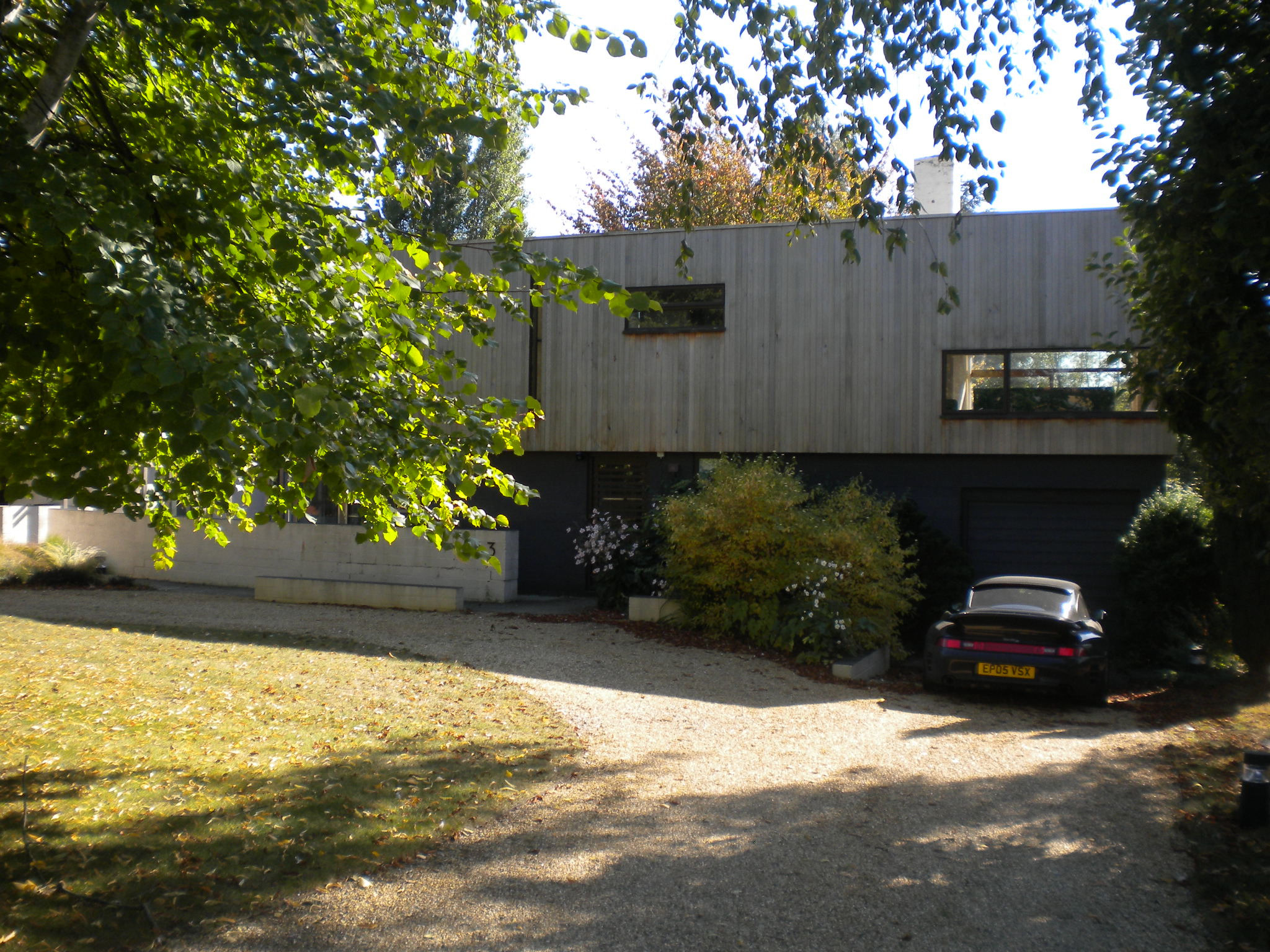
Return to Clarkson Road, left left, and walk back past the passage way. On your right, there is 3 Clarkson Road. This was built in 1958 in a Scandinavian-influenced modern style. It is listed grade II.
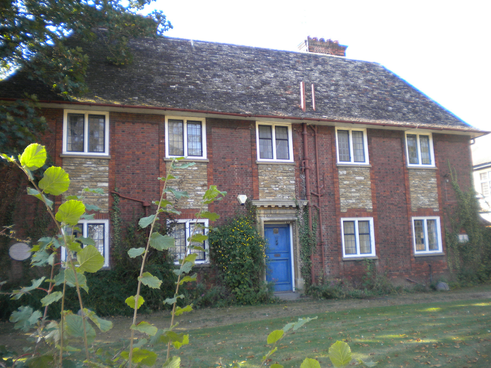
71 Grange Road was built in 1911 in a neo-Georgian style. It is listed grade II.
It is called Saxmeadham from the Saxon burial ground on which the house is built. "Remains of a burial were found: a bone pin, a small broken flagon of red ware and an iron spearhead. This was considered to be a Roman burial mixed up with a spearhead from a later Anglo-Saxon. Other Roman remains were found nearby" (Proceedings of the Cambridge Antiquarian Society Vol. 67).
One of the people who lived here was Frederick Gowland Hopkins, born 1861, professor of Biochemistry and awarded Nobel Prize in 1929 for 'discovery of vitamins'.
Return back along Grange Road.
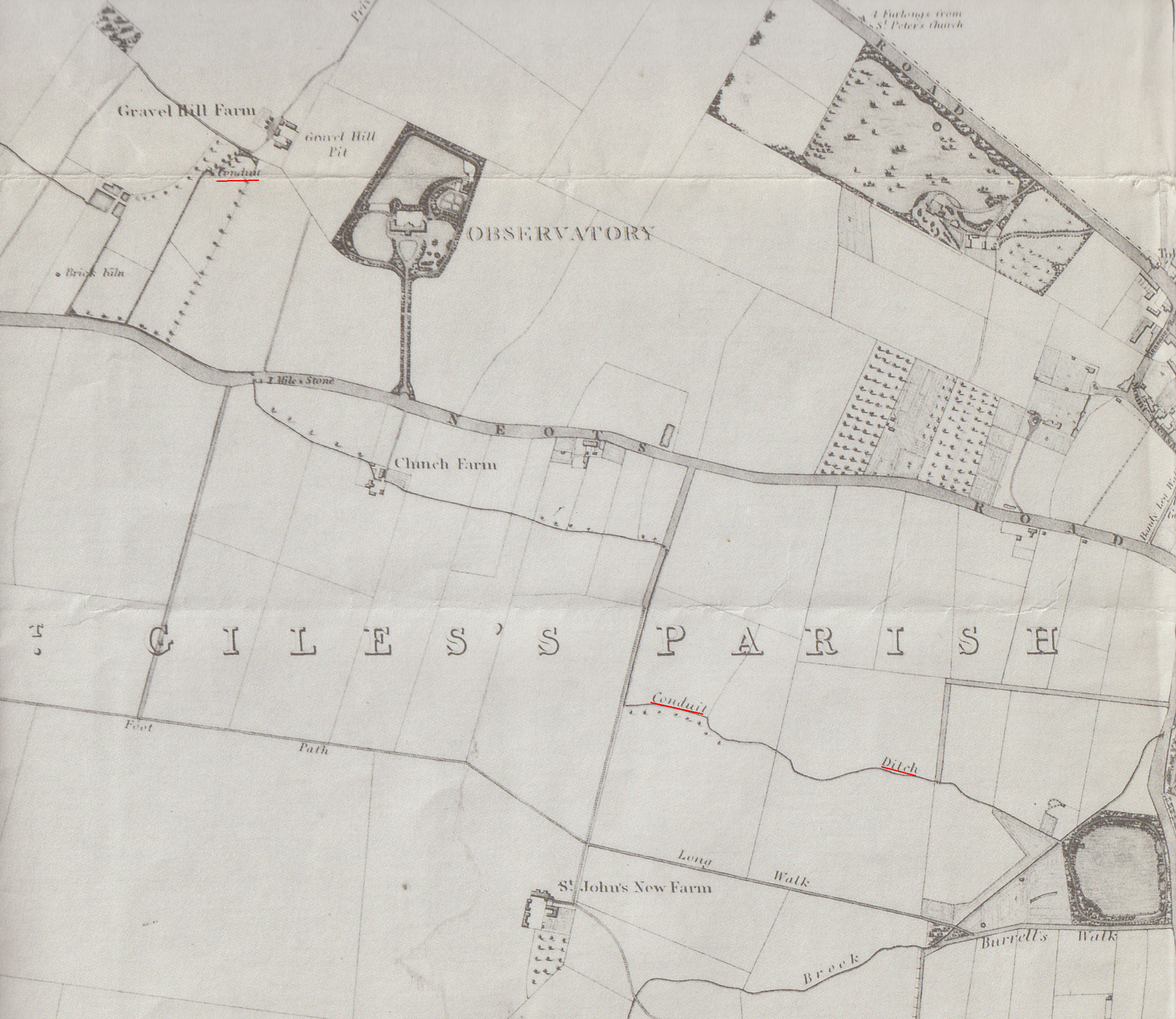
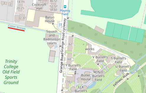
The Trinity conduit must cross Grange Road at somewhere around here. This map, Baker's Map of the University and Town of Cambridge 1830 (above), is the only map that I can find which gives a clue to where the conduit ran. It shows "Conduit" (underlined in red, top left) and "Conduit Ditch" (underlined in red, heading bottom right) - click on map for larger version. If you look at this area on a modern map, this is called Coton Stream, which joins with Bin Brook (which we see later). Perhaps the conduit fed into Coton Stream at some point. Or perhaps the Baker map is just wrong! You can see the Coton stream (or rather, dry ditch) just before 62 Grange Road, on the left.
The Trinity conduit used to be an important source of water for the town. In 1325, the Franciscan Friars acquired from 17 different owners a strip of land one mile in length and two feet wide, from what is now Conduit Head Road, off Madingley Road, to their Friary, in Sidney Street. In this strip, they laid pipes which crossed streets, brooks and the river, and passed through what is now Trinity College. They provided a well-house and pump for the use of the townsfolk in the wall of their Friary. In 1439, the college of Kings Hall obtained the right to tap the conduit as it passed through their site. The Franciscan Friary was dissolved in 1538, and King Henry VIII granted full rights of the conduit to Trinity College (as it now was). The fountain is supplied from this water. There is a tap in Trinity gatehouse. This tap shows that Trinity allowed the townsfolk to carry on using the water, although the tap isn't that old, and the notice shows that we are discouraged from using it!
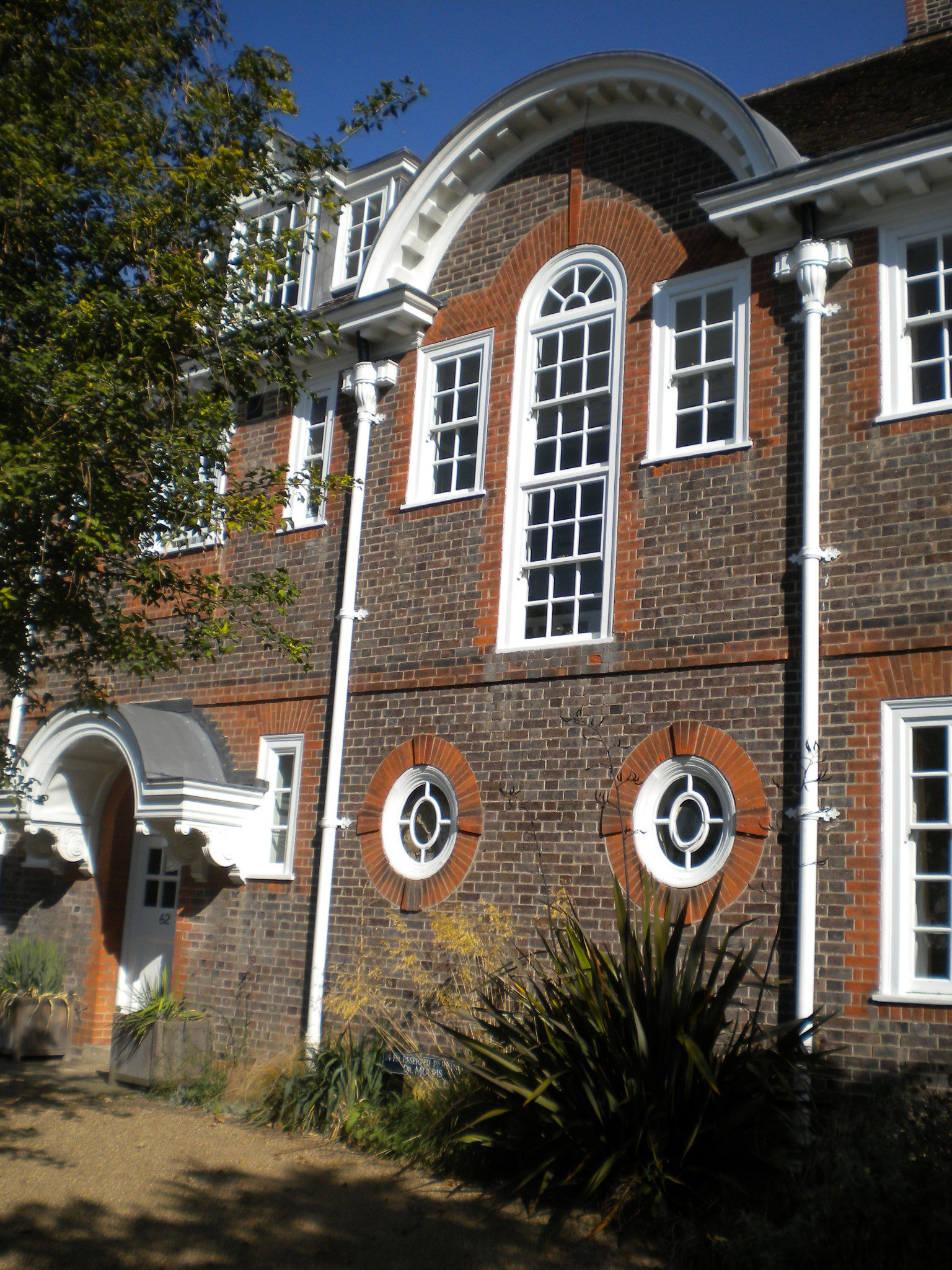
62 Grange Road was built in 1906. The style is Edwardian Baroque. It is called Whewell House. It is listed grade II.
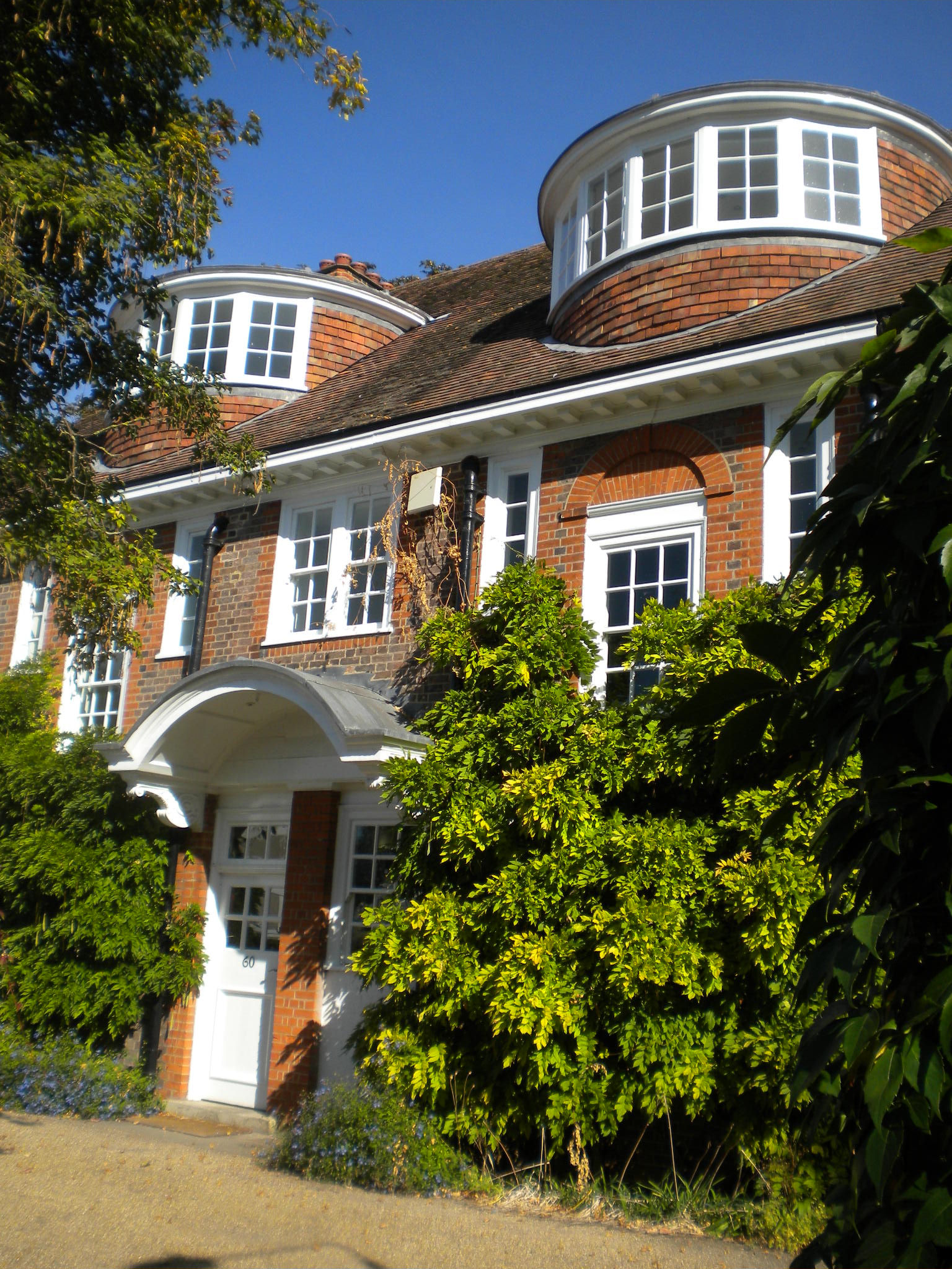
60 Grange Road was built in 1906. The style is Edwardian Baroque. It is called Silbury House. It is listed grade II.
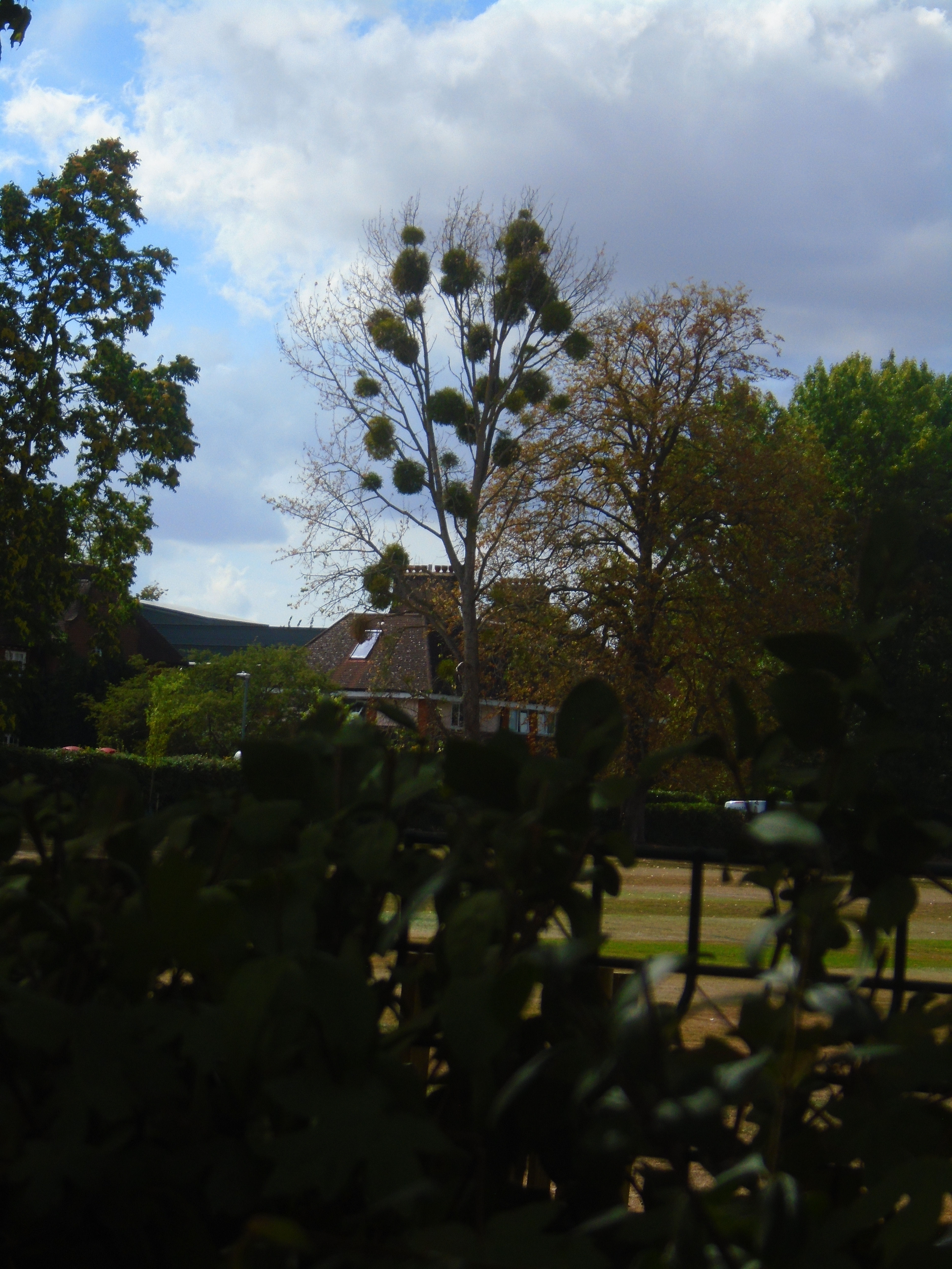
On the right, across the sports field, you can see a tree covered with mistletoe.
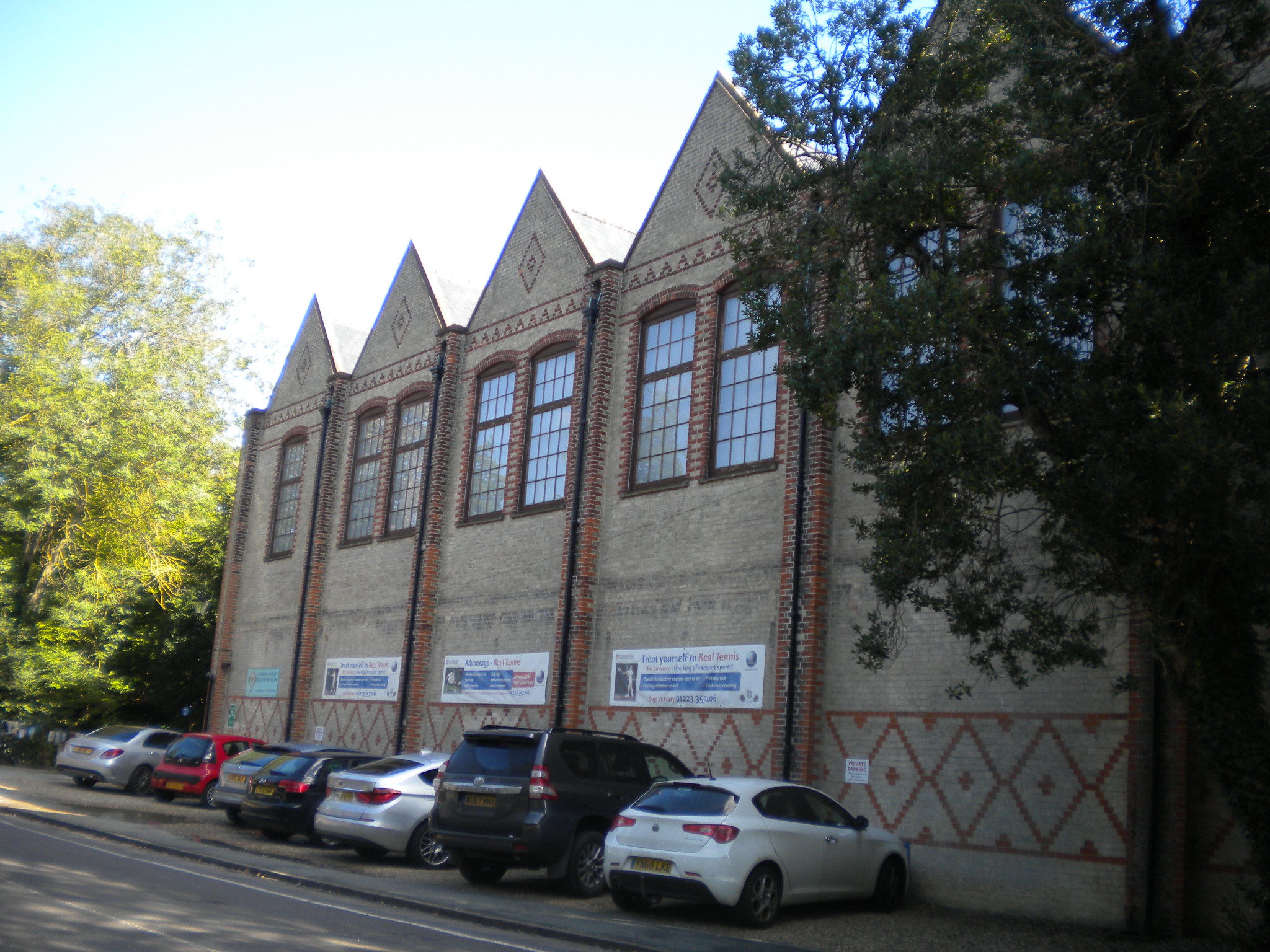
The Real Tennis Club in Grange Road was built in 1866. It is listed grade II. Real Tennis is much older than lawn tennis, and is played indoors. It was played by Henry V. Lawn tennis was developed in the late Victorian period.

Outside the Real Tennis Club is a Victorian letter box.
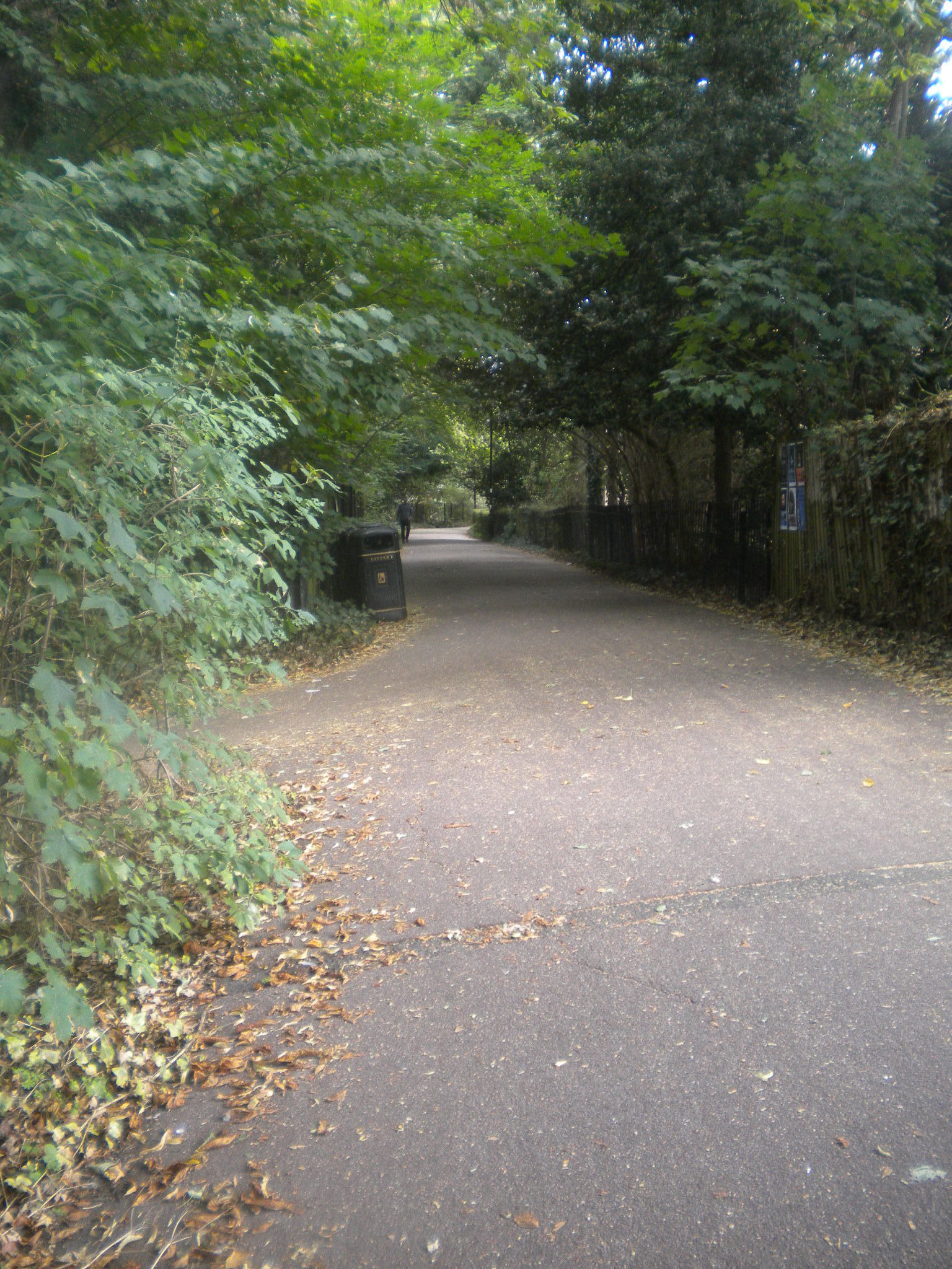
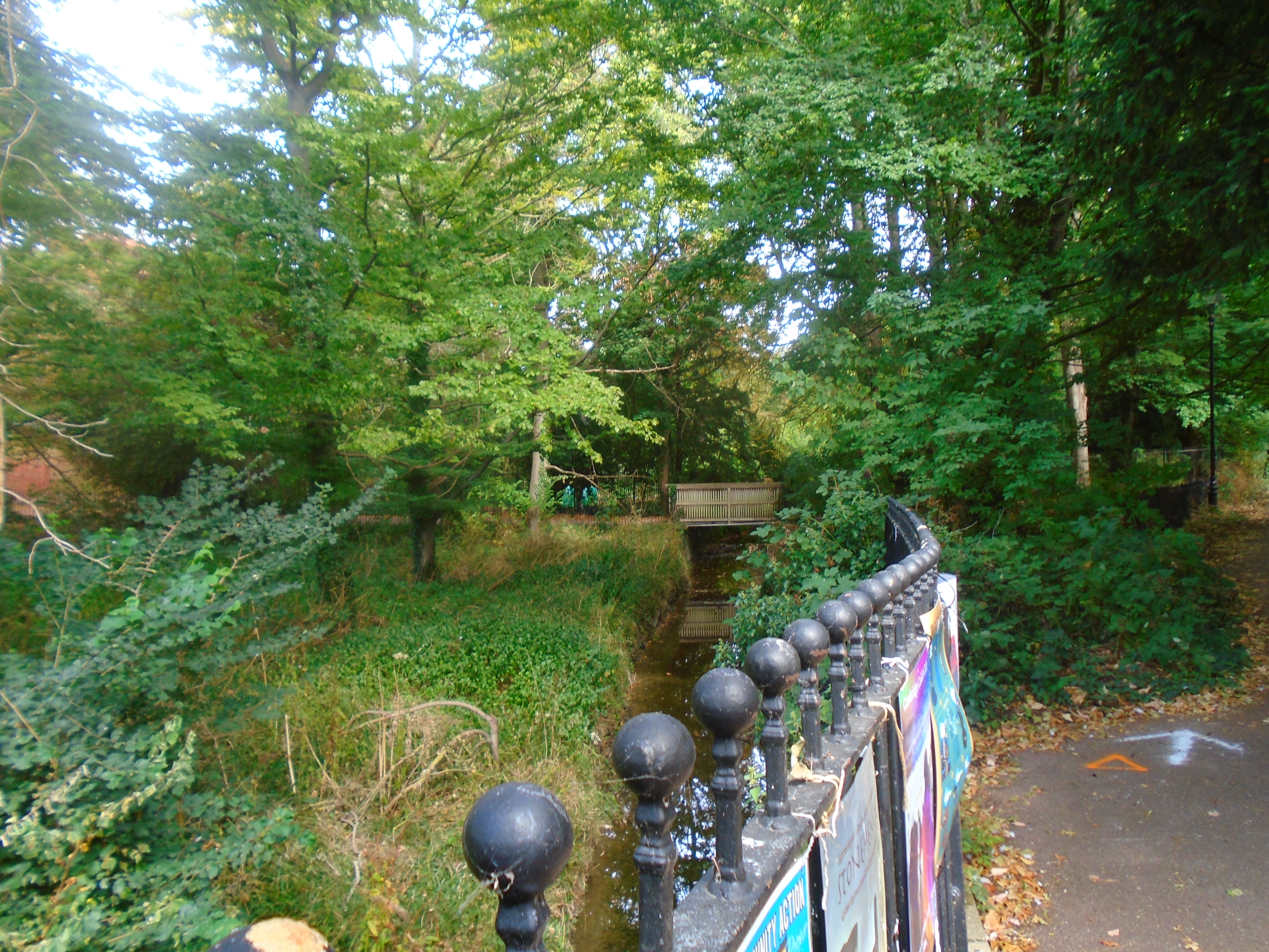
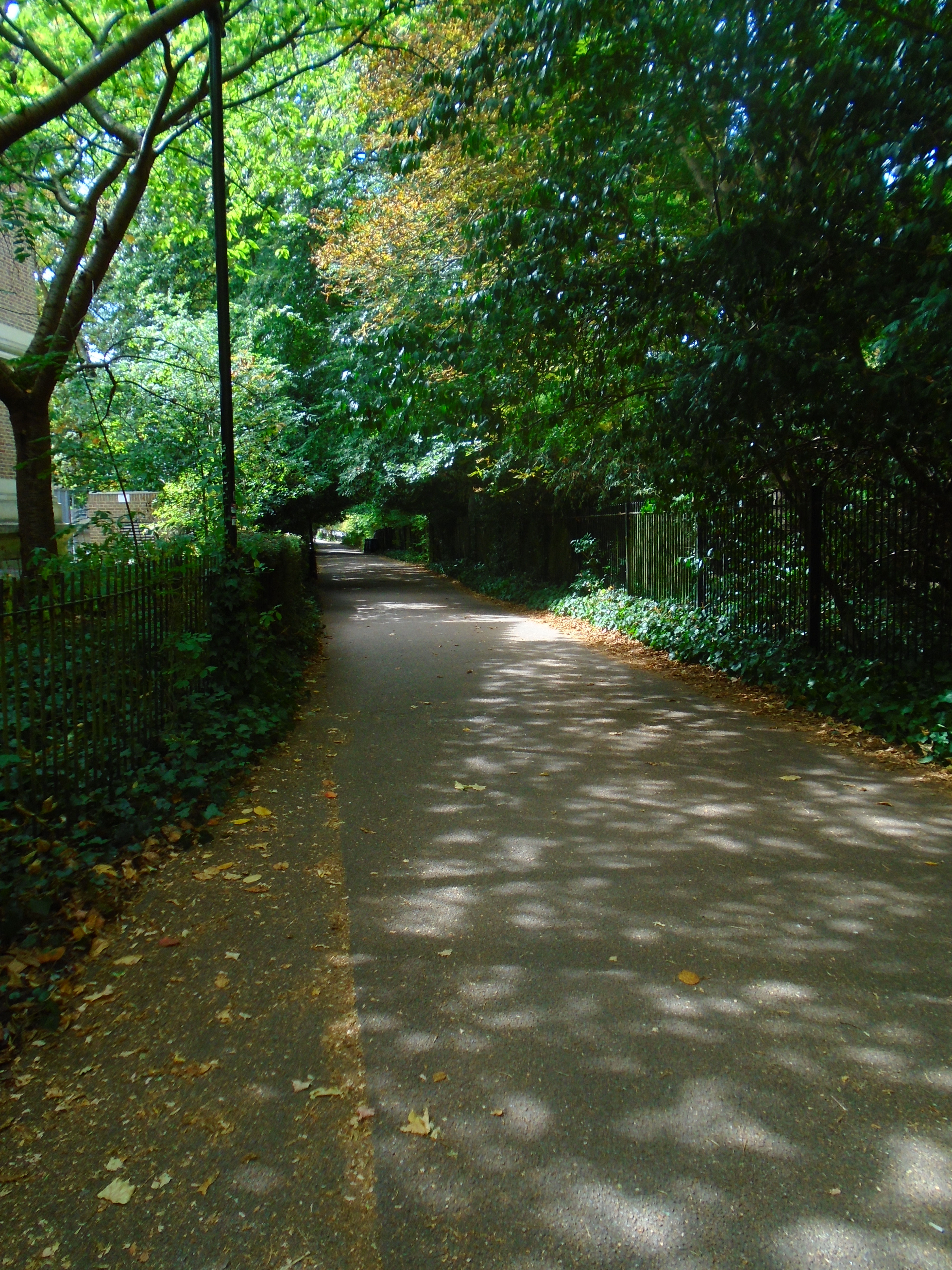
Turn back, and turn right into Burrells Walk. Immediately on your left you can see Bin Brook. This runs east to west across Cambridge. In places it is little more than a ditch but it has caused serious flooding at times. In October 2001 it burst its banks. So its water level is monitored! We saw it running along the back of St Johns College.

The University Library was built by Sir Giles Gilbert Scott in 1931-4. The construction company was Rattee and Kett, a well-known Cambridge firm. The library is listed grade II.

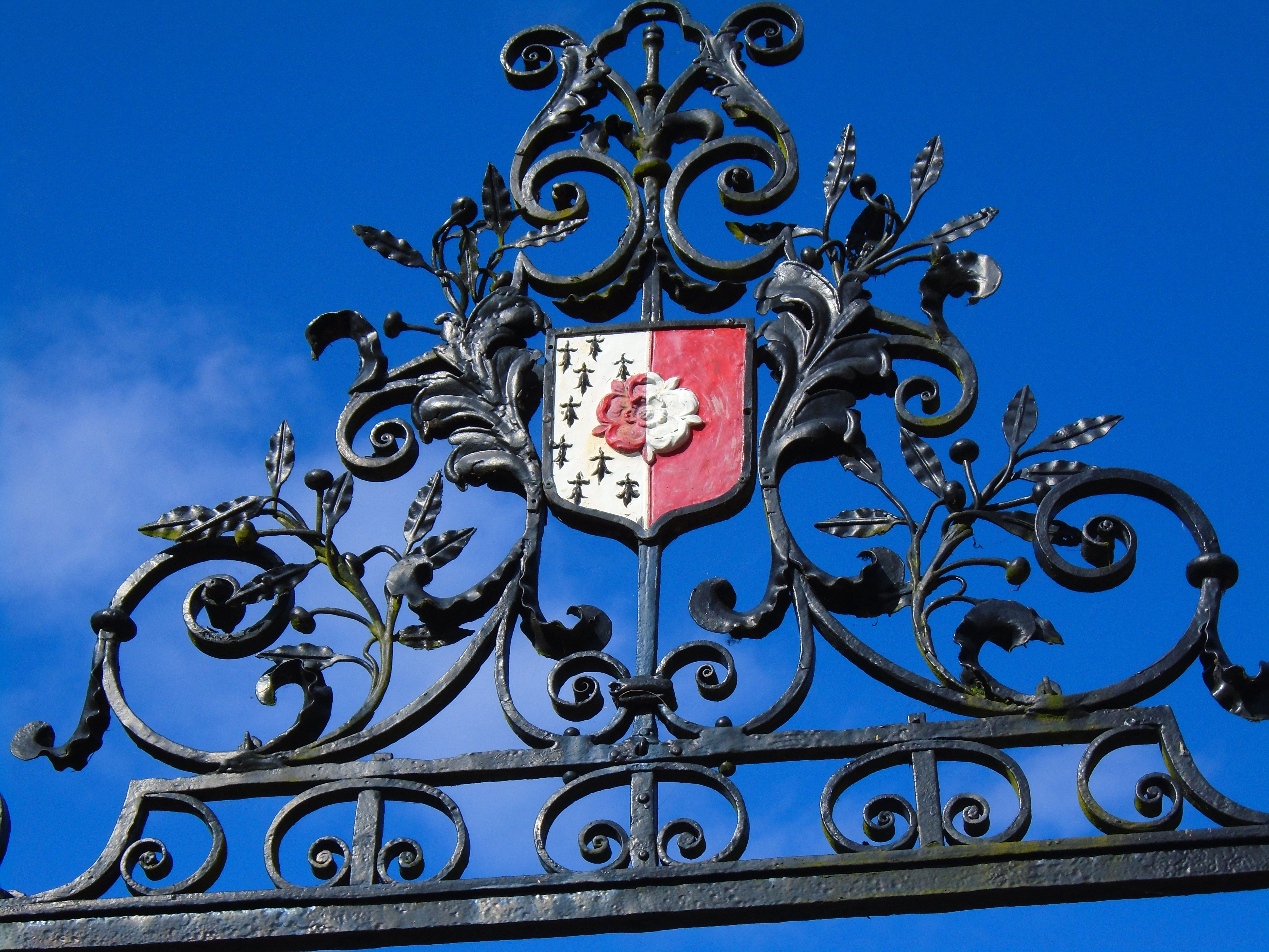
This gateway is listed grade II. It was installed at the same time as the library, but the actual gate is a lot older. It is early /mid C18 and came originally from Rectory Manor House, Enfield, Middlesex. The coat of arms are described in the listing as "Arms of J G Nightingale". I think this is Joseph Gascoigne NIghtingale (1695-1752) who came from Enfield. He was a student at Trinity, and another member of the Nightingale family founded a library, whose books are now in the UL, but I suspect that the coat of arms was on the original gate, and when it was bought, they didn't bother to change it!

There is a line of stacks of books (in bronze) in front of the UL. This is called Ex Libris, by Harry Gray, dated 2009. "Ex Libris" with a library name is written inside books to give the library or book collection that they belong to. The middle four stacks of books are bigger than the rest, and a book in each of these has part of the title of the artwork - EX - LI - BR - IS. You can read more about it here. The middle four stacks can be rotated.
Return to Burells Walk, and carry on to Queens Road.
© Jo Edkins 2025 - Return to Walks index