
| U3AC walks | U3AC walk - City centre |
Route: Bridge St, All Saints passage, St John St, Trinity Street, Rose Crescent, Market Hill, Senate House Hill, Kings Parade, St Edmunds passage, Peas Hill, Benet Street, Free School Lane, Boltolph Lane, Trumpington Street, Little St Marys Lane, Granta Place, Laundress Lane, Silver Street
Length: 1.05 miles Start: Quayside - Finish: Silver Street
Introduction: The main road through Cambridge centre is Roman. A Saxon road branches off it, at the Round Church. This walk explores the Saxon Road and the various passageways, which were often medieval streets. For some reason, old Cambridge churches often have passages connected with them. See how many you can spot! We will pass seven churches which may have had Saxon foundations. The description below counts them.
The Saxon settlement was originally within the ramparts of the Roman fort. It is known that there was some destruction during the conflicts between the kingdoms of Mercia and East Anglia. In 634AD the Mercian king Penda conquered the East Anglians at the site. The Venerable Bede mentions the site when he describes the monks from Ely coming in 695 in search of a suitable coffin for the founder of their monastery, St Etheldreda. They are said to have found a coffin at the foot of Castle Hill in 'a waste chester called Grantacaester' i.e. the Roman camp next to the Granta, the old name for the River Cam.
Click on photos for a larger version.
Quayside is a modern development, but this used to be an important part of Cambridge, as it was a river port long before the university was set up. The Saxons and Danes had a settlement by the river, including this area.

St Clement is on Bridge Street and is listed Grade II*. St Clement is patron saint of mariners, and is connected with Danish churches (such as St Celements Dane in London). Cambridge was in the Danelaw, and the Danes settled round Quayside. So there may have been a church here since then, which would make St Clements one of the Saxon (or rather Anglo-Danish) churches. However, this church was built in the second half of the C13 and restored several times since. This is Saxon church number 1.

Over the door in the tower, there is a sign "Deum Cole". This means "Worship God". It is a punning motto, belonging to William Cole, who left money to build the tower (1821-22). Pevsner (famous writer of guides to English architecture) called the tower "somewhat silly"! There used to be a steeple as well, but this got taken down in 1928. That is why the weather vane has to be on a spike!


The Round Church's correct name is the Church of the Holy Sepulchre. It was built around 1130 and is listed Grade I. It is one of four medieval round churches still in use in England. The shape was inspired by the rotunda in the church of the Holy Sepulchre, Jerusalem. It was built by the Fraternity of the Holy Sepulchre, who were probably a group of Austin canons. Initially it was a wayfarers chapel. By the middle of the 13th century it had become a parish church under the patronage of Barnwell Priory. The second image is from a Tudor map of Cambridge, and shows at that point it had a tower! (The current conical roof dates from 1841.) The Tudor map also called it St Pulchrer - they must have misunderstood the name. I like the pig!
The description of the church's building still survives: "At some date between 1114 and 1130 Reinald, Abbot of Ramsey, granted to the members of the fraternity of the Holy Sepulchre the graveyard of St. George's church and land adjoining to build thereon a 'monasterium' in honour of God and the Holy Sepulchre, always provided that the church of Ramsey retained its rights there." St George's church is no more, but its location must be somewhere round here. It's thought to be another Saxon church, number 2.

This was a major road junction. The Roman road continues straight on, with the other road bending off to the right. It seems likely that this was the Saxon road, following the path of the river, but not too close (presumably in case it flooded!) In medieval times, this was called High Warde, and was considered to be the road to London. Now it is called St John St, Trinity St, Senate House Hill, Kings Parade, Trumpington Street, and so on. Looking down it, you can see that it wiggles, unlike the straight Roman road.
However, we carry on the Roman Road for a bit.

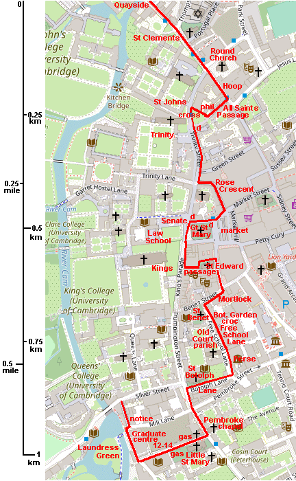
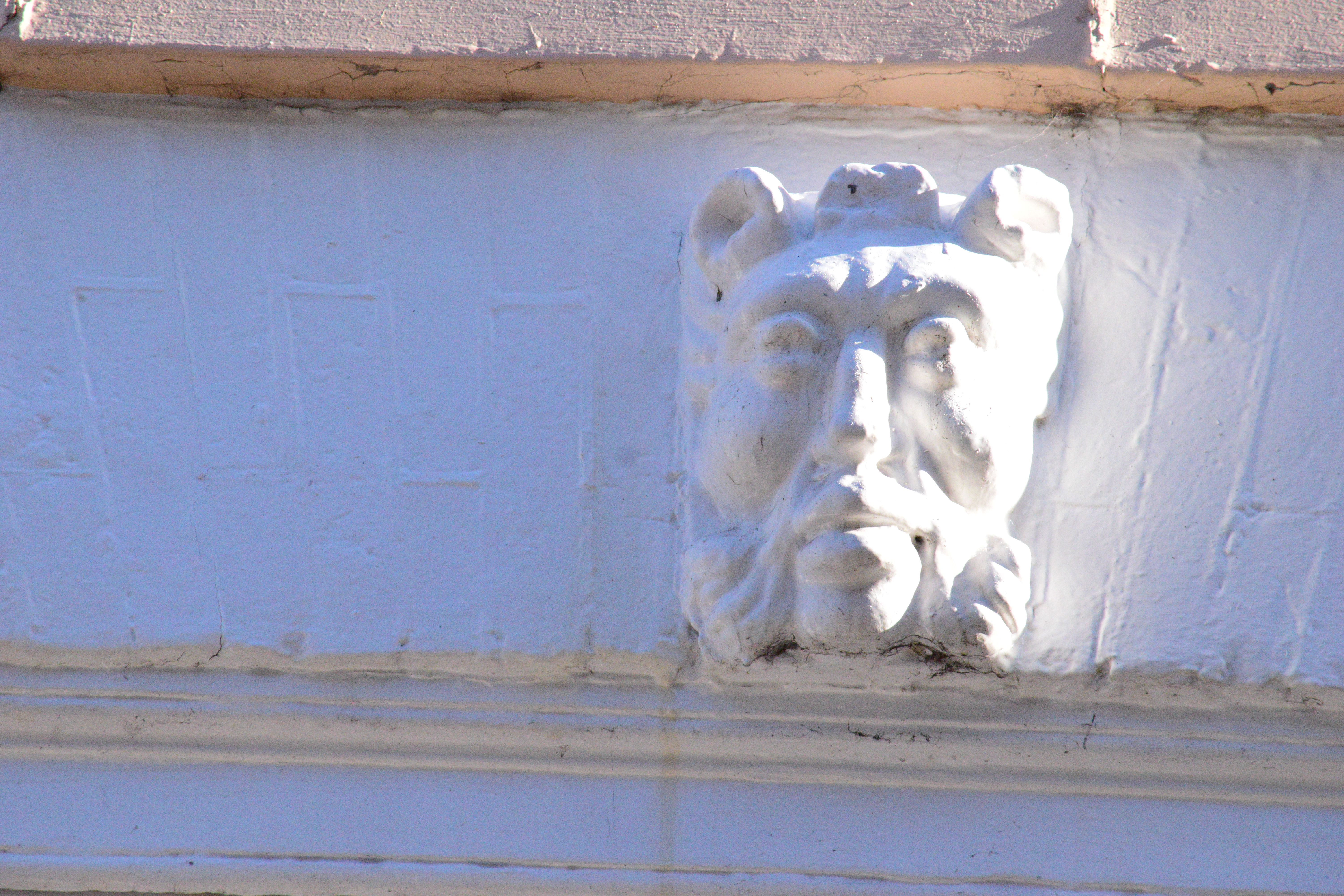
3-4 Bridge St is listed grade II. It was built in 1729. It used to be the Hoop Inn, which was mentioned by Wordsworth in The Prelude:
Onward we drove beneath the Castle; caught,
While crossing Magdalene Bridge, a glimpse of Cam:
And at the Hoop alighted, famous Inn.
Above each window is a little head. Every head on number 4 is different:


Turn right down All Saints Passage.

All Saints Passage is a medieval street.

This plaque is on a doctor's surgeryin All Saints Passage. The Cambridge Philosophical Society was founded in 1819 and still exists. Notable fellows have been Charles Babbage, Francis Crick, Paul Dirac, Stephen Hawking, Roger Penrose, Ernest Rutherford, Adam Sedgwick, J.J. Thomson and Alan Turing.


There used to be a church here called All Saints in Jewry, which may have been founded in Saxon times, number 3. The Jewry was where the Jews lived. It was a triangle of land between All Saints Passage and the Round Church. The Jews were moved to Huntingdon in 1275, and expelled from England in 1292. The church made the road too narrow (see picture above), so in 1865, it was demolished and the parish moved to a new church in Jesus Lane. The cross (dated 1880 and grade II) commemorates this.

The Great Gate of St Johns College is its main entrance, in St Johns Street. This was built in 1516. It is listed grade I. Christs College gatehouse looks similar to Johns, as they were both founded by the same woman, Margaret Beaufort, the mother of Henry VII. Before that, it was St Johns Hospital.
Click here for a list of all the colleges of the university, with dates of foundation and a little other information. When students want to come to Cambridge University, they have to apply to a college. The colleges provide accomodation and meals, although some students live out. They also provide tutorials and a Director of Studies. Students will describe themselves as belonging to a college as well as the university. The university provides lectures and exams. So there is a distinction whether a building belongs to a college or the university. Some of the colleges are extremely wealthy!


This Dinky Door is at the end of All Saints Passage - Angie has given a present to Mr D.Mon. Dinky Doors are made by a couple of anonymous artists, who don't ask permission before installing their miniature artworks. Their intention is to delight children. Click here for more information.
Cambridge roads often change their names along their route.


Trinity College is in Trinity Street and its Great Gate built from 1490-1530. It is listed grade I. Trinity College was founded in 1546 by King Henry VIII, from the merger of two existing colleges, Michaelhouse and Kings Hall. The lower stage of the Great Gate and the flanking ranges are surviving buildings of King's Hall, begun circa 1490 (in Henry VII's reign). This part includes the shields belong to Edward III, founder of Kings Hall, and his sons. Building went on slowly until circa 1505 and then lapsed until 1528-29. The gate tower was completed in 1535, in the reign of Henry VIII, and his statue is above the door.
Turn left down Rose Crescent.

Although it is charming, Rose Crescent is not that old. It was built around 1826, in the yard of the old Rose Tavern.
Turn right into Market Hill.
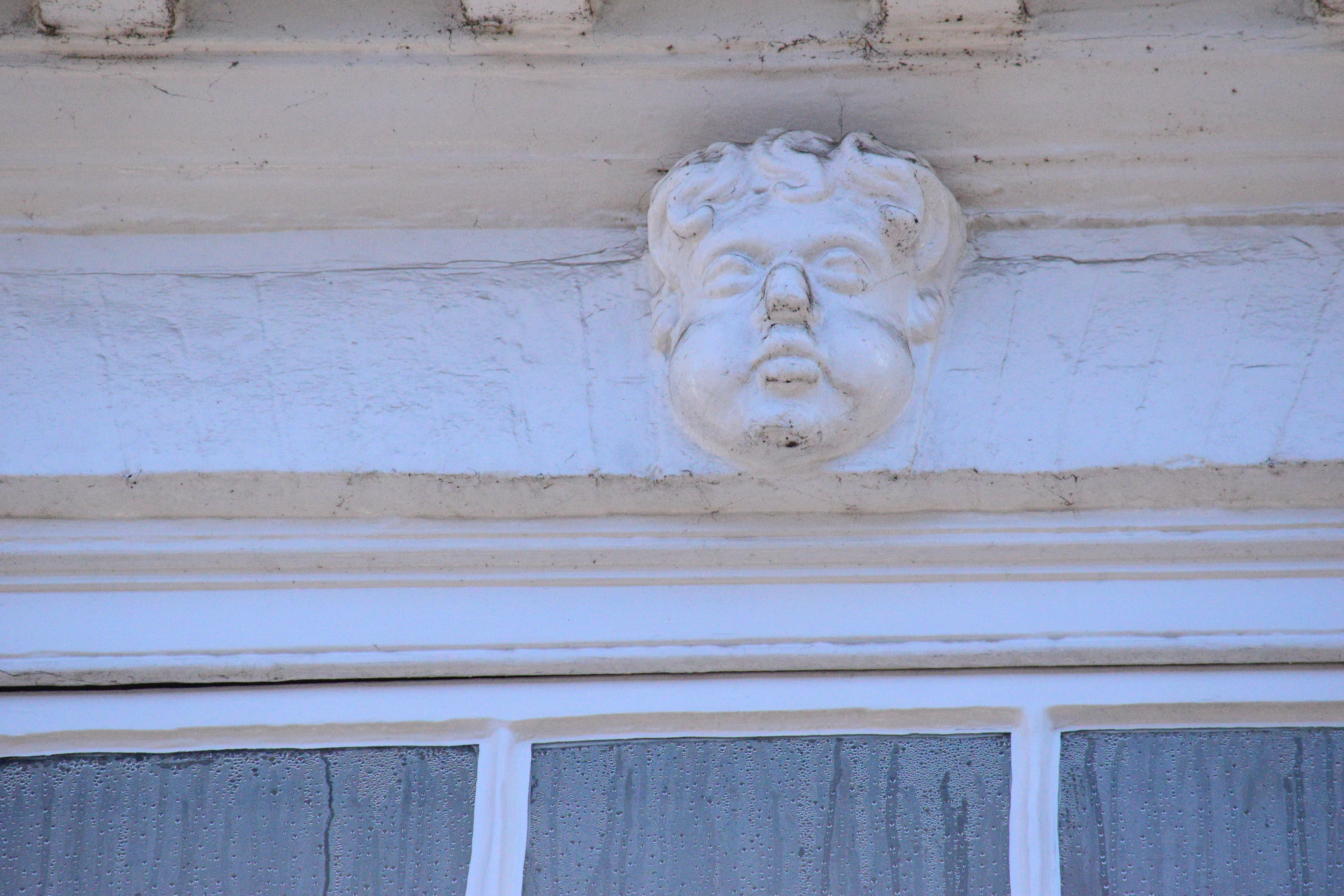
There was an active market here in 973, although it may have occupied different areas at different times.
Market Hill is another medieval street. There are three streets in central Cambridge known as hills, which are completely flat! There are two theories about this. One is that "hill" meant a meeting place. The other is that these used to be slight hills. This whole area used to flood, from the river. Any area slightly raised above the water was useful. Later, the whole area was flattened but the names stuck.


There is a Dinky Door between two phone boxes near Gt St Marys. It is a teleporter, and needs 3p coins to operate. There used to be a 3d coin, but no 3p coin of course. Rather a shame - I'd like to teleport somewhere.


Cambridge University Press bookshop says that it is the oldest printer and the oldest bookshop in England. In fact, the building is not that old. It is true that CUP (Cambridge University Press) is the oldest printer, and also that there has been a bookshop on this site for a very long time. But CUP only took over over these premises from another book shop a few decades ago. The Dinky Door outside is growing books, because that's where they come from, isn't it? One of the books mischieviously gives the dates of CUP, and the oldest bookshop, and the (recent) date they moved here. The books show other jokes, such as "A brief history of thyme".
Turn left into Senate House Hill.
Another "hill".


Great St Marys church (listed Grade I) is so-called to distinguish it from Little St Mary on Trumpington Street, which we will see later. Perhaps surprisingly, it doesn't seem to date back to Saxon times. It is a late 15th century church with the remains of a 14th century chancel. It is the university church, and is considered to be the centre of Cambridge. Milestones measured their distance from Cambridge from this point (see plaque on wall). One of these milestones can be seen at the end of Station Road, near the war memorial. Great St Marys has a peal of 12 bells, and the church clock strikes the 'Cambridge Quarters', which were copied for the 'Westminister chimes' of Big Ben.
")
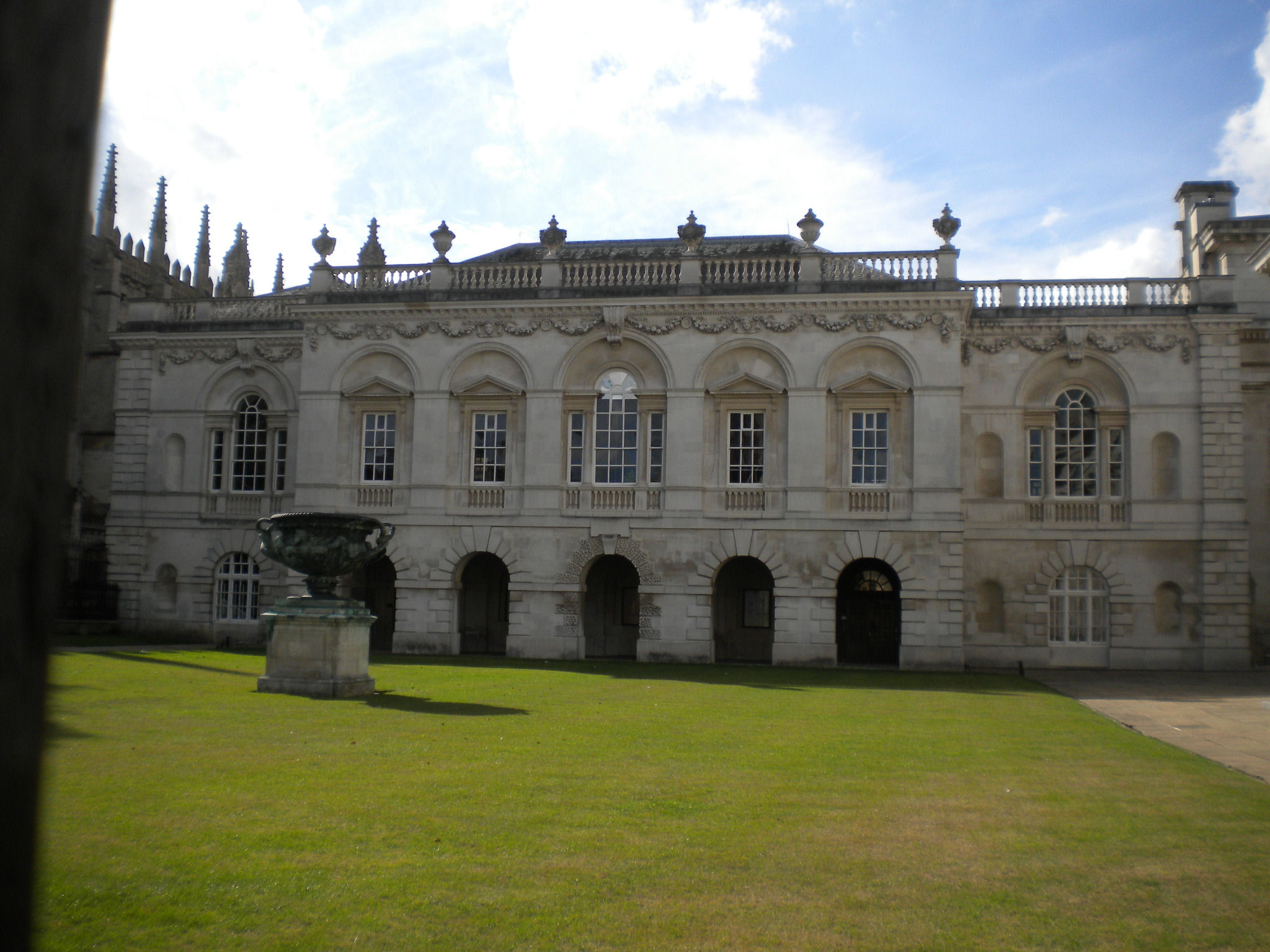
The Senate House (listed Grade I) was built in 1722-30. It is a university building, and Cambridge University degrees are awarded in this building. Before this was built, Great St Marys was the official gathering place for meetings and debates for Cambridge University.

The Law School or Old Schools, is listed grade I. The front was built 1754-8. The back has older buildings, late C14 and C15. We will see this on another walk.
The railings and gates round the Senate House are listed grade I. They are probably original and therefore among the earliest cast-iron railings in England. Re-erected 1789.
Sometimes the walls of Senate House and the Law School get used for light shows! They are surprisingly effective.
")
Kings College Chapel is listed Grade I. This is one of the finest examples of late Perpendicular English architecture. Construction on Kings College Chapel began in 1446 under King Henry VI's master mason Robert Ely, but paused in 1461 when Henry was defeated and taken prisoner at the Battle of Towton. Some further progress was made under the king's Yorkist successors between 1476 and 1483. Building work began again in earnest in 1506, after King Henry VII visited Cambridge with his mother Lady Margaret Beaufort. Overseen by John Wastell, the chapel and its stonework were completed by 1515. The glass was added between 1515 and 1531.
They have recently added solar panels to the roof. You can see this by climbing to the top of the tower of Great St Marys.
")
Kings gate house and front screen is grade I. It was desgned in 1824 to fit in with the appearance of the chapel.


This passage is famous for its bookshops. It is an old passageway. Richard Lyne's map (1574) shows one part of it, and John Hammond's map (1592) shows all of it.

The passage runs right round St Edward's church. This church is dedicated to St Edward, King and Martyr, a Saxon saint. Edward was King of the English from 975 until he was murdered in 978. He was considered to be a martyr, and so made a saint. His cult was popular before the Normans came, and so it is likely that the first church here was Saxon, number 4. The current church is listed Grade II*. Despite the rather startling brick parapet on top of the tower, it dates back to the early 13th century. There is more concrete. The tower is actually old, but native Cambridge stone is soft and sometimes they later had to use concrete to preserve it! Hugh Latimer preached here, and inside the church you can see the pulpit he preasched from. He was an important person in the English Reformation. He was burnt at the stake at Oxford under Queen Mary.
The third Cambridge "hill"! The medieval market was divided into different parts. "Peas" is likly to refer to fish (Latin pisces) rather than peas.


These plaques are on the wall of Barclays Bank in Benet Street. This building has been a bank for a long time, as this plaque shows. John Mortlock was a famous, even notorious, politician. He used to drink at the Eagle. The plaque says 'John Morlock 1755-1816 "Master of the Town of Cambridge". This site was his home where he opened the first banking house in Cambridge. Draper, Banker, MP, Recorder and thirteen times Mayor. "That which you call corruption I call influence."' Mortlock's portrait is in the Guildhall.


St Benets church is on Benet Street. The church is listed Grade I. St Benets is the oldest building in Cambridge and the oldest church in Cambridgeshire. The tower is late Saxon. The listing description says that it is built of "rubble"! The tower has characteristically Anglo-Saxon long-and-short quoins (corner stones). So this is Saxom church number 5.
The Saxons had a large settlement by the River Cam, which they used for trade, as it was navigable right down to the Wash and the North Sea. Various churches in Cambridge have the names of Saxon saints, but St Benets is the only Saxon church still standing. St Benets church should really be written St. Bene't's church. It's one of the reasons why I have given up apostrophes for this website! Bene't is a contraction of Benedict, who is the patron saint of students. He lived 480-548, and founded monasteries, which turned into the Benedictine order.

Free School Lane is a medieval street. Originally there was an Augustinian friary here. Later the first Cambridge Botanic Garden was set up here around 1760. This moved to its current position after 1825, but a small remenant survives, planted with plants representative of the stock of the original garden.

The old Botanic Garden was replaced by the Cavendish Laboratory. The Old Cavendish site (now called the New Museums site) runs along one side. There have been many famous scientific discoveries here, and there are plaques both in Free School Lane and inside the site describing a few of them - click here for details. The lane is called after the Free Grammar School which was founded in 1615 by Dr Stephen Perse. There is a plaque about this as well.
If you enter the New Museums site, you will see this crocodile. It is on the outer wall of the Mond Laboratory. The Laboratory was built in 1933 by the Royal Society for Kapitza to continue his work into intense magnetic fields. During the building work, those passing the lab were surprised to see a figure in a brown monk's habit busily chipping away at the brickwork behind a tarpaulin screen. This was Eric Gill who had been commissioned by Kapitza to carve both a plaque of Rutherford and this Crocodile - "The Crocodile" being Kapitza's pet name for Rutherford, either because of his fear of having his head bitten off by him, or because his voice could be relied upon to precede his visits, just like the crocodile's alarm clock in "Peter Pan". Eric Gill is a well-known sculptor. He did not often sign his work, but on this piece his initials are carved as the crocodile's tongue.


On the other side, you can see the back of Old Court. It is part of Corpus Christi College and was built in 1352. It is listed Grade I. There is a claim that Old Court is the oldest continually inhabited courtyard in the country, but this is disputed by Merton College, Oxford who say the same of their Mob Quad.

The oldest two colleges are Peterhouse (1284) and Clare (1326). Then there are four colleges founded very close together: Pembroke (1347), Gonville and Caius (1348), Trinity Hall (1350) and Corpus Christi (1352). This was because of the Black Death. So many clerics had died of the plague, and they needed to train up more to replace them.
Just after the end of the back of Old Court are parish boundary marks, painted on the wall. The clearer one is at the bottom. It is dated 1889. It marks the boundary of St Botolph and St Benet. The marking says "St Bt P". The upper one is more faded. It is dated 1834, and says P SB. Again, this the border between St Benets and St Botolphs. The Bt is probably St Benets, and the SB St Botolphs. (One frivolous suggestion is that SB stands for St Both!)


This plaque commemorates Stephen Perse who set up the Free Grammar School in Free School Lane (hence the name of this alleyway). The hall of of the school are still inside the Whipple Museum, so it is listed grade II. Look up at the ceiling if you visit it!


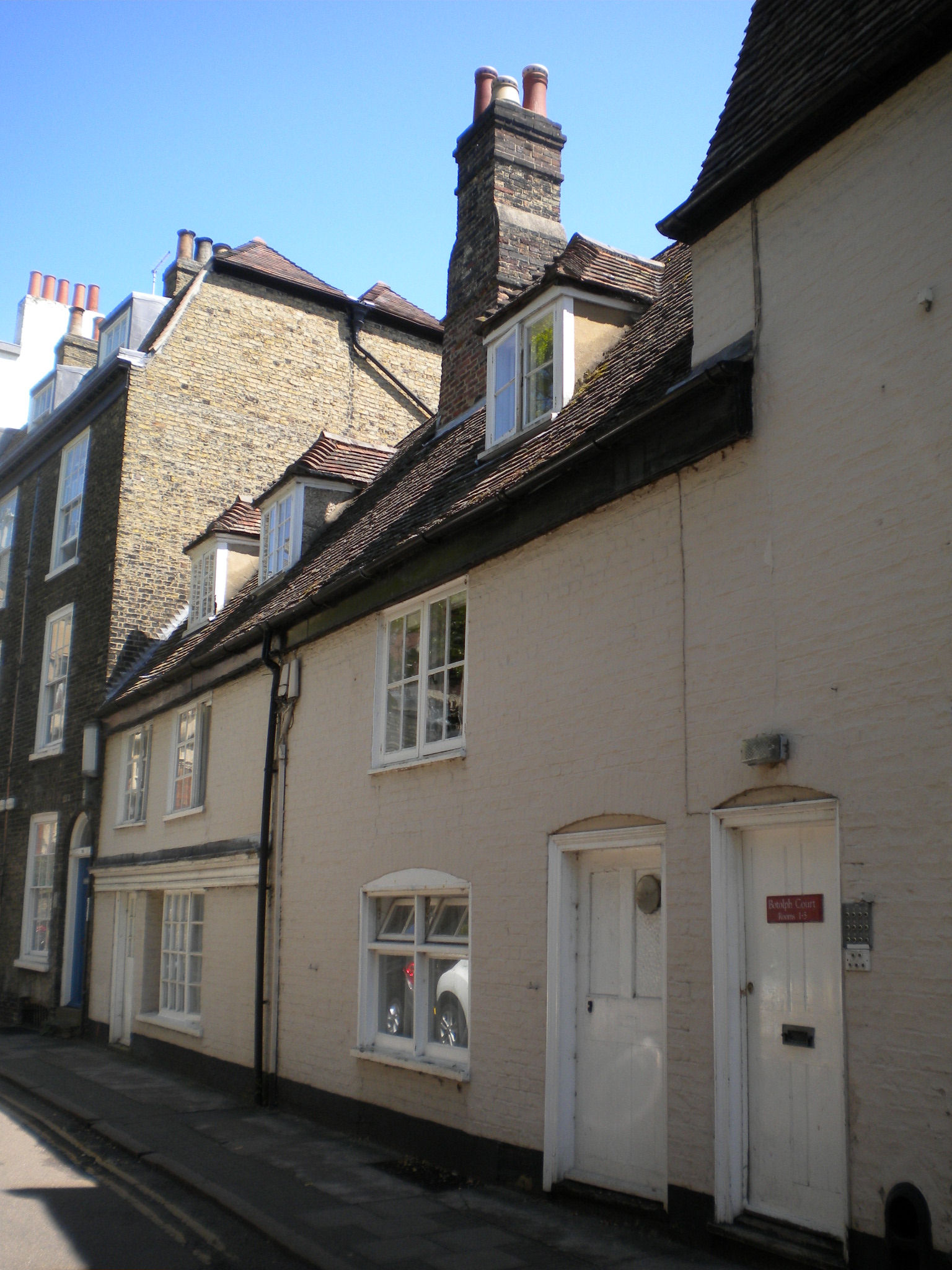
On Richard Lyne's map (1574), this lane is called Penny Farthing Lane. All the houses in the lane was lsited. 12-13 Botolph Lane (grade II) dates back to 16C.


St Botolphs church is listed Grade I. It was built in 1350. It has two sun dials on the corner.
The church is dedicated to St Botolph, another Saxon saint. He was a seventh century abbot in East Anglia, and is the patron saint of travellers. So this is likely to be another Saxon church, number 6. It was near Trumpington Gate, the south gate of medieval Cambridge, through which travellers from London entered the town. Cambridge was fortified not with a wall, but by the river, and the Kings Ditch. That will be another walk!
")
Pembroke chapel (listed Grade I) was built in 1663-5. Around the Civil War, one of Pembroke's fellows and Chaplain to Charles I before he was king, Matthew Wren, was imprisoned by Oliver Cromwell. On his release after eighteen years, he fulfilled a promise by hiring his nephew Christopher Wren to build a great Chapel in his former college. It is the earliest completed work by Wren.

Little St Mary is listed Grade II*. It was originally a Saxon church called St Peter by the Gate (to distinguish it from St Peter near the castle), number 7. This church used to be the chapel for Peterhouse college (which explains Peterhouse's name - it's similar to the old college Michaelhouse connected with the church of St Michael). This church was mostly built between 1340 and 1352, and rededicated to St Mary. The name distinguishes it from Great St Mary.
We have walked past seven churches or sites which may have been founded in Saxon times. The Domesday Book specifically describes "before 1066". It says that there were ten Saxon wards (administrative areas), with three up Castle Hill and seven by the river. It seems likely that each ward had a church. So these churches were on Castle Hill, Bridge Street, or the Saxon road (St Johns St, Trinity St, etc.) The churches on the eastern side of the city, St Andrews the Great and Trnity, are later, even though they are on the Roman Road. Saxon Cambridge seems to have been closely connected with the river.
However, the Saxon Road was not next to the river, possibly beceause of flooding. We will now walk down to the river.


There are various gas lights around Cambridge, but most of them has been converted to electricity. However, there are two working gas lights in Little St Marys Lane, one near Trumpington Street and one on the other side of the road, in Little St Mary's churchyard.

All the houses in the lane are listed grade II. Numbers 12, 13 and 14 are C17.


The Graduate Centre is listed grade II. It was built in 1967. The listing says "representative of the New Brutalist aesthetic in a sensitive historic location"! It is unused at the moment (the restaurant has moved to West Cambridge).
The building has cladding from Roach-bed Portland limestone. This has many fossil shells embedded in it. There were two types of shell. One type turned to stone, and the other got dissolved away, leaving small holes. Both types can be seen.


The green bit over the river is called Laundress Green, where the colleges had their washing done.

Laundress Lane leads down to Laundress Green. Presumably the laundary had to be carried, since horses were forbidden! The cartoon is from "A Cambridge Scrap-book" by John Lewis Roget (1859).
© Jo Edkins 2025 - Return to Walks index