
 Lanes and Passages in the City Centre
Cambridge has a number of passages and back alleyways. Some have interesting shops in, others are used for short-cuts or to avoid traffic. Here are some of them. You could make up your own walk weaving backwards and forwards across the centre, but perhaps it's best just to wander through them as you please.
A warning - the map below seems to give footpaths within the college buildings and faculty buildings. These exist, but they may not be open to the general public, or you may be required to pay to enter the college. The footpaths described on this page are marked in solid, bright red. Click on them, or the names, to go to the description. These are open all the time to the general public, and free. They are also mostly through-ways. The two exceptions are one part of Trinity Lane (which leads to Kings College Chapel) and Holy Trinity Passage (which leads to Marks and Spensers).
I refer to old maps below. You can buy copies of these maps - try the Cambridgeshire Collection in the Central Library, Grand Arcade. If a road or alleyway is on an old map, it does not imply that it contains old buildings. Cambridge has always been constantly rebuilt (see the scaffolding in the photos below!) and so some of these lanes have modern buildings. Others have older buildings but not as old as the original route.
In the map below, there is a scale. 100 metres is similar to 100 yards and 400 metres is about a quarter of a mile. You can see that the map covers a small area, just in the city centre. There are other alleyways on the shopping page and the public transport page, and even one on the public art page!

Click on the photos for a bigger version.
This is a little street off Trinity Street. It runs between various colleges. Trinity Hall and Clare have their entrances here. There are also some of the older parts of Trinity College. The lane ends at a side entrance to Kings College, but an important one as this is how you enter the chapel as a tourist (you will have to pay). Garret Hostel Lane leads off this road, and that is one of the few public bridges over the River Cam. So this lane is popular with tourists, and has students in term time. There are no shops, only college and university buildings. See third river walk for more about this lane.
This is an old street, shown in Cambridge's oldest map, Richard Lyne's map (1574) although the name is more recent. The part off Trinity Street used to be called Find Silver Lane. The other part, parallel to the river, was called Mill Street, and used to continue through what is now Kings College to meet up with Queens' Lane.
 |
 |
 |
This joins Trinity Lane to Queens Road. The Garret Hostel bridge is important, as it is the only public bridge across the River Cam between Magdalene Bridge (Magdalane Street/Castle Street) and the Silver Street bridge. It is for pedestrians and cyclists only. There are a lot more such bridges over the Cam on this stretch of river, but they are on college property. This makes this lane busy, with tourists looking at the college Backs, and university people going to the University Library across the river. Half the lane has buildings on both sides, and the other half, over the bridge, has trees and streams running by the lane. See third river walk for more about this lane.
When the university started, hostels were places for students to study as well as the more conventional colleges. As the colleges took over, the hostels disappeared until now hostels are part of colleges, being just halls of residence. Richard Lyne's map (1574) shows an island in the river here, called Garret Ostell Green, with a bridge onto it, and a lane leading from Trinity Lane (then called Mill Street). John Hammond's map (1592) shows the island to have disappeared and Garret Hostel Lane and bridge in their present position, although not named. The current bridge is a modern one.
The first picture shows the entrance of Garret Hostel Lane - the cyclists are just turning into it.
 |
 |
 |
 |
This passageway takes you from Trinity Lane back to Senate House Hill, outside Great St Marys. Halfway down, there is an attractive side gate to Gonville and Caius College called the Gate of Honour. On the other side, there are university buildings including the Senate House, where degree ceremonies are held.
This passageway is on a map of 1763, but not on earlier maps.
 |
 |
 |
Kings Lane starts at Kings Parade. It is an unattractive modern delivery road. However, it leads to Queens Lane, with Queens gatehouse.
Queens Lane was originally a continuation of Mill Street, an old road. See Trinity Lane. Kings Lane, despite its currently unlovely modern state, is also an old lane. It was called Piott and Nuts Lane. Both are shown on Richard Lyne's map (1574).
 |
 |
 |
This is partly an alleyway, partly a road. It goes from Benet Street to Downing Street. It is used mainly by university people, as there is an entrance to the New Museums site (belonging to Cambridge University). There have been many famous scientific discoveries here, and there are plaques both in Free School Lane and inside the site describing a few of them - click here for details. The lane is called after the Free Grammar School which was founded in 1615. There is a plaque about this as well. Most of the buildings in the lane are fairly modern, but you can see the back of Old Court in Corpus Christi, dating from 1350s, plus St Benets church, dating back to Saxon times.
There has been a road here since Richard Lyne's map (1574).
 |
 |
 |
This joins Trinity Street to Sidney Street. This is not really an alleyway, but it has no traffic and is a quiet lane with interesting little shops, and naturally, the occasional cyclist.
Green Street is not as old as it looks. It is marked on David Logan's map of 1688, but not on John Hammond's map of 1592. This is a nice story that Green Street was called this as it was shut off during a plague, when the grass grew on the street, but this is not true. In fact, it was named after Oliver Green (1563-1623), who was mayor in 1594. Green Street was part of his estate.
 |
 |
This alleyway takes you from Trinity Street to the Market. It has little shops and cafes, and can be a bustling place full of shoppers. At the market end, there is a plaque on the wall with Calvery's Ode To Tobacco on it. Click here for more on this.
This follows the edge of St Michaels graveyard. St Michaels church is still there, now called Michaelhouse, but you can only reach the church from Trinity Street, and can't even see it from Rose Crescent. The route of Rose Crescent gradually appeared on maps of 1688 and 1763.
 |
 |
 |
Sussex Street is a road rather than an alleyway, but has no traffic. It has fun shops, including a music shop. The shape of the buildings makes an attractive space in the middle, with a tree. At the end, you pass underneath an archway connecting two parts of Sidney Sussec college. This is modern, but also attractive, with carvings from the college's coat of arms.
Although there are no particularly old buildings in it, Sussex Street has the same route as an old road originally called Walls Lane, which is marked on the oldest map of Cambridge by Richard Lyne (1574). Walls Lane included King Street as well.
 |
 |
 |
Petty CuryIt's rather a shame that this busy shopping street with an attractive name and an ancient history is rather dull. It does have no traffic, and is popular with shoppers. Sometimes there are buskers. The name means 'Little market' (from the French) and it appears on all maps of Cambridge.
|
There is an entrance to the Lion Yard shopping mall from Petty Cury. I am not going to cover the various pathways through the Lion Yard and next door Grand Arcade, partly because they are modern and dull, and partly because they don't like people photographing them. Look at the map for details. |
This is a short, broad alleyway, running along side Great St Marys church, from Kings Parade to the Market. There are shops and cafes in it, but it is used mainly by tourists (and others) going between some of the most important tourist sites in Cambridge, Kings College Chapel, Great St Marys (the university church) and Cambridge Market. There are a few bikes there, as well.
This is an old passageway, appearing on the oldest map of Cambridge by Richard Lyne (1574).
 |
 |
 |
This is a narrow alleyway from Kings Parade to Peas Hill. It runs right round St Edwards church. The greenery round the church and the book shops in the passage make it an attractive place to place to walk through.
This is an old passageway. Richard Lyne's map (1574) shows one part of it, and John Hammond's map (1592) shows all of it.
 |
 |
 |
I don't know if this passageway has a name. I've called it Holy Trinity Passage as it runs alongside Holy Trinity church. Another name might be Mark and Spensers passage, since it leads to the back entrance of one of their shops in the city. For some reason, most people walking along it have shopping bags...
There is a suggestion of this passageway in William Custance's map (1798).
 |
 |
 |
I don't know if this passageway has a name either. I've called it St Andrews Passage as it runs alongside Great St Andrews church.
It follows the path of the Kings Ditch, so it's hard to see if it appears as a path on the early maps.
 |
 |
This passage joins St Johns Street to Sidney Street. There are a few shops here (including an excellent cheese shop), but it is mostly used as a short cut. These passages are mostly for pedestrians, but, as in most of Cambridge, don't be surprised to meet a cyclist!
The straight part of the passage is an old alleyway. It is marked on the oldest map of Cambridge by Richard Lyne (1574). The passage splits into two to go round All Saints Garden. This used to be the location of a church, All Hallows (or All Saints) in Jewry. See Greens, Commons and Pieces for more about that.
 |
 |
 |
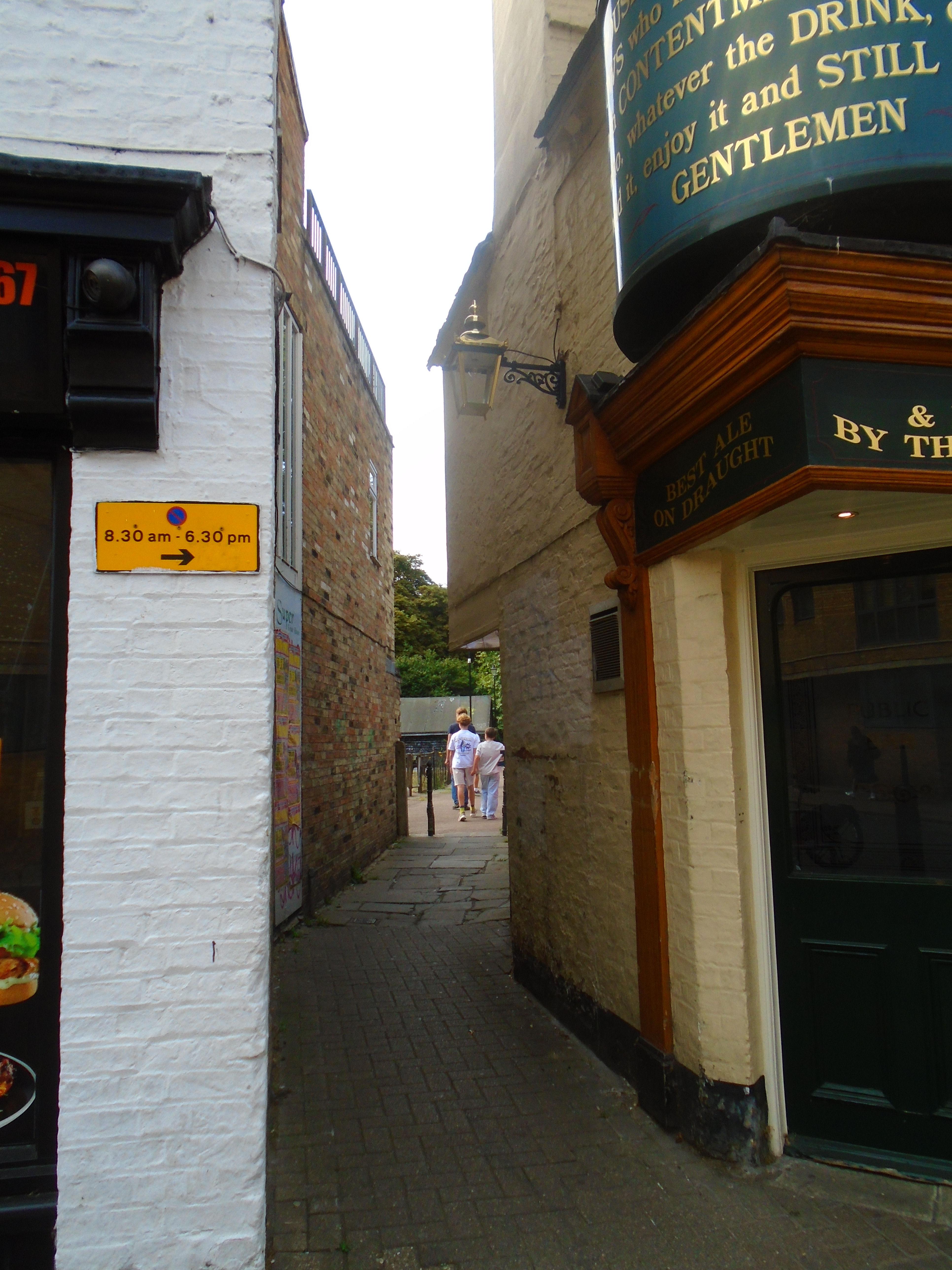
This runs by the side of St Botolphs church, from Free School Lane to Trumpington Street. There are a few shops but it is mostly a short-cut. There is a good view of St Botolphs church.
On Richard Lyne's map (1574), this lane is called Penny Farthing Lane.
 |
 |
 |
This is a narrow road leading from Trumpington Street to Granta Place, and then down to the river. Most people would use the next road, Mill Lane, to get to the river, so this lane is quiet and has the greenery of Little St Marys churchyard on one side.
There has been a road here since Richard Lyne's map (1574).
You may wonder at the name of Little St Mary. It is a Cambridge custom to distinguish between two churches with the same saint by giving them a size. So Great St Marys is next to the market, and Little St Marys is on Trumpington Street. St Andrews the Greater is on St Andrews Street (naturally) and St Andrews the Less is on Newmarket Road.
 |
 |
 |
It is interesting that so many lane and passages in Cambridge are associated with churches. Free School Lane runs by St Benets church. Rose Crescent runs round the old area of St Michaels churchyard. Other roads include: Round Church Street next to the Round Church; the alleyways round St Andrews the Greater (now part of the Lion Yard) and Portugal Place which is next to St Clements Church.
This alleyway takes you from Market Hill (another of the Cambridge 'hills') to Sidney Street. It is a little dull (even without the scaffolding), running alongside some shops, and only containing a couple of restaurants. Still, it provides a quiet way to avoid the sometimes over-crowded Market Hill.
This passage seemed to be about the same age as Rose Crescent, gradually appearing on maps of 1688 and 1763.
 |
 |
 |
 |
Not all of Cambridge is beautiful! This is an alleyway from Sidney Street to Hobson Street, between two previously grand but now reused buildings, Dorothy's ballroom (now a bookshop) and a cinema (now not even a bingo hall). There are a few architectural features from these buildings in the passageway, but better ones in Hobson Street. It is used as a short-cut, and to store dustbins.
Hobsons Passage is not even an old route. A map from by W P Spalding (1898) shows it, but there is little trace of it earlier. It is named from Hobson Street, and that is named after Thomas Hobson, although neither passage nor street seem to have much to do with him. Click here for more information about Thomas Hobson.
 |
 |
 |
This leads from St Andrews Street to Christs Pieces. It is busy, as it is on the main pedestrian route from the city centre to the Grafton Centre, so it is much used by shoppers. It leads directly to the bus station. Many people also use this short cut to Christs Pieces to enjoy some time enjoying the greenery, flowers and trees. It continues into Miltons Walk (see below)
This is an odd route as most people in Cambridge would tell you that it's new, yet it is on the the oldest map of Cambridge by Richard Lyne (1574). Until recently it was locked up. It was reopened as part of a new development and I don't think that it has yet managed to acquire a character. It does have a small food supermarket, and some art benches.


Corn Exchange Street is a backstreet whose main function is to channel traffic into a multi-storey carpark. The pavement is narrow or non-existent. But if you are starting from the Grand Arcade shopping centre and wish to get to Downing Street (or vice versa), there is a secret path alonside the carpark. You start by walking round the restaurant Carluccio's, in Fisher Square, off Corn Exchange Street. To the right of this restaurant, you will see a doorway, with a walkway beyond. Wal along it, ignoring the fact that you seem to be climbing well above street level. Finally you dive through a building which turns out to be the Crowne Plaza in Downing Street. Steps take you down to street level. To go the other way, look for the doorway to the left of the Crowne Plaza.
This is an entirely new path.
 |
 |
 |
There is a pleasant boardwalk along the river (see river walk 2). A small passage way branches off to Richmond Terrace.
 |
 |
There are several paths connected with shopping areas. See Shopping.
Here are some other pleasant walkways outside the map area:
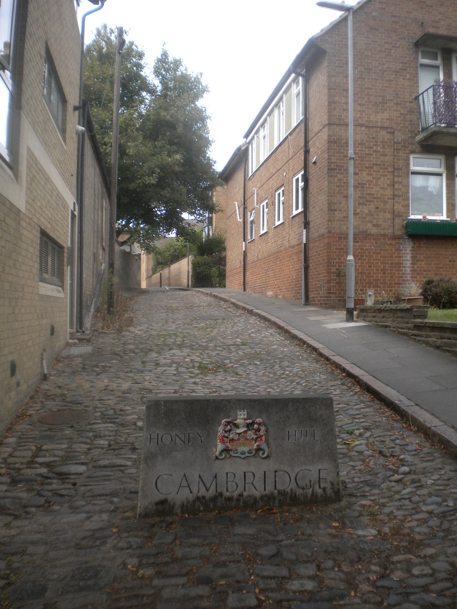
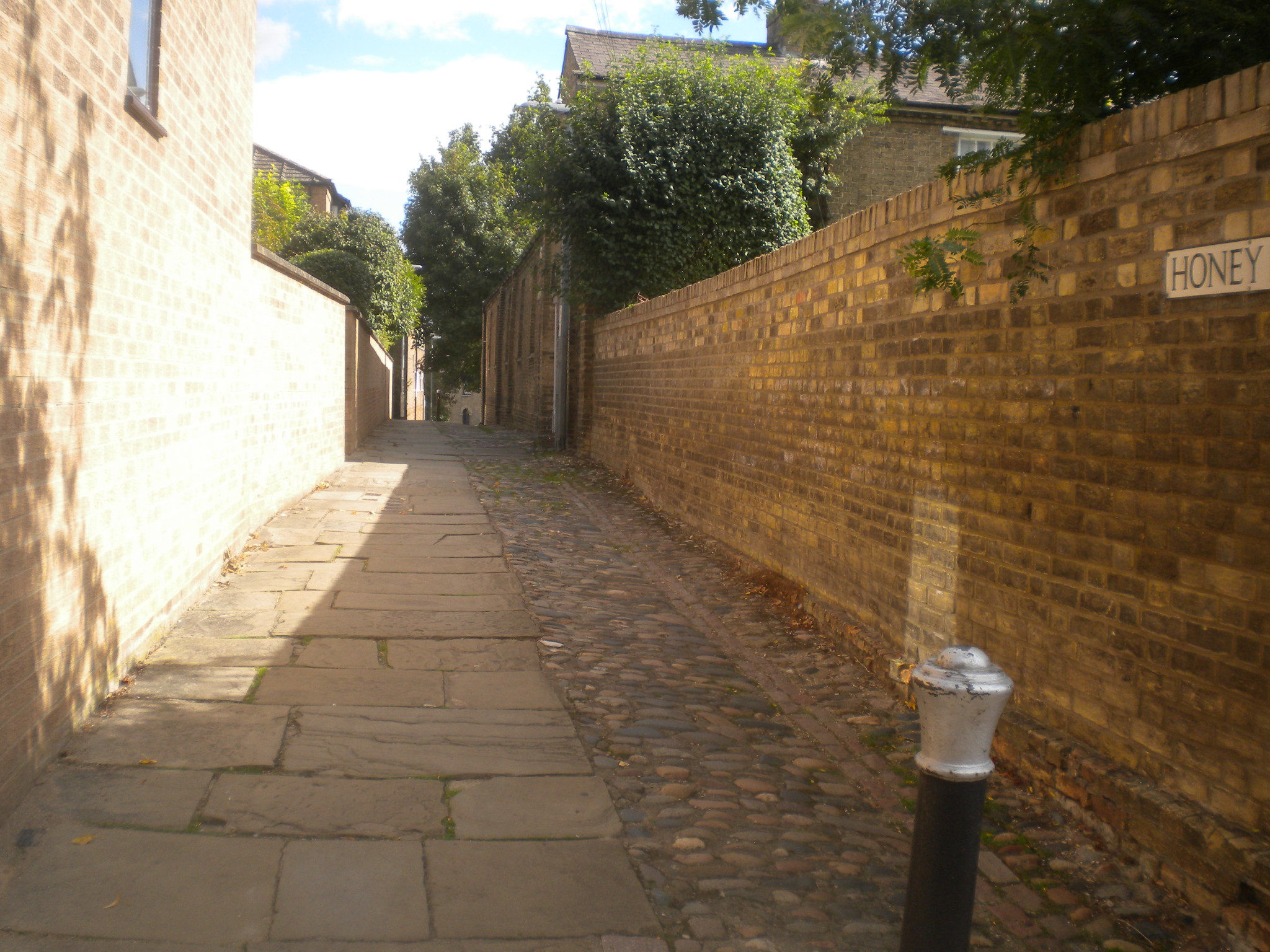
Honey Hill is between Castle Street and Northampton Street, at the back of St Peters Church.
 |
 |
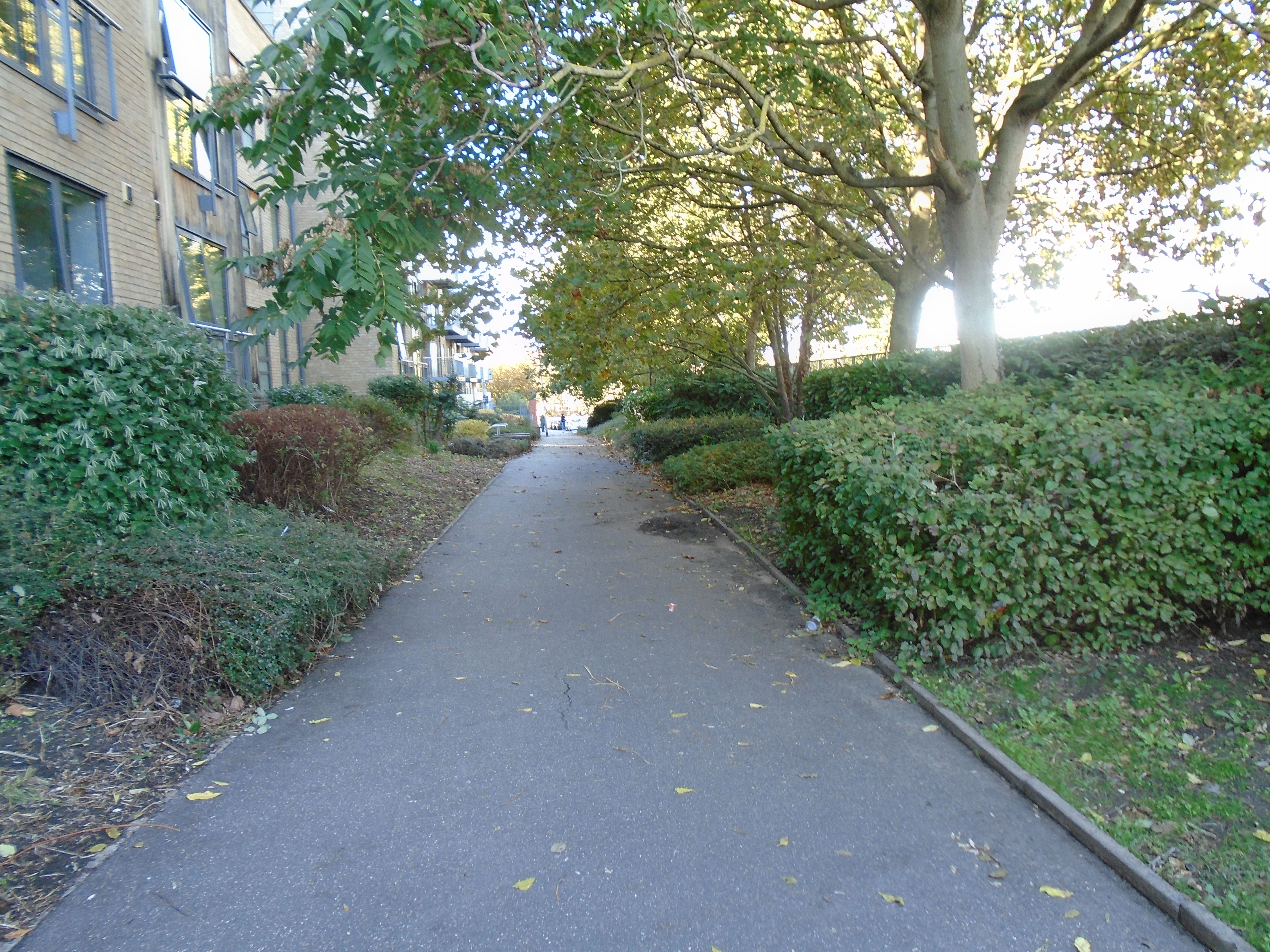
This pleasant passage is between Madingley Road and Clarkson Road. It goes past the Centre for Mathematical Sciences.
 |
 |
 |
Burrells Walk is a continuation of Garret Hostel Lane, the other side of Queens Road. It leads past the University Library to Grange Road.
 |
 |
 |
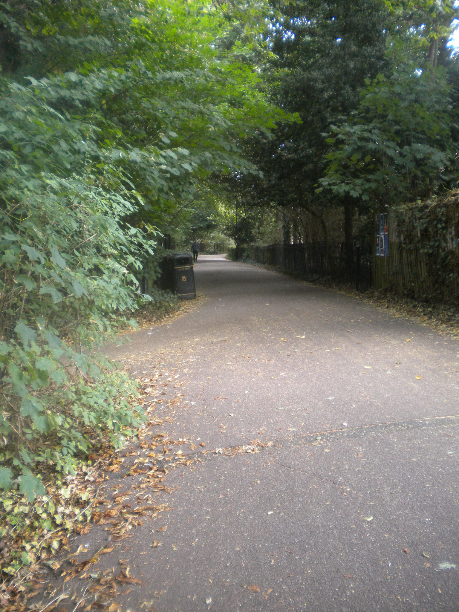
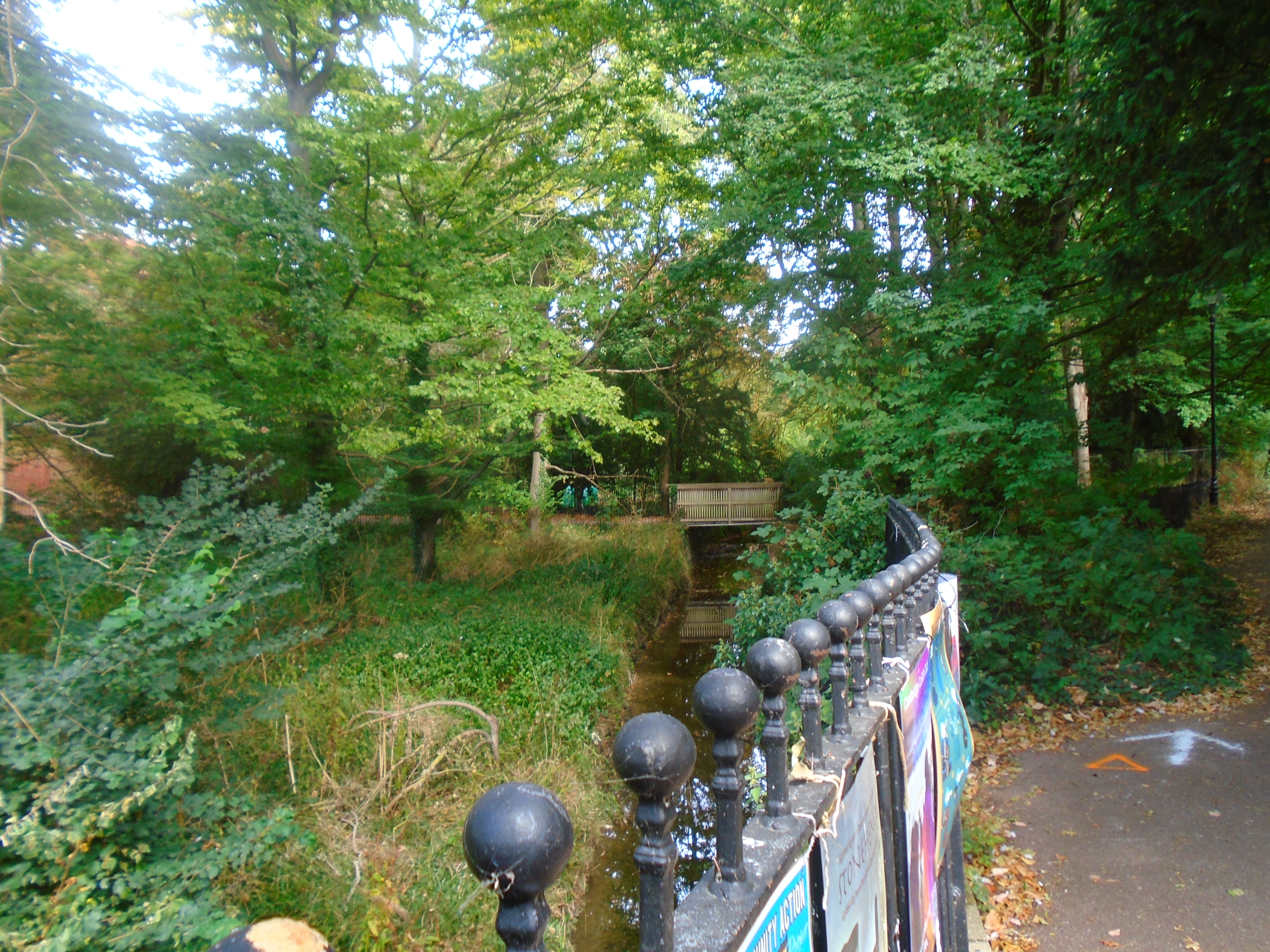
At the Grange Road end, the walk meets Bin Brook. This runs east to west across Cambridge. In places it is little more than a ditch but it has caused serious flooding at times. In October 2001 it burst its banks. So its water level is monitored! It ends up running along the back of St Johns College.
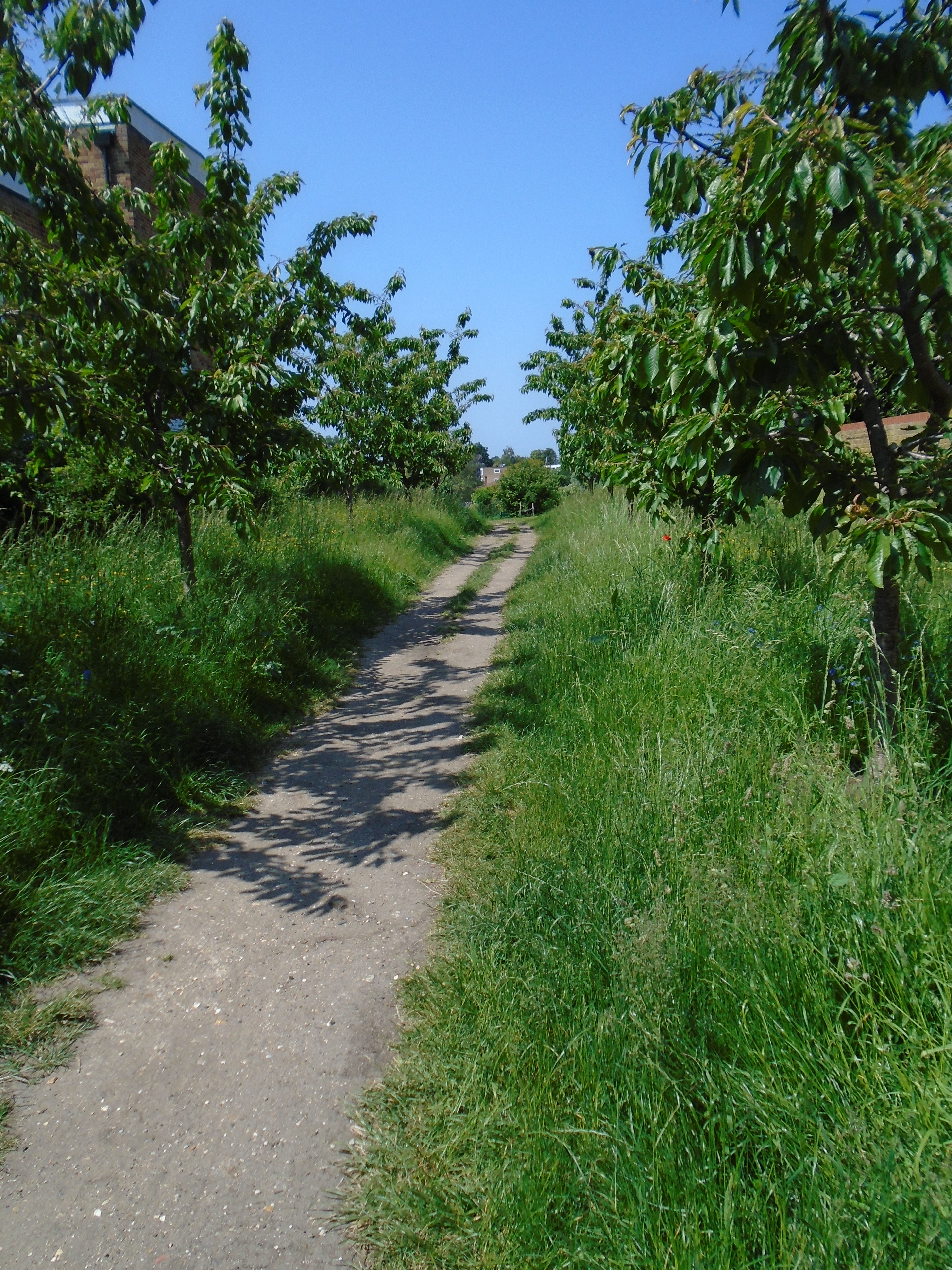
This community orchard can also be used as a short-cut between Maids Causeway/Newmarket Road and Midsummer Common. It has over 50 trees, seating areas, and other plantings.


I've taken the name from Open Street Map. I've never heard it called that! This is a path leading from the Elizabeth Way roundabout, next to the Elizabeth Way, but leading downwards to Midsummer Common.
This may have existed in the past, but has recently be reopened. It runs from Bridge Street to Park Street, where the multi-story carpark used to be.There were plenty of these yards leading off streets in the past, but not many are left.
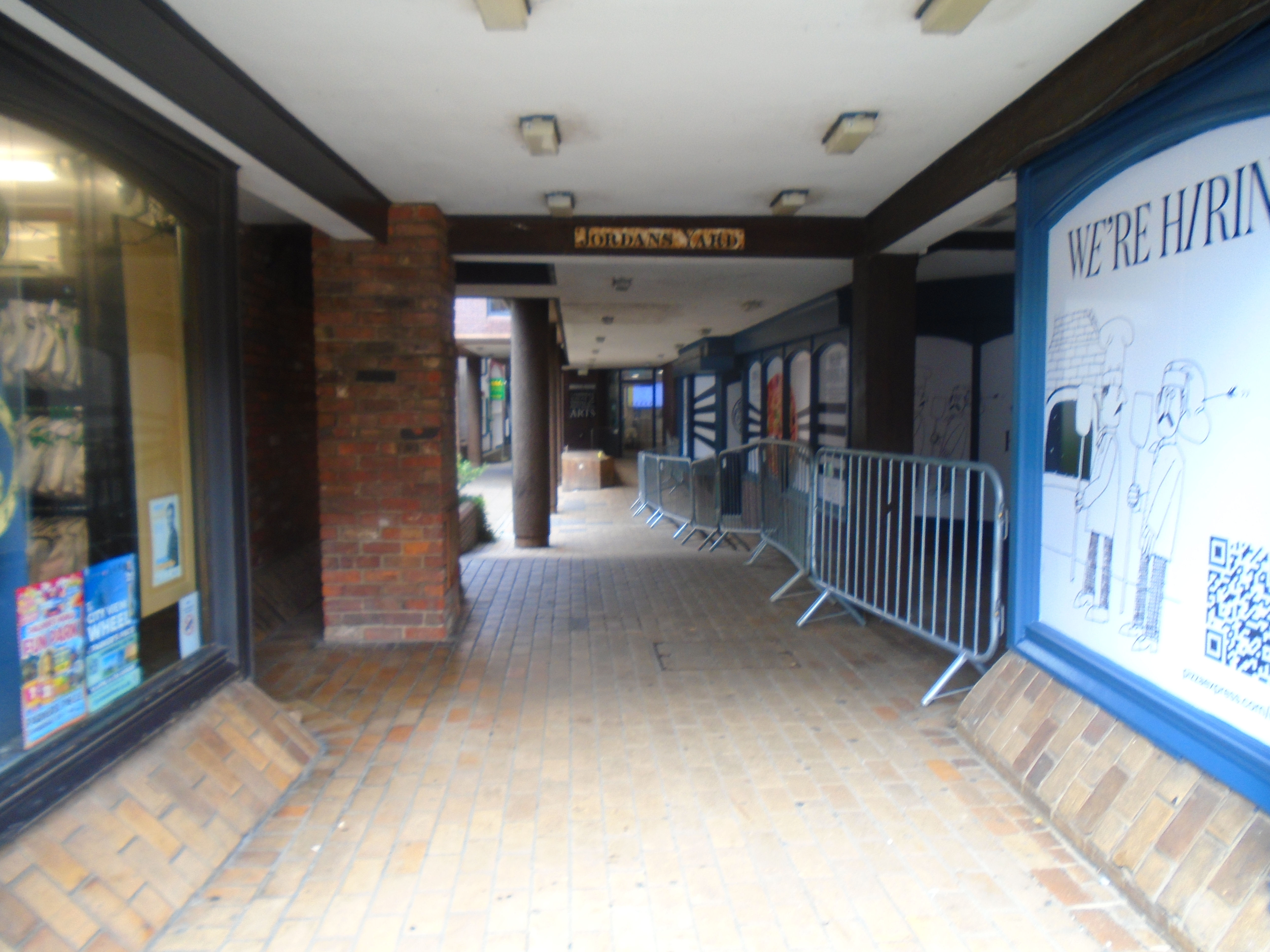

This is the Park Street end.

There is some machinery visible off one side of the passageway.
This starts from Kings Street, near the Maids causeway end, and crosses Christs Pieces. On the other side of Kings Street, there is a narrow road called belmont Place, which leads to Jesus Lane.


There is another passage from Kings Street accross Christs Pieces. It starts by the Champion of the Thames, and then goes along one edge of Christs Pieces. It's called Miltons Walk. On the Tudor map by Richard Lyne (1574), it's called Christs College Walk, but that predates Milton! It ends up at Christs Lane (see above).

© Jo Edkins 2010 - Return to Walks index

